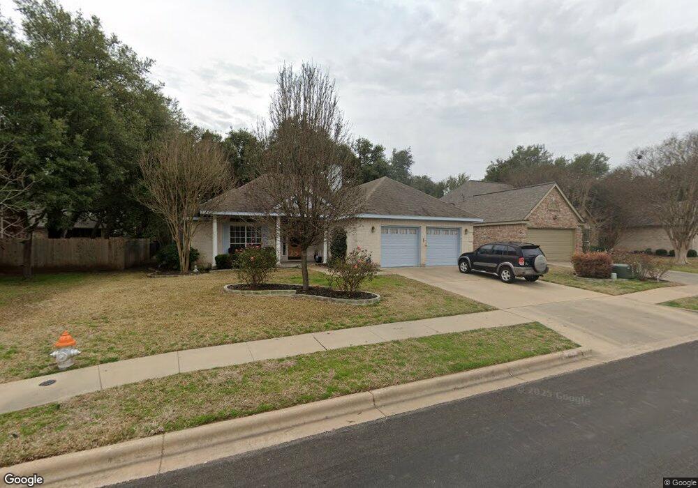
107 River Down Rd Georgetown, TX 78628
Estimated Value: $400,297 - $466,000
Studio
3
Baths
1,955
Sq Ft
$217/Sq Ft
Est. Value
About This Home
This home is located at 107 River Down Rd, Georgetown, TX 78628 and is currently estimated at $425,074, approximately $217 per square foot. 107 River Down Rd is a home located in Williamson County with nearby schools including Dell Pickett Elementary School, James Tippit Middle School, and East View High School.
Ownership History
Date
Name
Owned For
Owner Type
Purchase Details
Closed on
Jul 12, 2006
Sold by
The F Dorine Molsberry Living Trust
Bought by
Greenfield Cheryl Lynn
Current Estimated Value
Home Financials for this Owner
Home Financials are based on the most recent Mortgage that was taken out on this home.
Original Mortgage
$154,400
Outstanding Balance
$91,512
Interest Rate
6.62%
Mortgage Type
Purchase Money Mortgage
Estimated Equity
$333,562
Purchase Details
Closed on
Apr 24, 2006
Sold by
Molsberry Dorine and Molsberry Dorine F
Bought by
Molsberry F Dorine and Molsberry Frank H
Purchase Details
Closed on
Feb 25, 2005
Sold by
Harmon Harry and Harmon Sharon
Bought by
Molsberry Dorine
Home Financials for this Owner
Home Financials are based on the most recent Mortgage that was taken out on this home.
Original Mortgage
$97,000
Interest Rate
5.71%
Mortgage Type
New Conventional
Create a Home Valuation Report for This Property
The Home Valuation Report is an in-depth analysis detailing your home's value as well as a comparison with similar homes in the area
Purchase History
| Date | Buyer | Sale Price | Title Company |
|---|---|---|---|
| Greenfield Cheryl Lynn | -- | Independence Title Company | |
| Molsberry F Dorine | -- | None Available | |
| Molsberry Dorine | -- | Austin Title Company |
Source: Public Records
Mortgage History
| Date | Status | Borrower | Loan Amount |
|---|---|---|---|
| Open | Greenfield Cheryl Lynn | $154,400 | |
| Previous Owner | Molsberry Dorine | $97,000 |
Source: Public Records
Tax History
| Year | Tax Paid | Tax Assessment Tax Assessment Total Assessment is a certain percentage of the fair market value that is determined by local assessors to be the total taxable value of land and additions on the property. | Land | Improvement |
|---|---|---|---|---|
| 2025 | $2,371 | $399,050 | -- | -- |
| 2024 | $2,371 | $362,773 | -- | -- |
| 2023 | $2,223 | $329,794 | $0 | $0 |
| 2022 | $3,831 | $299,813 | $0 | $0 |
| 2021 | $5,952 | $272,557 | $77,000 | $242,341 |
| 2020 | $5,495 | $247,779 | $71,437 | $176,342 |
| 2019 | $6,081 | $265,779 | $66,019 | $199,760 |
| 2018 | $4,111 | $259,085 | $66,019 | $193,066 |
| 2017 | $6,010 | $260,224 | $61,700 | $198,524 |
| 2016 | $5,567 | $241,041 | $61,700 | $179,341 |
| 2015 | $4,251 | $222,959 | $50,200 | $172,759 |
| 2014 | $4,251 | $214,105 | $0 | $0 |
Source: Public Records
Map
Nearby Homes
- 300 River Ridge Dr
- 301 Rim Rock Dr
- 100 S Ridge Cir
- 501 River Down Rd
- 108 S Ridge Cir
- 318 Ridge Run Dr
- 300 Norwood Dr W
- 302 S Ridge Cir
- 312 River Overlook Rd
- 509 Summer Place Ln
- 513 Summer Place Ln
- 508 High Summit Dr
- 420 River Overlook Rd
- 412 Tamara Dr
- 504 Alameda Ln
- 532 Summer Place Ln
- 221 Running Fawn
- 212 Rockcrest Dr
- 1533 Jay Wolf Dr
- 540 Summer Place Ln
- 105 River Down Rd
- 109 River Down Rd
- 103 River Down Rd
- 103 Red Oak Ct
- 102 Oakmont Ct
- 104 Oakmont Ct
- 106 River Down Rd
- 104 River Down Rd
- 108 River Down Rd
- 101 River Down Rd
- 102 River Down Rd
- 100 Red Oak Ct
- 105 Red Oak Ct
- 110 River Down Rd
- 100 Oakmont Ct
- 102 Red Oak Ct
- 200 Riverview Dr
- 200 River Down Rd
- 107 Fox Hollow Dr
- 105 Fox Hollow Dr
Your Personal Tour Guide
Ask me questions while you tour the home.