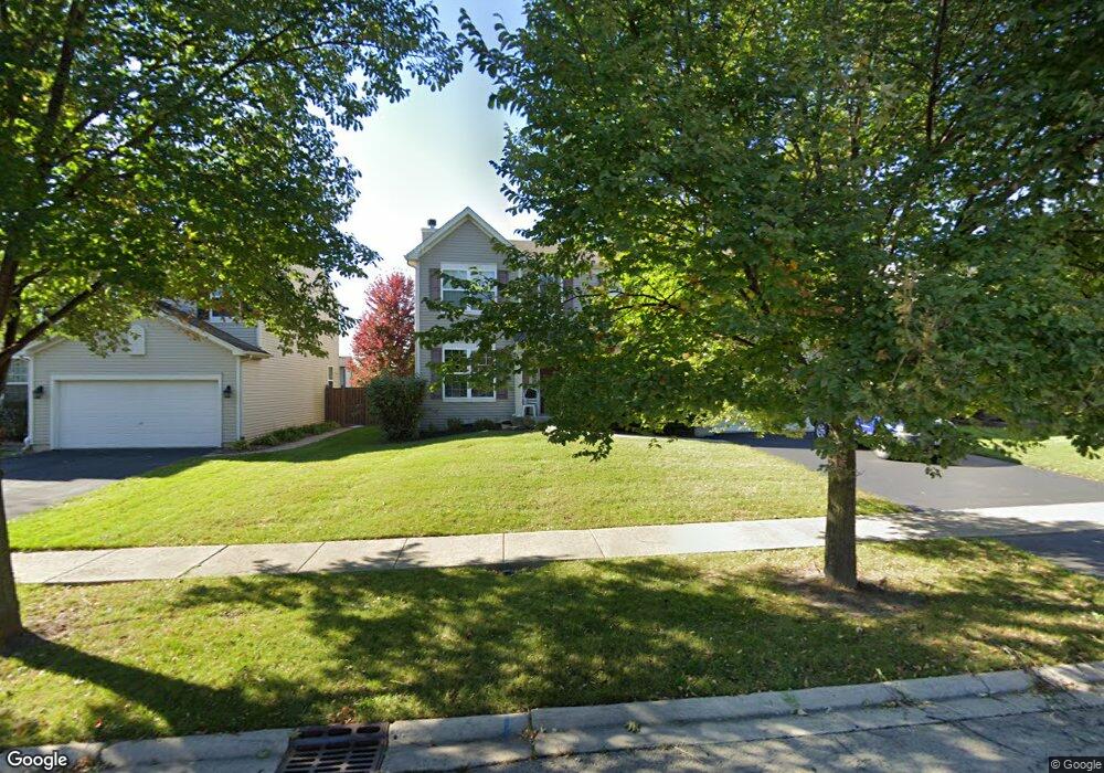
107 S Commonwealth Dr Bolingbrook, IL 60440
Balstrode Park NeighborhoodEstimated Value: $494,471 - $567,000
Studio
1
Bath
2,978
Sq Ft
$178/Sq Ft
Est. Value
About This Home
This home is located at 107 S Commonwealth Dr, Bolingbrook, IL 60440 and is currently estimated at $529,618, approximately $177 per square foot. 107 S Commonwealth Dr is a home located in Will County with nearby schools including Jamie Mcgee Elementary School, Jane Addams Middle School, and Brooks Middle School.
Ownership History
Date
Name
Owned For
Owner Type
Purchase Details
Closed on
Aug 5, 2005
Sold by
The Ryland Group Inc
Bought by
Preiser Joseph J
Current Estimated Value
Home Financials for this Owner
Home Financials are based on the most recent Mortgage that was taken out on this home.
Original Mortgage
$321,155
Outstanding Balance
$170,438
Interest Rate
5.82%
Mortgage Type
Fannie Mae Freddie Mac
Estimated Equity
$359,180
Create a Home Valuation Report for This Property
The Home Valuation Report is an in-depth analysis detailing your home's value as well as a comparison with similar homes in the area
Home Values in the Area
Average Home Value in this Area
Purchase History
| Date | Buyer | Sale Price | Title Company |
|---|---|---|---|
| Preiser Joseph J | $357,000 | Ryland Title Company |
Source: Public Records
Mortgage History
| Date | Status | Borrower | Loan Amount |
|---|---|---|---|
| Open | Preiser Joseph J | $321,155 |
Source: Public Records
Tax History
| Year | Tax Paid | Tax Assessment Tax Assessment Total Assessment is a certain percentage of the fair market value that is determined by local assessors to be the total taxable value of land and additions on the property. | Land | Improvement |
|---|---|---|---|---|
| 2024 | $14,033 | $159,950 | $40,444 | $119,506 |
| 2023 | $14,033 | $143,917 | $36,390 | $107,527 |
| 2022 | $12,232 | $129,748 | $32,807 | $96,941 |
| 2021 | $11,610 | $121,316 | $30,675 | $90,641 |
| 2020 | $11,261 | $117,327 | $29,666 | $87,661 |
| 2019 | $10,910 | $111,740 | $28,253 | $83,487 |
| 2018 | $10,485 | $106,949 | $27,042 | $79,907 |
| 2017 | $9,996 | $101,373 | $25,632 | $75,741 |
| 2016 | $9,719 | $96,500 | $24,400 | $72,100 |
| 2015 | $8,422 | $92,600 | $23,400 | $69,200 |
| 2014 | $8,422 | $84,200 | $21,300 | $62,900 |
| 2013 | $8,422 | $84,200 | $21,300 | $62,900 |
Source: Public Records
Map
Nearby Homes
- 167 Penny Ln
- 154 Grady Dr
- 1086 Lily Field Ln
- 8 Lily Ct
- 333 Claridge Cir
- 1150 Coventry Ln
- 265 Commonwealth Dr Unit 1
- 867 Harris Dr Unit 5
- 1042 Churchill Dr Unit 12
- 313 Fox Bend Cir
- 845 Barclay Dr
- 358 Thistle Dr
- 184 Fox Bend Cir
- 4 Franklin Ct Unit 2
- 217 S Orchard Dr
- 4 Ridge Ct Unit 1
- 420 Quarry Dr
- 460 Springwood Ln
- 162 N Canyon Dr
- 301 Inner Circle Dr
- 103 S Commonwealth Dr
- 111 S Commonwealth Dr
- 1052 Ridgewood Dr
- 101 Commonwealth Dr
- 1050 Ridgewood Dr
- 115 S Commonwealth Dr
- 1054 Ridgewood Dr
- 1020 Ashbrook Cir
- 105 Commonwealth Dr
- 1048 Ridgewood Dr
- 114 S Commonwealth Dr
- 119 S Commonwealth Dr
- 1021 W Briarcliff Rd
- 1046 Ridgewood Dr
- 1059 Towner Dr
- 118 S Commonwealth Dr
- 1056 Ridgewood Dr Unit 2
- 1047 Towner Dr
- 1016 Ashbrook Cir
- 1017 W Briarcliff Rd
Your Personal Tour Guide
Ask me questions while you tour the home.