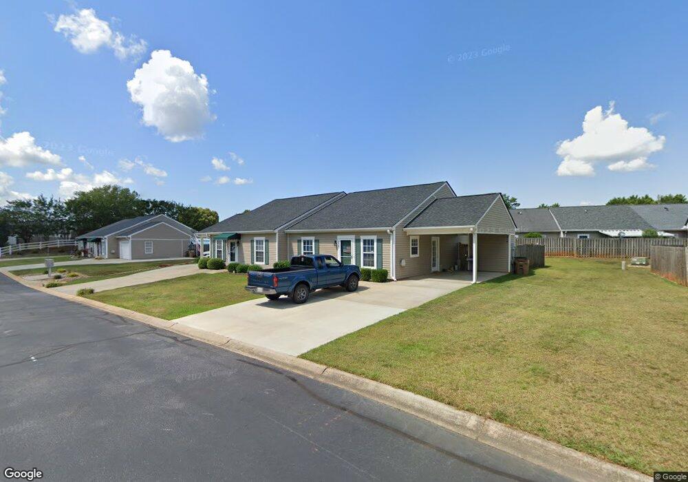
107 Sydney Ct Unit 27 Anderson, SC 29625
Estimated Value: $174,643 - $197,000
2
Beds
2
Baths
1,100
Sq Ft
$171/Sq Ft
Est. Value
About This Home
This home is located at 107 Sydney Ct Unit 27, Anderson, SC 29625 and is currently estimated at $187,661, approximately $170 per square foot. 107 Sydney Ct Unit 27 is a home located in Anderson County with nearby schools including Whitehall Elementary School, Westside High School, and Anderson Institute of Technology.
Ownership History
Date
Name
Owned For
Owner Type
Purchase Details
Closed on
Nov 13, 2013
Sold by
Raffini Amanda and Raffini Amanda
Bought by
Kizer Johnnie R and Kizer Patricia T
Current Estimated Value
Home Financials for this Owner
Home Financials are based on the most recent Mortgage that was taken out on this home.
Original Mortgage
$69,600
Outstanding Balance
$51,904
Interest Rate
4.23%
Mortgage Type
New Conventional
Estimated Equity
$135,757
Purchase Details
Closed on
Jul 8, 2009
Sold by
Phillips John H and Phillips Carol A
Bought by
Kane Emily
Home Financials for this Owner
Home Financials are based on the most recent Mortgage that was taken out on this home.
Original Mortgage
$84,932
Interest Rate
4.88%
Mortgage Type
FHA
Purchase Details
Closed on
Dec 3, 2007
Sold by
Dixon Don W
Bought by
Phillips Carol A and Phillips John H
Create a Home Valuation Report for This Property
The Home Valuation Report is an in-depth analysis detailing your home's value as well as a comparison with similar homes in the area
Home Values in the Area
Average Home Value in this Area
Purchase History
| Date | Buyer | Sale Price | Title Company |
|---|---|---|---|
| Kizer Johnnie R | $36,807 | -- | |
| Kane Emily | $86,500 | -- | |
| Phillips Carol A | $85,000 | None Available |
Source: Public Records
Mortgage History
| Date | Status | Borrower | Loan Amount |
|---|---|---|---|
| Open | Kizer Johnnie R | $69,600 | |
| Previous Owner | Kane Emily | $84,932 |
Source: Public Records
Tax History Compared to Growth
Tax History
| Year | Tax Paid | Tax Assessment Tax Assessment Total Assessment is a certain percentage of the fair market value that is determined by local assessors to be the total taxable value of land and additions on the property. | Land | Improvement |
|---|---|---|---|---|
| 2024 | $1,342 | $4,290 | $470 | $3,820 |
| 2023 | $1,342 | $4,290 | $470 | $3,820 |
| 2022 | $271 | $4,290 | $470 | $3,820 |
| 2021 | $215 | $3,540 | $400 | $3,140 |
| 2020 | $214 | $3,540 | $400 | $3,140 |
| 2019 | $214 | $3,540 | $400 | $3,140 |
| 2018 | $217 | $3,540 | $400 | $3,140 |
| 2017 | -- | $3,540 | $400 | $3,140 |
| 2016 | $208 | $3,460 | $400 | $3,060 |
| 2015 | $213 | $3,460 | $400 | $3,060 |
| 2014 | $213 | $3,280 | $400 | $2,880 |
Source: Public Records
Map
Nearby Homes
- 401 Phil Watson Rd
- 505 Brookgreen Ct
- 408 Greenbriar Ln
- 211 Phil Watson Rd
- 8 Rivanna Dr
- 216 Maplewood Rd
- 4214 Hembree Creek Rd
- 185 Norfolk Cir
- 309 Hembree Rd
- 3406 Dixon Rd
- 4115 Liberty Hwy
- 105-107 Independence Path
- 212 Middleton Shores Dr
- 103 Northlake Dr
- 203 Northlake Dr Unit 2C
- 1106 Northlake Dr Unit 11F
- 1011 Northlake Dr Unit 10K
- 905 Northlake Dr
- 1210 Northlake Dr Unit 12 J
- 302 Northlake Dr Unit 3B
- 107 P-9-38
- 105 Sydney Ct Unit 26
- 105 P-9-38
- 109 Sydney Ct Unit 28
- 111 P-9-38
- 111 Sydney Ct
- 104 Mayci Way
- 102 Mayci Way Unit 22
- 106 Mayci Way
- 100 Mayci Way
- 110 Sydney Ct Unit 38
- 108 P-9-37
- 108 Mayci Way Unit 19
- 108 Sydney Ct
- 106 Sydney Ct
- 106 P-9-38
- 103 Sydney Ct Unit 25
- 113 P-9-38
- 101 Sydney Ct
- 112 P-9-38