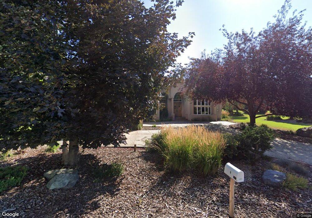
107 Whitetail Ct Bigfork, MT 59911
Estimated Value: $1,210,000 - $1,323,000
3
Beds
3
Baths
3,185
Sq Ft
$390/Sq Ft
Est. Value
About This Home
This home is located at 107 Whitetail Ct, Bigfork, MT 59911 and is currently estimated at $1,242,347, approximately $390 per square foot. 107 Whitetail Ct is a home with nearby schools including Bigfork Elementary School, Bigfork Middle School, and Bigfork High School.
Ownership History
Date
Name
Owned For
Owner Type
Purchase Details
Closed on
Jun 4, 2020
Sold by
Mooring Lavon R
Bought by
Catron Jason L and Bjorkman Gina
Current Estimated Value
Home Financials for this Owner
Home Financials are based on the most recent Mortgage that was taken out on this home.
Original Mortgage
$508,000
Interest Rate
3.2%
Mortgage Type
New Conventional
Purchase Details
Closed on
Dec 12, 2016
Sold by
Mitchell G Daniel G and Mitchell Joyce L
Bought by
Mooring Lavon R
Purchase Details
Closed on
Aug 26, 2005
Sold by
Locations Montana Inc
Bought by
Mitchell Daniel G and Mitchell Joyce L
Create a Home Valuation Report for This Property
The Home Valuation Report is an in-depth analysis detailing your home's value as well as a comparison with similar homes in the area
Home Values in the Area
Average Home Value in this Area
Purchase History
| Date | Buyer | Sale Price | Title Company |
|---|---|---|---|
| Catron Jason L | -- | First American Title Company | |
| Catron Jason L | -- | First American Title Company | |
| Mooring Lavon R | -- | First American Title Company | |
| Mooring Lavon R | -- | First American Title Company | |
| Mitchell Daniel G | -- | None Available | |
| Mitchell Daniel G | -- | None Available |
Source: Public Records
Mortgage History
| Date | Status | Borrower | Loan Amount |
|---|---|---|---|
| Previous Owner | Catron Jason L | $508,000 |
Source: Public Records
Tax History
| Year | Tax Paid | Tax Assessment Tax Assessment Total Assessment is a certain percentage of the fair market value that is determined by local assessors to be the total taxable value of land and additions on the property. | Land | Improvement |
|---|---|---|---|---|
| 2025 | $5,457 | $1,321,500 | $0 | $0 |
| 2024 | $4,591 | $822,700 | $0 | $0 |
| 2023 | $4,618 | $822,700 | $0 | $0 |
| 2022 | $5,345 | $683,000 | $0 | $0 |
| 2021 | $5,370 | $683,000 | $0 | $0 |
| 2020 | $6,077 | $755,600 | $0 | $0 |
| 2019 | $5,859 | $755,600 | $0 | $0 |
| 2018 | $5,648 | $692,338 | $0 | $0 |
| 2017 | $5,523 | $692,338 | $0 | $0 |
| 2016 | $5,670 | $717,600 | $0 | $0 |
| 2015 | $5,280 | $717,600 | $0 | $0 |
| 2014 | $5,390 | $441,119 | $0 | $0 |
Source: Public Records
Map
Nearby Homes
- 220 Bridger Dr
- 1358 Ponderosa Ridge Dr
- 351 Chapman Ln
- 116 Golden Bear Dr
- 112 Golden Bear Dr
- 106 Golden Bear Dr
- 181 Fox Run Ct
- 161 Fox Run Ct
- 145 Fox Run Ct
- 173 Fox Run Ct
- 153 Fox Run Ct
- 175 Aerie Place
- 151 Bjork Dr
- 266 Eagle Bend Dr
- 486 Hogue Dr
- 147 Bjork Dr
- 394 Windsor Ct
- 29 Bearpaw Loop
- 324 Lake Hills Dr
- 94 Golf Terrace
- 107 Whitetail Ct
- 105 Whitetail Ct
- 111 Whitetail Ct
- 113 Whitetail Ct
- 113 Whitetail Ct Unit A-9 Boatslip
- 113 Whitetail Ct
- 101 Whitetail Ct
- 247 Bridger Dr
- 247 Bridger Dr
- 251 Bridger Dr
- 249 Bridger Dr
- 245 Bridger Dr
- 243 Bridger Dr
- 243 Bridger Dr
- 253 Bridger Dr
- 241 Bridger Dr
- 239 Bridger Dr
- 100 Cougar Loop
- 99 Cougar Loop
- 115 Cougar Loop
Your Personal Tour Guide
Ask me questions while you tour the home.