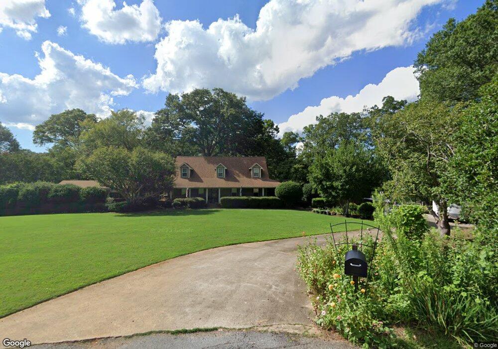
107 Wiltshire Ct Anderson, SC 29621
Estimated Value: $363,000 - $602,000
3
Beds
3
Baths
3,751
Sq Ft
$133/Sq Ft
Est. Value
About This Home
This home is located at 107 Wiltshire Ct, Anderson, SC 29621 and is currently estimated at $499,151, approximately $133 per square foot. 107 Wiltshire Ct is a home located in Anderson County with nearby schools including Midway Elementary School, Glenview Middle School, and T.L. Hanna High School.
Ownership History
Date
Name
Owned For
Owner Type
Purchase Details
Closed on
May 9, 2022
Sold by
Holder Lindsey C
Bought by
Holder Lindsey C and Holder Kathleen
Current Estimated Value
Purchase Details
Closed on
Mar 30, 2021
Sold by
Violette Brian M
Bought by
Holder Lindsey C and Holder Kathleen
Home Financials for this Owner
Home Financials are based on the most recent Mortgage that was taken out on this home.
Original Mortgage
$300,000
Interest Rate
3%
Mortgage Type
New Conventional
Create a Home Valuation Report for This Property
The Home Valuation Report is an in-depth analysis detailing your home's value as well as a comparison with similar homes in the area
Home Values in the Area
Average Home Value in this Area
Purchase History
| Date | Buyer | Sale Price | Title Company |
|---|---|---|---|
| Holder Lindsey C | -- | None Listed On Document | |
| Holder Lindsey C | $425,000 | None Available |
Source: Public Records
Mortgage History
| Date | Status | Borrower | Loan Amount |
|---|---|---|---|
| Previous Owner | Holder Lindsey C | $300,000 |
Source: Public Records
Tax History Compared to Growth
Tax History
| Year | Tax Paid | Tax Assessment Tax Assessment Total Assessment is a certain percentage of the fair market value that is determined by local assessors to be the total taxable value of land and additions on the property. | Land | Improvement |
|---|---|---|---|---|
| 2024 | $1,791 | $15,090 | $1,060 | $14,030 |
| 2023 | $1,791 | $15,090 | $1,060 | $14,030 |
| 2022 | $7,142 | $22,630 | $1,590 | $21,040 |
| 2021 | $6,304 | $19,150 | $1,200 | $17,950 |
| 2020 | $6,209 | $19,150 | $1,200 | $17,950 |
| 2019 | $6,209 | $19,150 | $1,200 | $17,950 |
| 2018 | $1,539 | $12,770 | $800 | $11,970 |
| 2017 | -- | $12,770 | $800 | $11,970 |
| 2016 | $1,385 | $12,610 | $880 | $11,730 |
| 2015 | $1,418 | $12,610 | $880 | $11,730 |
| 2014 | $1,413 | $12,610 | $880 | $11,730 |
Source: Public Records
Map
Nearby Homes
- 607 Hopewell Ridge
- 1420 White Oak Dr
- 174 Buckland Dr
- 1 Tolkien Dr
- Lot 46 Loudwater Dr
- 4 Rohan Dr
- 402 Hopewell Ridge
- 105 Bree Dr
- 104 Harlond Dr
- 139 Rivendell Dr
- 289 Silo Ridge Dr
- 283 Silo Ridge Dr
- 274 Silo Ridge Dr
- 276 Silo Ridge Dr
- 288 Silo Ridge Dr
- 284 Silo Ridge Dr
- 278 Silo Ridge Dr
- 131 Silo Ridge Dr
- 129 Silo Ridge Dr
- 231 Silo Ridge Dr
- 110 Wiltshire Ct
- 105 Wiltshire Ct
- 106 Wiltshire Ct
- 610 Hopewell Ridge
- 104 Wiltshire Ct
- 103 Wiltshire Ct
- 608 Hopewell Ridge
- 403 Devon Way
- 401 Devon Way
- 301 Devon Way
- 303 Devon Way
- 1306 White Oak Dr
- 606 Hopewell Ridge
- 1304 White Oak Dr
- 1401 White Oak Dr
- 219 Devon Way Unit ANDERSON
- 219 Devon Way
- 405 Devon Way
- 1302 White Oak Dr
- 604 Hopewell Ridge