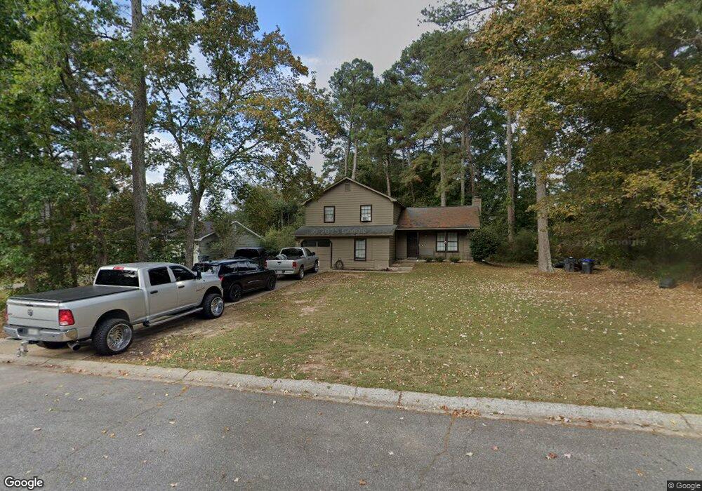
1070 Forest Park Ln Suwanee, GA 30024
Estimated Value: $341,401 - $392,000
3
Beds
2
Baths
1,308
Sq Ft
$280/Sq Ft
Est. Value
About This Home
This home is located at 1070 Forest Park Ln, Suwanee, GA 30024 and is currently estimated at $366,600, approximately $280 per square foot. 1070 Forest Park Ln is a home located in Gwinnett County with nearby schools including Walnut Grove Elementary School, Creekland Middle School, and Collins Hill High School.
Ownership History
Date
Name
Owned For
Owner Type
Purchase Details
Closed on
May 9, 2018
Sold by
Lee Curtis W
Bought by
Lee Carol S and Lee Curtis W
Current Estimated Value
Purchase Details
Closed on
Jun 11, 2004
Sold by
Lee Carol S
Bought by
Lee Curtis W
Home Financials for this Owner
Home Financials are based on the most recent Mortgage that was taken out on this home.
Original Mortgage
$104,200
Interest Rate
6.09%
Mortgage Type
New Conventional
Create a Home Valuation Report for This Property
The Home Valuation Report is an in-depth analysis detailing your home's value as well as a comparison with similar homes in the area
Home Values in the Area
Average Home Value in this Area
Purchase History
| Date | Buyer | Sale Price | Title Company |
|---|---|---|---|
| Lee Carol S | -- | -- | |
| Lee Curtis W | -- | -- |
Source: Public Records
Mortgage History
| Date | Status | Borrower | Loan Amount |
|---|---|---|---|
| Previous Owner | Lee Curtis W | $104,200 |
Source: Public Records
Tax History Compared to Growth
Tax History
| Year | Tax Paid | Tax Assessment Tax Assessment Total Assessment is a certain percentage of the fair market value that is determined by local assessors to be the total taxable value of land and additions on the property. | Land | Improvement |
|---|---|---|---|---|
| 2025 | $4,851 | $127,240 | $22,120 | $105,120 |
| 2024 | $5,005 | $130,240 | $33,200 | $97,040 |
| 2023 | $5,005 | $130,240 | $33,200 | $97,040 |
| 2022 | $4,015 | $103,280 | $27,200 | $76,080 |
| 2021 | $2,845 | $69,480 | $12,480 | $57,000 |
| 2020 | $2,859 | $69,480 | $12,480 | $57,000 |
| 2019 | $2,754 | $69,480 | $12,480 | $57,000 |
| 2018 | $2,754 | $69,480 | $12,480 | $57,000 |
| 2016 | $1,747 | $40,240 | $6,000 | $34,240 |
| 2015 | $1,762 | $40,240 | $6,000 | $34,240 |
| 2014 | $1,436 | $30,880 | $6,000 | $24,880 |
Source: Public Records
Map
Nearby Homes
- 619 Kenridge Way
- 2305 Compton Place
- 727 Eight Point Ct
- 2445 Whitehead Place Dr
- 715 Welford Rd
- 2538 Brentmoor Ct
- 868 Ashley Crossing Ln
- 2105 Tropicana Dr
- 327 Lee Miller Dr
- 804 Bankshire Dr
- 2470 Jakin Way
- 2430 Jakin Way
- 318 Lee Miller Dr
- 2210 Ashley Crossing Ct Unit 2
- 2021 Huntcliff Dr Unit 1
- 620 Telfair Ct
- 741 Saddle Wood Way
- 1974 Hunt Crossing Ct Unit 1
- 2312 Mahogany Glen Place
- 1050 Forest Park Ln Unit 1
- 2350 Whitehead Place Dr Unit 1
- 626 Kenridge Way
- 624 Kenridge Way Unit 35
- 1030 Forest Park Ln Unit 1
- 622 Kenridge Way Unit 34
- 1071 Forest Park Ln
- 1061 Forest Park Ln
- 2360 Whitehead Place Dr
- 618 Kenridge Way Unit 32
- 616 Kenridge Way Unit 31
- 634 Kenridge Way Unit 38
- 1020 Forest Park Ln
- 636 Kenridge Way
- 636 Kenridge Way Unit 636
- 0 Kenridge Way Unit 8024676
- 0 Kenridge Way Unit 8087324
- 0 Kenridge Way Unit 7268362
- 0 Kenridge Way Unit 8008334
- 0 Kenridge Way Unit 7323412