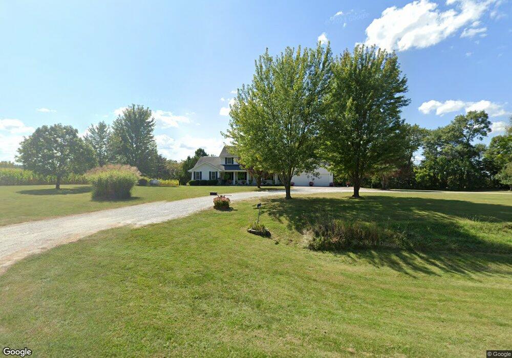
1070 Highway 78 Wayland, IA 52654
Estimated Value: $358,000 - $561,936
6
Beds
2
Baths
2,968
Sq Ft
$155/Sq Ft
Est. Value
About This Home
This home is located at 1070 Highway 78, Wayland, IA 52654 and is currently estimated at $459,968, approximately $154 per square foot. 1070 Highway 78 is a home located in Henry County with nearby schools including WACO Elementary School and WACO High School.
Create a Home Valuation Report for This Property
The Home Valuation Report is an in-depth analysis detailing your home's value as well as a comparison with similar homes in the area
Home Values in the Area
Average Home Value in this Area
Tax History Compared to Growth
Tax History
| Year | Tax Paid | Tax Assessment Tax Assessment Total Assessment is a certain percentage of the fair market value that is determined by local assessors to be the total taxable value of land and additions on the property. | Land | Improvement |
|---|---|---|---|---|
| 2025 | $6,674 | $472,850 | $64,940 | $407,910 |
| 2024 | $6,310 | $416,220 | $50,760 | $365,460 |
| 2023 | $6,322 | $416,220 | $50,760 | $365,460 |
| 2022 | $6,140 | $344,250 | $39,300 | $304,950 |
| 2021 | $6,140 | $344,250 | $39,300 | $304,950 |
| 2020 | $6,058 | $330,050 | $43,860 | $286,190 |
| 2019 | $5,350 | $332,550 | $0 | $0 |
| 2018 | $5,108 | $332,550 | $0 | $0 |
| 2017 | $5,108 | $315,520 | $0 | $0 |
| 2016 | $4,546 | $291,630 | $0 | $0 |
| 2015 | $4,546 | $306,470 | $0 | $0 |
| 2014 | $4,976 | $306,470 | $0 | $0 |
Source: Public Records
Map
Nearby Homes
- 1083 Benton Ave
- 204 W 3rd St
- 402 E Railroad St
- 408 E Front St
- Tbd 320th St
- 1320 Clayton Ave
- TBD 320th St
- 2604 330th St
- 1326 150th St
- 117 E Washington St
- 113 W Washington St
- 410 S Mechanic St
- 408 S Mechanic St
- 0 Iowa Ave
- 1750 140th St
- 3327 Terrace Lake Rd
- 3329 Terrace Lake Rd
- 0000 295th St
- 3300-1 Underwood Ave
- 3300 Underwood Ave
- 1084 Ash Ave
- 0 Hwy 78 Unit 202204753
- 1072 110th St
- 1083 Ash Ave
- 1096 Ash Ave
- 1062 Ash Ave
- 1068 110th St
- 1050 Ash Ave
- 1099 Ash Ave
- 1118 Highway 78
- 1035 Ash Ave
- 0 Coppock Rd Unit 28004822
- 0 Coppock Rd Unit 28004821
- 0 Coppock Rd Unit 5427168
- 0 Coppock Rd Unit 5427169
- 1023 Ash Ave
- 101 Coppock Rd
- 3 Coppock Rd
- 115 Locust Ave
- 100 Locust Ave