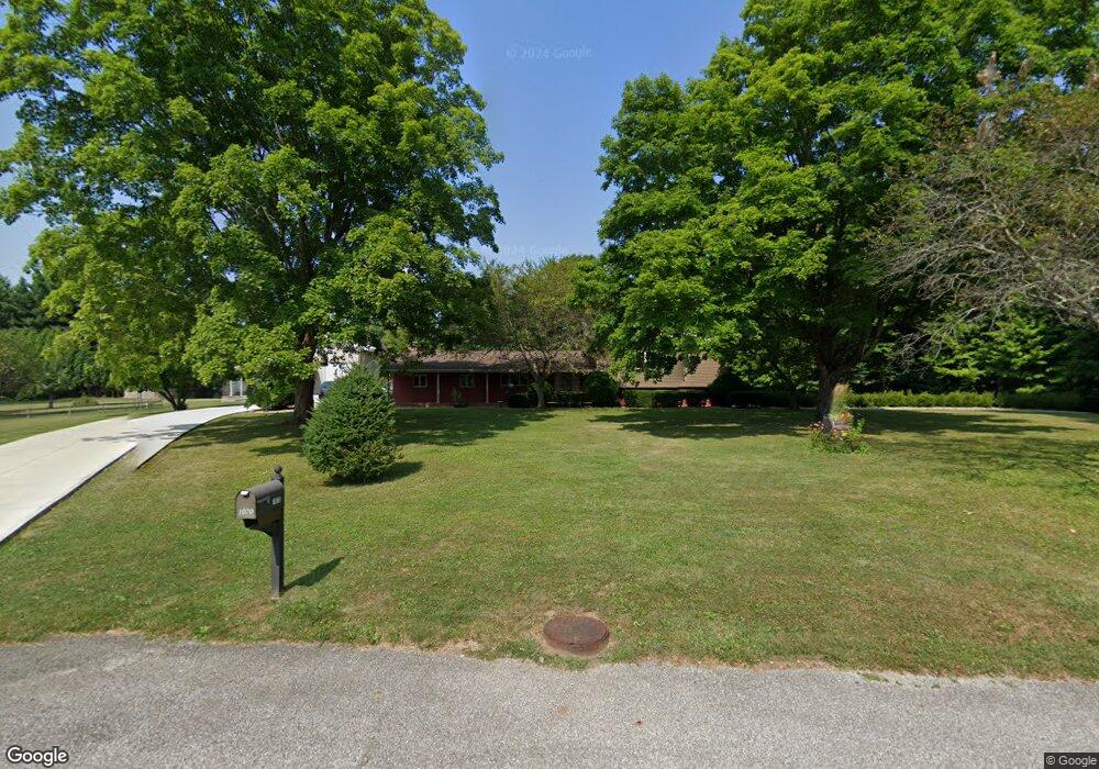
1070 Royal Ct NE Lancaster, OH 43130
Estimated Value: $366,000 - $453,519
4
Beds
4
Baths
2,688
Sq Ft
$152/Sq Ft
Est. Value
About This Home
This home is located at 1070 Royal Ct NE, Lancaster, OH 43130 and is currently estimated at $409,880, approximately $152 per square foot. 1070 Royal Ct NE is a home located in Fairfield County with nearby schools including Medill Elementary School, Thomas Ewing Junior High School, and Lancaster High School.
Ownership History
Date
Name
Owned For
Owner Type
Purchase Details
Closed on
Nov 16, 2006
Sold by
Sheridan Brian J and Sheridan Kristen K
Bought by
Sheridan Kristen K
Current Estimated Value
Purchase Details
Closed on
May 14, 2002
Sold by
Searfoorce Mark T
Bought by
Sheridan Brian J and Sheridan Kristen K
Home Financials for this Owner
Home Financials are based on the most recent Mortgage that was taken out on this home.
Original Mortgage
$150,000
Outstanding Balance
$64,718
Interest Rate
7.24%
Mortgage Type
New Conventional
Estimated Equity
$345,162
Purchase Details
Closed on
Feb 25, 1994
Sold by
Moore Donald A
Bought by
Moore Donald A
Purchase Details
Closed on
Feb 5, 1993
Sold by
Moore Donald A
Bought by
Moore Donald A
Create a Home Valuation Report for This Property
The Home Valuation Report is an in-depth analysis detailing your home's value as well as a comparison with similar homes in the area
Home Values in the Area
Average Home Value in this Area
Purchase History
| Date | Buyer | Sale Price | Title Company |
|---|---|---|---|
| Sheridan Kristen K | -- | None Available | |
| Sheridan Brian J | $225,000 | -- | |
| Moore Donald A | $169,800 | -- | |
| Moore Donald A | -- | -- |
Source: Public Records
Mortgage History
| Date | Status | Borrower | Loan Amount |
|---|---|---|---|
| Open | Sheridan Brian J | $150,000 |
Source: Public Records
Tax History Compared to Growth
Tax History
| Year | Tax Paid | Tax Assessment Tax Assessment Total Assessment is a certain percentage of the fair market value that is determined by local assessors to be the total taxable value of land and additions on the property. | Land | Improvement |
|---|---|---|---|---|
| 2024 | $10,745 | $110,660 | $20,530 | $90,130 |
| 2023 | $4,464 | $110,660 | $20,530 | $90,130 |
| 2022 | $4,520 | $110,660 | $20,530 | $90,130 |
| 2021 | $3,834 | $91,250 | $18,660 | $72,590 |
| 2020 | $3,854 | $91,250 | $18,660 | $72,590 |
| 2019 | $3,518 | $91,250 | $18,660 | $72,590 |
| 2018 | $2,935 | $71,990 | $18,660 | $53,330 |
| 2017 | $2,938 | $71,990 | $18,660 | $53,330 |
| 2016 | $2,725 | $71,990 | $18,660 | $53,330 |
| 2015 | $2,732 | $69,990 | $18,660 | $51,330 |
| 2014 | $2,607 | $69,990 | $18,660 | $51,330 |
| 2013 | $2,607 | $69,990 | $18,660 | $51,330 |
Source: Public Records
Map
Nearby Homes
- 2149 Pleasantview Dr NE
- 1801 Pleasantview Dr NE
- 715 Sherman Bluff Way Unit 14715
- 1700 Rosewood Dr NE
- 0 Old Millersport Rd NE Unit Lot 10 225033491
- 0 Old Millersport Rd NE Unit 225010386
- 0 Old Millersport Rd NE Unit Tract 8 224028101
- 2444 Sheridan Dr
- 0 Tschopp Rd NE Unit Lot 33 225027324
- 0 Tschopp Rd NE Unit Lot 17 225027320
- 1916 Country Place
- 1760 Rainbow Dr NE
- 980 Coonpath Rd NE
- 1976 Breed Hill Ct
- 1799 Declaration Dr W
- 1669 Lexington Dr
- 0 Declaration Dr W Unit 219044159
- 173 Lakeview Dr NE
- 1750 Coonpath Rd NE Unit Tract 5
- 3155 Old Millersport Rd NE
- 1090 Royal Ct NE
- 1089 Royal Ct NE
- 1030 Rhoda Ln NE
- 1010 Rhoda Ln NE
- 2340 Lancaster Newark Rd NE
- 2340 Lancaster Newark Rd NE
- 1050 Rhoda Ln NE
- 1109 Royal Ct NE
- 1110 Royal Ct NE
- 2251 Scenic Dr NE
- 1130 Royal Ct NE
- 1129 Royal Ct NE
- 2205 Pleasantview Dr NE
- 2275 Scenic Dr NE
- 1037 Rhoda Ln NE
- 2204 Pleasantview Dr NE
- 2199 Scenic Dr NE
- 2375 Sunnyhill Dr NE
- 2300 Lancaster Newark Rd NE
- 1150 Royal Ct NE