
Seller's Agent in 2013
Jim Cleveland
RE/MAX
(217) 433-1144
512 Total Sales
Estimated Value: $162,000 - $293,095
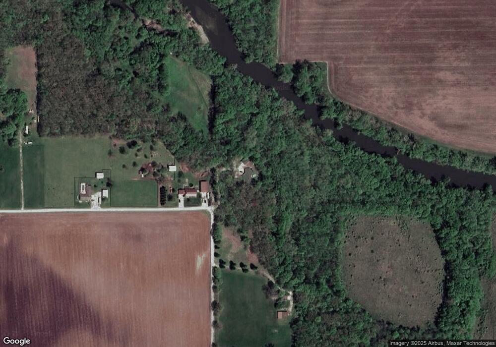
Over $18,000 Price Drop!! Berm ranch with brick embossed concrete walls in wooded setting on over 5.5 acres along Sangamon River. Many possibilities to add your personal style as home is in beginning stages of remodeling. Patio door from master bedroom leads to backyard with vista of the woods. Country kitchen with large dining area & bay window. Wood shed and play cabin. Partially fenced yard. Private setting of densely wooded hardwoods & two small ponds and deer galore! HOME WARRANTY.
Last Buyer's Agent
Gary Loy
Dammerman & Associates Benchmark Realty
| Date | Buyer | Sale Price | Title Company |
|---|---|---|---|
| Donovan Ryan A | $107,500 | None Available | |
| -- | -- | -- | |
| -- | $125,000 | -- | |
| -- | $117,500 | -- |
| Date | Status | Borrower | Loan Amount |
|---|---|---|---|
| Open | Donovan Ryan A | $92,000 |
| Date | Event | Price | List to Sale | Price per Sq Ft | Prior Sale |
|---|---|---|---|---|---|
| 01/24/2013 01/24/13 | Sold | $107,500 | 0.0% | $44 / Sq Ft | View Prior Sale |
| 01/24/2013 01/24/13 | Sold | $107,500 | 0.0% | $44 / Sq Ft | |
| 01/23/2013 01/23/13 | For Sale | $107,500 | -23.2% | $44 / Sq Ft | |
| 12/10/2012 12/10/12 | Pending | -- | -- | -- | |
| 12/14/2011 12/14/11 | For Sale | $139,897 | -- | $57 / Sq Ft |
| Year | Tax Paid | Tax Assessment Tax Assessment Total Assessment is a certain percentage of the fair market value that is determined by local assessors to be the total taxable value of land and additions on the property. | Land | Improvement |
|---|---|---|---|---|
| 2024 | $4,831 | $75,513 | $13,297 | $62,216 |
| 2023 | $4,141 | $63,477 | $12,056 | $51,421 |
| 2022 | $3,855 | $57,637 | $10,947 | $46,690 |
| 2021 | $3,793 | $54,747 | $10,398 | $44,349 |
| 2020 | $3,620 | $51,590 | $9,798 | $41,792 |
| 2019 | $3,620 | $51,590 | $9,798 | $41,792 |
| 2018 | $3,514 | $50,367 | $9,566 | $40,801 |
| 2017 | $3,519 | $50,579 | $9,606 | $40,973 |
| 2016 | $3,549 | $50,518 | $9,594 | $40,924 |
| 2015 | $3,415 | $49,047 | $9,315 | $39,732 |
| 2014 | $3,279 | $48,562 | $9,223 | $39,339 |
| 2013 | $3,416 | $48,562 | $9,223 | $39,339 |
Seller's Agent in 2013
Jim Cleveland
RE/MAX
(217) 433-1144
512 Total Sales
G
Buyer's Agent in 2013
Gary Loy
Dammerman & Associates Benchmark Realty
Source: Central Illinois Board of REALTORS®
MLS Number: 4217561
APN: 02-11-31-200-011
Ask me questions while you tour the home.