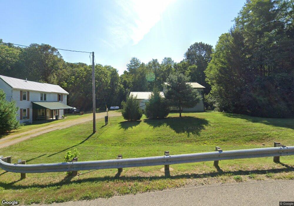
10700 State Route 682 the Plains, OH 45780
Estimated Value: $120,481 - $264,000
3
Beds
1
Bath
1,512
Sq Ft
$145/Sq Ft
Est. Value
About This Home
This home is located at 10700 State Route 682, the Plains, OH 45780 and is currently estimated at $219,870, approximately $145 per square foot. 10700 State Route 682 is a home located in Athens County with nearby schools including The Plains Elementary School, Athens Middle School, and Athens High School.
Ownership History
Date
Name
Owned For
Owner Type
Purchase Details
Closed on
Jun 30, 2025
Sold by
Wymer Renee M
Bought by
Chesser Teri A
Current Estimated Value
Home Financials for this Owner
Home Financials are based on the most recent Mortgage that was taken out on this home.
Original Mortgage
$142,000
Outstanding Balance
$141,760
Interest Rate
6.86%
Mortgage Type
New Conventional
Estimated Equity
$78,110
Purchase Details
Closed on
Sep 6, 2002
Sold by
Brady Edison
Bought by
Wymer Gary M
Purchase Details
Closed on
Mar 29, 2001
Sold by
Hultgren Harry A
Bought by
Brady Edison
Purchase Details
Closed on
Sep 3, 1992
Sold by
Hultgren Harry A
Bought by
Hultgren Harry A
Create a Home Valuation Report for This Property
The Home Valuation Report is an in-depth analysis detailing your home's value as well as a comparison with similar homes in the area
Home Values in the Area
Average Home Value in this Area
Purchase History
| Date | Buyer | Sale Price | Title Company |
|---|---|---|---|
| Chesser Teri A | $185,000 | Secured Title | |
| Wymer Gary M | $62,900 | -- | |
| Brady Edison | $50,000 | -- | |
| Hultgren Harry A | -- | -- |
Source: Public Records
Mortgage History
| Date | Status | Borrower | Loan Amount |
|---|---|---|---|
| Open | Chesser Teri A | $142,000 |
Source: Public Records
Tax History Compared to Growth
Tax History
| Year | Tax Paid | Tax Assessment Tax Assessment Total Assessment is a certain percentage of the fair market value that is determined by local assessors to be the total taxable value of land and additions on the property. | Land | Improvement |
|---|---|---|---|---|
| 2024 | $957 | $26,680 | $7,230 | $19,450 |
| 2023 | $942 | $26,680 | $7,230 | $19,450 |
| 2022 | $780 | $22,440 | $6,120 | $16,320 |
| 2021 | $783 | $22,440 | $6,120 | $16,320 |
| 2020 | $721 | $22,440 | $6,120 | $16,320 |
| 2019 | $661 | $20,420 | $5,310 | $15,110 |
| 2018 | $640 | $20,420 | $5,310 | $15,110 |
| 2017 | $1,896 | $20,420 | $5,310 | $15,110 |
| 2016 | $775 | $23,690 | $4,820 | $18,870 |
| 2015 | $2,337 | $23,690 | $4,820 | $18,870 |
| 2014 | $2,337 | $23,690 | $4,820 | $18,870 |
| 2013 | $2,233 | $23,220 | $4,820 | $18,400 |
Source: Public Records
Map
Nearby Homes
- 10639 State Route 682
- 10639 Ohio 682
- 4-20 Beech Rd
- 0 S Plains Rd
- 0 Carol Ln Unit 2433046
- 7 W 2nd St
- 0 Shady Ln
- 36 Johnson Rd
- 115 University Estates Blvd
- 5 Oak St
- 8175 Vore Ridge Rd
- 13 Rallen Dr
- 10 Rallen Dr
- 98 Central Ave
- 550 W Union St
- 0 Lemaster Rd Unit 23368524
- 0 Lemaster Rd Unit 11486521
- 56.15/15.5 Central & Clark
- 0 Luhrig Rd
- 0 Lemaster Rd
- 10711 State Route 682
- 10669 State Route 682
- 10800 State Route 682
- 10811 State Route 682
- 10811 State Route 682
- 10605 State Route 682
- SR682 Highway
- 10590 Ohio 682
- 10595 State Route 682
- 10833 State Route 682
- 10578 State Route 682
- 10574 State Route 682
- 3 Slater Dr
- 10558 Ohio 682
- 10570 Ohio 682
- 10547 State Route 682
- 10522 Ohio 682
- 10522 State Route 682
- 10515 State Route 682
- 10485 State Route 682