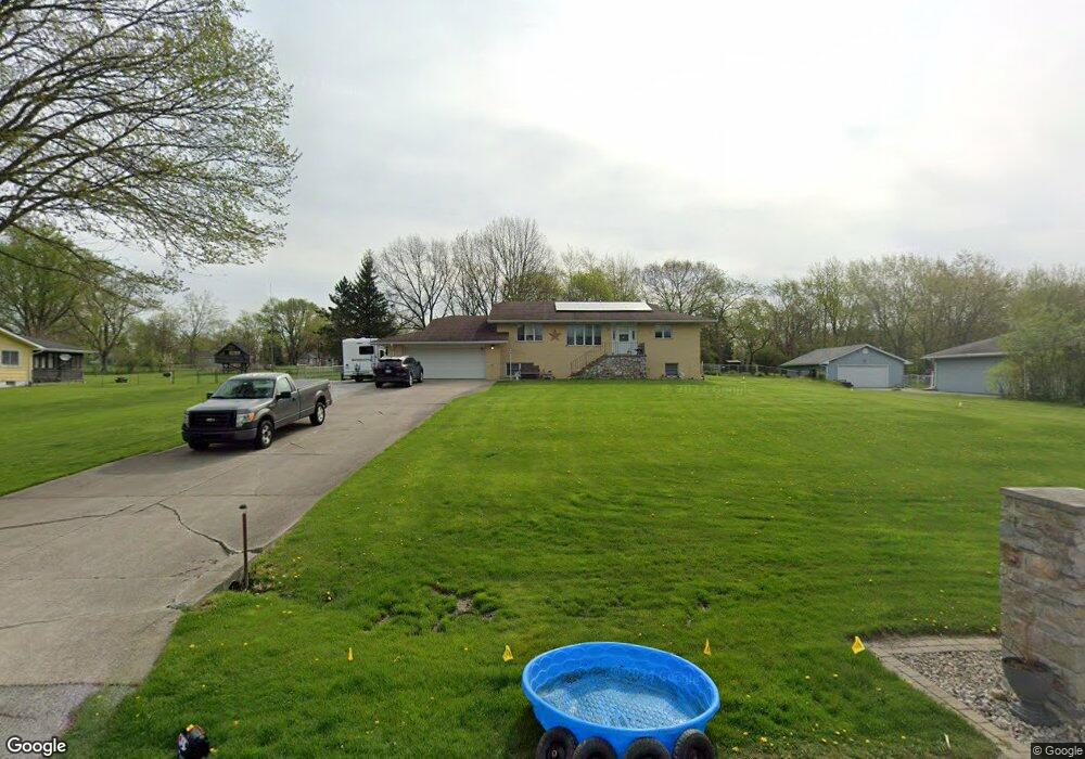
10705 Porter St Crown Point, IN 46307
Estimated Value: $423,000 - $506,000
2
Beds
3
Baths
3,168
Sq Ft
$146/Sq Ft
Est. Value
About This Home
This home is located at 10705 Porter St, Crown Point, IN 46307 and is currently estimated at $462,035, approximately $145 per square foot. 10705 Porter St is a home located in Lake County with nearby schools including Timothy Ball Elementary School, Robert Taft Middle School, and Crown Point High School.
Ownership History
Date
Name
Owned For
Owner Type
Purchase Details
Closed on
Aug 1, 2018
Sold by
Andrews Arnold Claude
Bought by
Andrews Arnold Claude and Andrews Jill L
Current Estimated Value
Purchase Details
Closed on
Nov 20, 2017
Sold by
Rupp John and Ziegler Lloyd J
Bought by
Rupp John
Purchase Details
Closed on
Oct 20, 2010
Sold by
Ziegler Lloyd J
Bought by
Ziegler Lloyd J and Andrews Arnold Claude
Create a Home Valuation Report for This Property
The Home Valuation Report is an in-depth analysis detailing your home's value as well as a comparison with similar homes in the area
Home Values in the Area
Average Home Value in this Area
Purchase History
| Date | Buyer | Sale Price | Title Company |
|---|---|---|---|
| Andrews Arnold Claude | -- | None Available | |
| Rupp John | -- | None Available | |
| Ziegler Lloyd J | -- | None Available |
Source: Public Records
Tax History Compared to Growth
Tax History
| Year | Tax Paid | Tax Assessment Tax Assessment Total Assessment is a certain percentage of the fair market value that is determined by local assessors to be the total taxable value of land and additions on the property. | Land | Improvement |
|---|---|---|---|---|
| 2024 | $7,700 | $383,000 | $38,500 | $344,500 |
| 2023 | $3,503 | $362,300 | $38,500 | $323,800 |
| 2022 | $3,819 | $356,800 | $38,500 | $318,300 |
| 2021 | $3,398 | $336,200 | $29,700 | $306,500 |
| 2020 | $3,422 | $322,700 | $29,700 | $293,000 |
| 2019 | $3,636 | $327,200 | $29,700 | $297,500 |
| 2018 | $3,743 | $319,500 | $29,700 | $289,800 |
| 2017 | $6,152 | $299,500 | $29,700 | $269,800 |
| 2016 | $3,360 | $284,600 | $29,700 | $254,900 |
| 2014 | $3,263 | $295,200 | $29,700 | $265,500 |
| 2013 | $3,285 | $297,400 | $29,700 | $267,700 |
Source: Public Records
Map
Nearby Homes
- 10710 Porter St
- 10729 Hanley St
- 10813 Lane St
- 5496 W 107th Ct
- 7830 W 106th Ln
- 7770 W 106th Ln
- 11217 Burr Parcel 2 St
- 3725 W 105th Ave
- 11224 Durbin Place
- 700 Meadow Ln
- 11341 Lakewood St
- 767 Kenmare Pkwy
- 3604 W 104th Place
- 771 Kenmare Pkwy
- 11531 Westvalley Dr
- 11606 Westvalley Dr
- 114 S Chase Dr
- 621 Pratt St
- 301 Hoffman St
- 1667 Chalone Ct
- 10707 Porter St
- 10701 Porter St
- 10709 Porter St
- 10702 Porter St
- 10625 Porter St
- 10704 Porter St
- 10706 Porter St
- 10700 Porter St
- 10711 Porter St
- 10708 Porter St
- 4730 W 107th Place
- 10624 Porter St
- 10622 Porter St
- 10627 Porter St
- 4710 W 107th Place
- 10630 Baker Place
- 4675 W 107th Place
- 10803 Porter St
- 10620 Porter St
- 10800 Porter St
