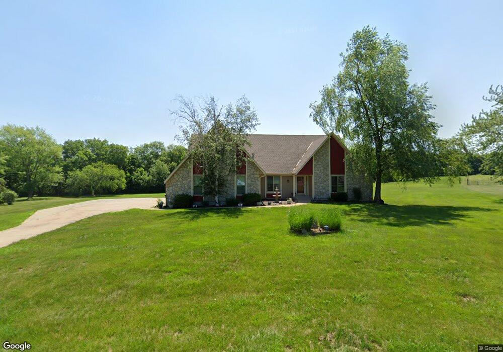
10705 W 154th St Overland Park, KS 66221
South Overland Park NeighborhoodEstimated Value: $802,000 - $1,004,000
4
Beds
4
Baths
3,022
Sq Ft
$292/Sq Ft
Est. Value
About This Home
This home is located at 10705 W 154th St, Overland Park, KS 66221 and is currently estimated at $883,631, approximately $292 per square foot. 10705 W 154th St is a home located in Johnson County with nearby schools including Morse Elementary School, Aubry Bend Middle School, and Blue Valley Southwest High School.
Ownership History
Date
Name
Owned For
Owner Type
Purchase Details
Closed on
Oct 13, 2020
Sold by
Hill Loren D and Hill Cheryl R
Bought by
Hill Loren D and Hill Cheryl R
Current Estimated Value
Home Financials for this Owner
Home Financials are based on the most recent Mortgage that was taken out on this home.
Original Mortgage
$300,000
Interest Rate
2.8%
Mortgage Type
New Conventional
Create a Home Valuation Report for This Property
The Home Valuation Report is an in-depth analysis detailing your home's value as well as a comparison with similar homes in the area
Home Values in the Area
Average Home Value in this Area
Purchase History
| Date | Buyer | Sale Price | Title Company |
|---|---|---|---|
| Hill Loren D | -- | Security 1St Title Llc |
Source: Public Records
Mortgage History
| Date | Status | Borrower | Loan Amount |
|---|---|---|---|
| Closed | Hill Loren D | $300,000 |
Source: Public Records
Tax History Compared to Growth
Tax History
| Year | Tax Paid | Tax Assessment Tax Assessment Total Assessment is a certain percentage of the fair market value that is determined by local assessors to be the total taxable value of land and additions on the property. | Land | Improvement |
|---|---|---|---|---|
| 2024 | $8,157 | $79,131 | $34,073 | $45,058 |
| 2023 | $7,952 | $76,119 | $30,972 | $45,147 |
| 2022 | $7,024 | $66,067 | $25,832 | $40,235 |
| 2021 | $7,024 | $64,193 | $25,832 | $38,361 |
| 2020 | $7,459 | $66,263 | $25,832 | $40,431 |
| 2019 | $7,378 | $64,159 | $25,836 | $38,323 |
| 2018 | $6,473 | $55,177 | $25,836 | $29,341 |
| 2017 | $6,542 | $54,775 | $27,768 | $27,007 |
| 2016 | $6,311 | $52,797 | $27,768 | $25,029 |
| 2015 | $5,509 | $45,896 | $23,140 | $22,756 |
| 2013 | -- | $43,573 | $23,140 | $20,433 |
Source: Public Records
Map
Nearby Homes
- 10319 W 151st Terrace
- 10311 W 151st Terrace
- The Westminster Plan at Villas of Avalon
- The Camelot Plan at Villas of Avalon
- The Coventry Plan at Villas of Avalon
- 15225 Perry St
- Westminster Plan at Villas of Avalon
- Camelot Plan at Villas of Avalon
- Coventry Plan at Villas of Avalon
- 10303 W 151st Terrace
- 11628 W 154th St
- 11307 W 158th Terrace
- 10125 W 149th Terrace
- 15348 Carter Rd
- 16001 Ballentine St
- 15460 Quivira Rd
- 9519 W 151st Terrace
- 9617 W 150th St
- 16200 Bluejacket St
- 16924 Futura St
- 10805 W 154th St
- 15385 Melrose St
- 10850 W 154th St
- 15350 Melrose St
- 15335 Melrose St
- 10905 W 154th St
- 15430 Switzer Rd
- 10950 W 154th St
- 11005 W 154th St
- 15345 Melrose Place
- 15310 Melrose St
- 15340 Larsen St
- 15344 Larsen St
- 11015 W 154th St
- 15332 Larsen St
- 15348 Larsen St
- 15325 Melrose St
- 10815 W 153rd Terrace
- 15400 Larsen St
- 15328 Larsen St