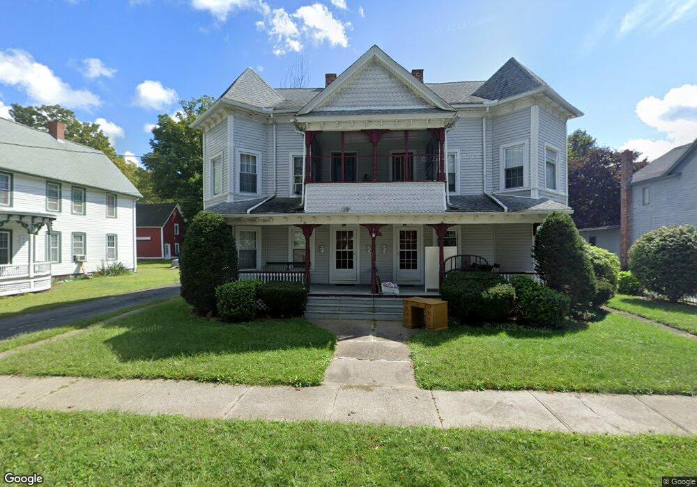
1071 Central St Unit 1073 Palmer, MA 01069
Estimated Value: $340,000 - $384,000
5
Beds
3
Baths
3,592
Sq Ft
$99/Sq Ft
Est. Value
About This Home
This home is located at 1071 Central St Unit 1073, Palmer, MA 01069 and is currently estimated at $356,000, approximately $99 per square foot. 1071 Central St Unit 1073 is a home located in Hampden County with nearby schools including Old Mill Pond Elementary School, Converse Middle School, and Palmer High School.
Ownership History
Date
Name
Owned For
Owner Type
Purchase Details
Closed on
Nov 5, 2020
Sold by
Rondeau Rachael L
Bought by
Rondeau Michelle L
Current Estimated Value
Purchase Details
Closed on
Nov 3, 2020
Sold by
Rondeau Christopher R
Bought by
Rondeau Michelle L
Create a Home Valuation Report for This Property
The Home Valuation Report is an in-depth analysis detailing your home's value as well as a comparison with similar homes in the area
Home Values in the Area
Average Home Value in this Area
Purchase History
| Date | Buyer | Sale Price | Title Company |
|---|---|---|---|
| Rondeau Michelle L | -- | None Available | |
| Rondeau Rachael L | -- | None Available | |
| Rondeau Michelle L | -- | None Available | |
| Rondeau Rachael L | -- | None Available | |
| Rondeau Michelle L | -- | None Available | |
| Rondeau Michelle L | -- | None Available |
Source: Public Records
Tax History Compared to Growth
Tax History
| Year | Tax Paid | Tax Assessment Tax Assessment Total Assessment is a certain percentage of the fair market value that is determined by local assessors to be the total taxable value of land and additions on the property. | Land | Improvement |
|---|---|---|---|---|
| 2025 | $6,663 | $367,100 | $53,600 | $313,500 |
| 2024 | $4,583 | $245,500 | $48,700 | $196,800 |
| 2023 | $4,351 | $223,800 | $48,700 | $175,100 |
| 2022 | $4,017 | $187,700 | $42,700 | $145,000 |
| 2021 | $3,666 | $162,000 | $47,300 | $114,700 |
| 2020 | $3,548 | $155,600 | $47,300 | $108,300 |
| 2019 | $3,445 | $155,600 | $47,300 | $108,300 |
| 2018 | $3,372 | $152,700 | $45,900 | $106,800 |
| 2017 | $3,294 | $152,700 | $45,900 | $106,800 |
| 2016 | $3,344 | $157,200 | $44,600 | $112,600 |
| 2015 | $3,243 | $157,200 | $44,600 | $112,600 |
Source: Public Records
Map
Nearby Homes
- 1018-1020 Maple St
- 44 Converse St
- 2034 Pleasant St
- 72 Quaboag Valley Co Op St Unit 70
- 160 Breckenridge St
- 207 Breckenridge St
- L 65-35-1 Pine Hill Dr
- 0 St Unit 73414881
- Lot 0 Thorndike and Lawrence St
- 62-91 Lawrence St
- Lot 8 Breckenridge St
- Lots 39-42 Lawrence
- 11 Allen St
- 1029 Wilson St
- 1415 Park St
- 1682 N Main St
- 268 Palmer Rd Unit 59
- 268 Palmer Rd Unit 44
- 268 Palmer Rd Unit 27
- 268 Palmer Rd Unit 2
- 1075 Central St
- 1067 Central St Unit 1069
- 1016 Maple St
- 1065 Central St
- 1065 Central St Unit B
- 1079 Central St
- 1064 Central St
- 1012 Maple St
- 1010 Maple St Unit 1012
- 1010 Maple St Unit 2
- 1070 Central St
- 1018 Maple St Unit 1020
- 1006-1008 Maple St
- 1006 Maple St Unit 1008
- 1057 Central St
- 1072 Central St
- 1083 Central St Unit 1085
- 54 Converse St
- 7 Grove St
- 47 Walnut St