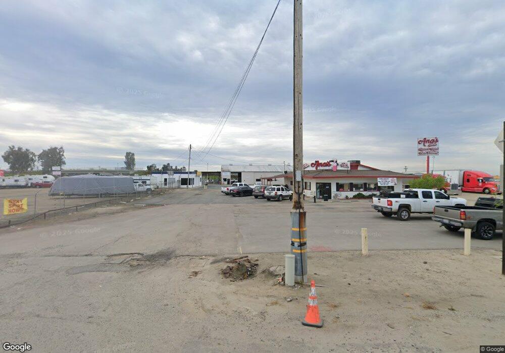
1071 E Rankin Rd Tulare, CA 93274
Tulare Southeast Neighborhood
--
Bed
3
Baths
3,050
Sq Ft
1
Acres
About This Home
This home is located at 1071 E Rankin Rd, Tulare, CA 93274. 1071 E Rankin Rd is a home located in Tulare County with nearby schools including Palo Verde Elementary School and Tulare Union High School.
Ownership History
Date
Name
Owned For
Owner Type
Purchase Details
Closed on
Mar 17, 2010
Sold by
Faria Raymond G
Bought by
Faria #2 Limited Partnership
Purchase Details
Closed on
Sep 30, 2009
Sold by
Faria Ray
Bought by
Faria Raymond G and Faria Letha K
Purchase Details
Closed on
Jun 27, 2005
Sold by
Freitas Danny S
Bought by
Faria Ray and Faria Letha
Home Financials for this Owner
Home Financials are based on the most recent Mortgage that was taken out on this home.
Original Mortgage
$352,000
Interest Rate
5.7%
Mortgage Type
Unknown
Purchase Details
Closed on
Feb 26, 1997
Sold by
Koster Frances
Bought by
Freitas Danny S and Freitas Jeanette A
Home Financials for this Owner
Home Financials are based on the most recent Mortgage that was taken out on this home.
Original Mortgage
$315,000
Interest Rate
7.63%
Create a Home Valuation Report for This Property
The Home Valuation Report is an in-depth analysis detailing your home's value as well as a comparison with similar homes in the area
Home Values in the Area
Average Home Value in this Area
Purchase History
| Date | Buyer | Sale Price | Title Company |
|---|---|---|---|
| Faria #2 Limited Partnership | -- | None Available | |
| Faria Raymond G | -- | None Available | |
| Faria Ray | $1,100,000 | Chicago Title Co | |
| Freitas Danny S | $450,000 | Chicago Title Co |
Source: Public Records
Mortgage History
| Date | Status | Borrower | Loan Amount |
|---|---|---|---|
| Previous Owner | Faria Ray | $352,000 | |
| Previous Owner | Freitas Danny S | $315,000 |
Source: Public Records
Tax History Compared to Growth
Tax History
| Year | Tax Paid | Tax Assessment Tax Assessment Total Assessment is a certain percentage of the fair market value that is determined by local assessors to be the total taxable value of land and additions on the property. | Land | Improvement |
|---|---|---|---|---|
| 2025 | $6,322 | $580,868 | $400,156 | $180,712 |
| 2024 | $6,322 | $569,479 | $392,310 | $177,169 |
| 2023 | $6,162 | $558,314 | $384,618 | $173,696 |
| 2022 | $5,982 | $547,368 | $377,077 | $170,291 |
| 2021 | $5,905 | $536,635 | $369,683 | $166,952 |
| 2020 | $6,004 | $531,132 | $365,892 | $165,240 |
| 2019 | $6,155 | $520,718 | $358,718 | $162,000 |
| 2018 | $6,056 | $510,508 | $351,684 | $158,824 |
| 2017 | $6,000 | $500,498 | $344,788 | $155,710 |
| 2016 | $5,737 | $490,684 | $338,027 | $152,657 |
| 2015 | $5,545 | $483,314 | $332,950 | $150,364 |
| 2014 | $5,545 | $473,847 | $326,428 | $147,419 |
Source: Public Records
Map
Nearby Homes
- 900 E Rankin Rd Unit 3
- 900 E Rankin Rd Unit 18
- 900 E Rankin Rd Unit 26
- 900 E Rankin Rd Unit 72
- 900 E Rankin Rd Unit 69
- 900 E Rankin Rd
- 900 E Rankin Rd Unit 5
- 900 E Rankin Rd Unit 134
- 900 E Rankin Rd Unit 30
- 0 Avenue 196
- 0 Road 112 Unit 202510708
- 0 Road 112 Unit 11681417
- 0 Road 112 Unit 232822
- 014 S Laspina St
- 182330014 S Laspina St
- 4620 Ave 288
- 571 SFT Bay Hill Dr
- 0 Road 160 Unit 232939
- 0 Road 160 Unit 237784
- 193 Ottawa Place
- 1075 E Rankin Rd
- 2135 Tamworth Ave
- 2117 Tamworth Ave
- 2118 Tamworth Ave
- 2143 Tamworth Ave
- 1035 E Rankin Rd
- 1183 E Rankin Rd
- 1035 Avenue 200
- 1069 E Rankin Rd
- 1073 E Rankin Rd
- 1066 E Rankin Rd
- 966 E Rankin Rd
- 900 W Rankin Unit 63
- 900 W Rankin
- 900 E Rankin Rd Unit 41
- 900 E Rankin Rd Unit 11
- 900 E Rankin Rd Unit 10
- 900 E Rankin Rd Unit 152
- 900 E Rankin Rd Unit 44
- 900 E Rankin Rd Unit 76
