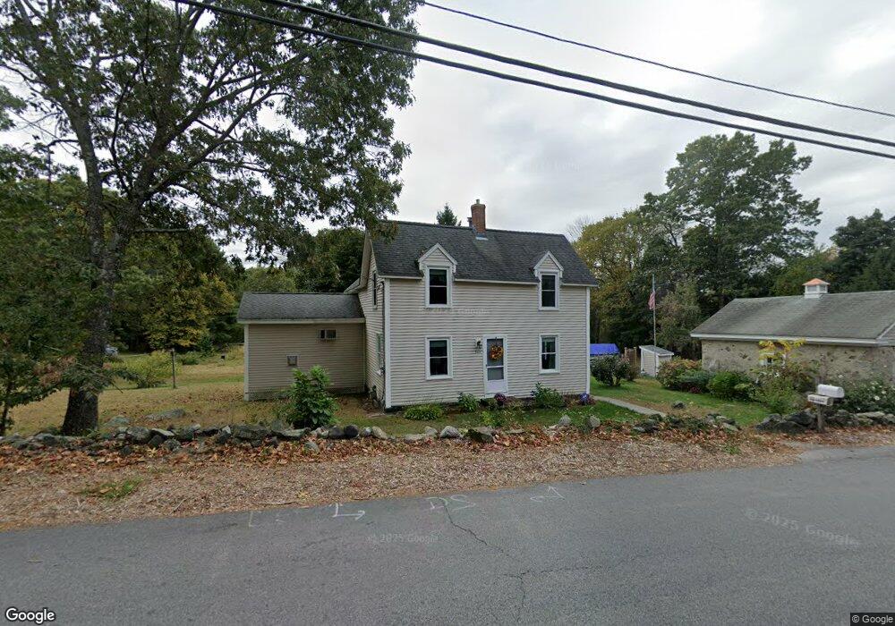
1071 Methuen St Dracut, MA 01826
Estimated Value: $545,000 - $664,000
3
Beds
2
Baths
1,553
Sq Ft
$399/Sq Ft
Est. Value
About This Home
This home is located at 1071 Methuen St, Dracut, MA 01826 and is currently estimated at $620,133, approximately $399 per square foot. 1071 Methuen St is a home located in Middlesex County with nearby schools including Joseph A. Campbell Elementary School, Richardson Middle School, and Dracut Senior High School.
Ownership History
Date
Name
Owned For
Owner Type
Purchase Details
Closed on
Jan 16, 2019
Sold by
Rogers Jr Ft
Bought by
M J Jr & T F Rogers Irt
Current Estimated Value
Purchase Details
Closed on
Mar 6, 2015
Sold by
Marshall J Rogers Jr F
Bought by
Rogers Jr Ft
Purchase Details
Closed on
Aug 21, 2007
Sold by
Rogers Marshall J and Rogers Theresa F
Bought by
Johnson Christine and Johnson Eric
Create a Home Valuation Report for This Property
The Home Valuation Report is an in-depth analysis detailing your home's value as well as a comparison with similar homes in the area
Home Values in the Area
Average Home Value in this Area
Purchase History
| Date | Buyer | Sale Price | Title Company |
|---|---|---|---|
| M J Jr & T F Rogers Irt | -- | -- | |
| Rogers Jr Ft | -- | -- | |
| Johnson Christine | -- | -- |
Source: Public Records
Tax History Compared to Growth
Tax History
| Year | Tax Paid | Tax Assessment Tax Assessment Total Assessment is a certain percentage of the fair market value that is determined by local assessors to be the total taxable value of land and additions on the property. | Land | Improvement |
|---|---|---|---|---|
| 2025 | $6,169 | $609,600 | $240,600 | $369,000 |
| 2024 | $5,952 | $569,600 | $229,300 | $340,300 |
| 2023 | $5,778 | $499,000 | $199,500 | $299,500 |
| 2022 | $5,830 | $474,400 | $182,100 | $292,300 |
| 2021 | $5,688 | $437,200 | $166,000 | $271,200 |
| 2020 | $5,716 | $428,200 | $161,200 | $267,000 |
| 2019 | $2,255 | $388,500 | $153,800 | $234,700 |
| 2018 | $5,294 | $374,400 | $153,800 | $220,600 |
| 2017 | $5,084 | $374,400 | $153,800 | $220,600 |
| 2016 | $4,971 | $335,000 | $148,100 | $186,900 |
| 2015 | $4,813 | $322,400 | $148,100 | $174,300 |
| 2014 | $4,548 | $313,900 | $148,100 | $165,800 |
Source: Public Records
Map
Nearby Homes
- 931 Methuen St Unit 6
- 51 Bellevue Ave
- 31 Varnum Ave
- 14 Mount Pleasant Ave
- 821 Merrimack Ave
- 820 Methuen St Unit 820
- 2 Francis Dr Unit 412
- 4 Francis Dr Unit 105
- 2 Francis Dr Unit 213
- 4 Francis Dr Unit 207
- 173 Merrimack Meadows Ln Unit 162
- 78 Merrimack Meadows Ln Unit 78
- 11 Merrimack Meadows Ln Unit 17
- 16 Winding Ln
- 16 Wetherbee Ave
- 173 Brook St
- 15 Sharyn Cir
- 4 Hazelwood Ave Unit 12
- 100 Merrimack Ave Unit 91
- 100 Merrimack Ave Unit 124
- 15 Tellier Way
- 1052 Methuen St
- 1100 Methuen St
- 1046 Methuen St
- 4 Presidential Cir
- 25 Tellier Way
- 1117 Methuen St
- 1024 Methuen St
- 8 Presidential Cir
- 8 Presidential Cir
- 7 Katies Way
- 5 Presidential Cir
- 5 Presidential Cir
- 34 Tellier Way
- 7 Presidential Cir
- 35 Tellier Way
- 84 Tellier Way
- 1018 Methuen St
- 12 Presidential Cir
- 3 Presidential Cir