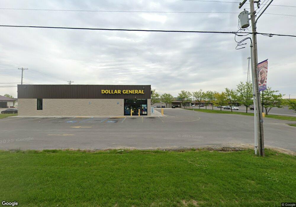
1071 N Williams St Paulding, OH 45879
Estimated Value: $1,813,894
--
Bed
--
Bath
--
Sq Ft
1.19
Acres
About This Home
This home is located at 1071 N Williams St, Paulding, OH 45879 and is currently estimated at $1,813,894. 1071 N Williams St is a home located in Paulding County with nearby schools including Paulding High School.
Ownership History
Date
Name
Owned For
Owner Type
Purchase Details
Closed on
Jun 27, 2023
Sold by
Cd Dg Paulding Llc
Bought by
Crossroad Real Estate Llc
Current Estimated Value
Home Financials for this Owner
Home Financials are based on the most recent Mortgage that was taken out on this home.
Original Mortgage
$1,000,000
Outstanding Balance
$607,346
Interest Rate
6.71%
Mortgage Type
Credit Line Revolving
Estimated Equity
$1,206,548
Purchase Details
Closed on
Jun 3, 2022
Sold by
Gross Gerald M and Gross Carol R
Bought by
Cd Dg Paulding Llc
Home Financials for this Owner
Home Financials are based on the most recent Mortgage that was taken out on this home.
Original Mortgage
$1,484,000
Interest Rate
5.27%
Mortgage Type
New Conventional
Purchase Details
Closed on
Apr 2, 1997
Bought by
Gross Gerald M Gross Carol R
Create a Home Valuation Report for This Property
The Home Valuation Report is an in-depth analysis detailing your home's value as well as a comparison with similar homes in the area
Home Values in the Area
Average Home Value in this Area
Purchase History
| Date | Buyer | Sale Price | Title Company |
|---|---|---|---|
| Crossroad Real Estate Llc | $388,925 | None Listed On Document | |
| Cd Dg Paulding Llc | $49,975 | Byrd Campbell Pa | |
| Gross Gerald M Gross Carol R | $85,000 | -- |
Source: Public Records
Mortgage History
| Date | Status | Borrower | Loan Amount |
|---|---|---|---|
| Open | Crossroad Real Estate Llc | $1,000,000 | |
| Previous Owner | Cd Dg Paulding Llc | $1,484,000 |
Source: Public Records
Tax History Compared to Growth
Tax History
| Year | Tax Paid | Tax Assessment Tax Assessment Total Assessment is a certain percentage of the fair market value that is determined by local assessors to be the total taxable value of land and additions on the property. | Land | Improvement |
|---|---|---|---|---|
| 2024 | $15,162 | $282,870 | $68,250 | $214,620 |
| 2023 | $15,162 | $8,370 | $8,370 | $0 |
| 2022 | $444 | $8,370 | $8,370 | $0 |
| 2021 | $462 | $8,370 | $8,370 | $0 |
| 2020 | $429 | $8,370 | $8,370 | $0 |
| 2019 | $439 | $8,370 | $8,370 | $0 |
| 2018 | $455 | $8,370 | $8,370 | $0 |
| 2017 | $453 | $8,370 | $8,370 | $0 |
| 2016 | $455 | $8,370 | $8,370 | $0 |
| 2015 | $445 | $8,370 | $8,370 | $0 |
| 2014 | $450 | $8,370 | $8,370 | $0 |
| 2013 | $471 | $8,370 | $8,370 | $0 |
Source: Public Records
Map
Nearby Homes
- 1045 Emerald Rd
- 1051 Emerald Rd
- 1065 Emerald Rd
- 13120 Helen St
- Tract 2 - 0000 Ohio 111
- 0000 Ohio 111
- 907 Country View Dr
- 752 N Dix St
- 741 Tom Tim Dr
- 825 Johnson Rd
- 606 Lincoln Ave
- 13678 Nancy St
- 13688 Kay St
- 12052 Dennis St
- 629 Airport Rd
- 215 N Dewitt St
- 614 W Jackson St
- 720 W Perry St
- 300 S Williams St
- 717 W Harrison St
- 1090 N Williams St
- 1082 N Williams St
- 1070 N Williams St
- 1052 N Williams St
- 1048 N Williams St
- 12702 Maple Ave
- 12582 Maple Ave
- 1036 N Williams St
- 0 N Williams St Unit 5079840
- 12642 Maple Ave
- 1096 N Williams St
- 12464 Maple Ave
- 12532 Maple Ave
- 1028 N Williams St
- 12438 Maple Ave
- 12866 Maple Ave
- TBD N Williams St St
- 1098 N Williams St
- 1019 N Williams St
- 12388 Maple Ave