Estimated Value: $1,049,000 - $1,411,000
3
Beds
2
Baths
5,112
Sq Ft
$236/Sq Ft
Est. Value
About This Home
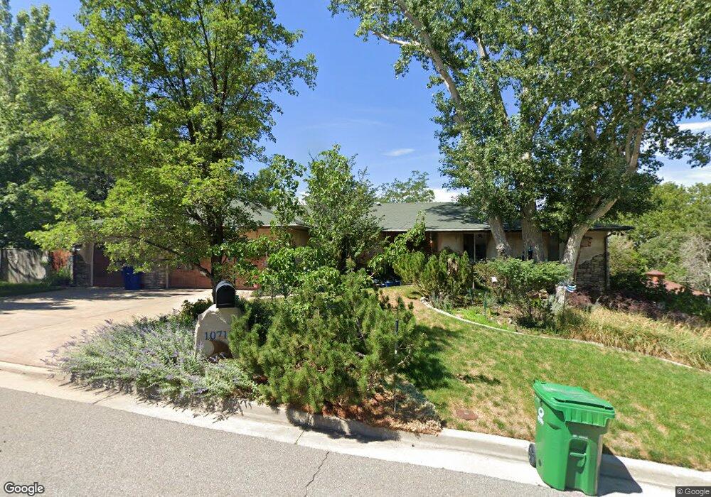
This home is located at 10718 Maple Hill Cir, Sandy, UT 84092 and is currently estimated at $1,208,233, approximately $236 per square foot. 10718 Maple Hill Cir is a home located in Salt Lake County with nearby schools including Granite Elementary School, Bell Canyon Montessori School, and Challenger School - Sandy.
Ownership History
Date
Name
Owned For
Owner Type
Purchase Details
Closed on
Jan 24, 2021
Sold by
Thompson Rudy Y and Thompson Pamela C
Bought by
Thompson Rudy Young and Thompson Pamela Christine
Current Estimated Value
Purchase Details
Closed on
Nov 30, 2000
Sold by
Unterreiner Joseph and Unterreiner Lydia
Bought by
Thompson Rudy Y and Thompson Pamela C
Home Financials for this Owner
Home Financials are based on the most recent Mortgage that was taken out on this home.
Original Mortgage
$101,000
Outstanding Balance
$37,648
Interest Rate
7.86%
Estimated Equity
$1,170,585
Purchase Details
Closed on
Sep 2, 1997
Sold by
Estep James G
Bought by
Unterreiner Joseph and Unterreiner Lydia
Home Financials for this Owner
Home Financials are based on the most recent Mortgage that was taken out on this home.
Original Mortgage
$135,000
Interest Rate
6.96%
Create a Home Valuation Report for This Property
The Home Valuation Report is an in-depth analysis detailing your home's value as well as a comparison with similar homes in the area
Home Values in the Area
Average Home Value in this Area
Purchase History
| Date | Buyer | Sale Price | Title Company |
|---|---|---|---|
| Thompson Rudy Young | -- | None Available | |
| Thompson Rudy Y | -- | Sutherland Title | |
| Unterreiner Joseph | -- | Superior Title Company |
Source: Public Records
Mortgage History
| Date | Status | Borrower | Loan Amount |
|---|---|---|---|
| Open | Thompson Rudy Y | $101,000 | |
| Previous Owner | Unterreiner Joseph | $135,000 |
Source: Public Records
Tax History Compared to Growth
Tax History
| Year | Tax Paid | Tax Assessment Tax Assessment Total Assessment is a certain percentage of the fair market value that is determined by local assessors to be the total taxable value of land and additions on the property. | Land | Improvement |
|---|---|---|---|---|
| 2025 | $5,934 | $1,040,300 | $365,200 | $675,100 |
| 2024 | $5,934 | $935,200 | $351,500 | $583,700 |
| 2023 | $5,604 | $839,400 | $338,000 | $501,400 |
| 2022 | $5,781 | $855,600 | $326,200 | $529,400 |
| 2021 | $5,215 | $676,000 | $238,900 | $437,100 |
| 2020 | $5,433 | $657,300 | $238,900 | $418,400 |
| 2019 | $5,130 | $616,300 | $225,300 | $391,000 |
| 2018 | $4,899 | $594,900 | $225,300 | $369,600 |
| 2017 | $4,689 | $557,000 | $225,300 | $331,700 |
| 2016 | $4,160 | $484,700 | $207,600 | $277,100 |
| 2015 | $4,871 | $527,600 | $295,200 | $232,400 |
| 2014 | $4,783 | $503,300 | $287,900 | $215,400 |
Source: Public Records
Map
Nearby Homes
- 2125 Dimple Dell Rd
- 10665 S 2340 E
- 5 Quietwood Ln
- 1 Pepperwood Pointe
- 2009 E Sweetbriar Ln
- 2111 Glacier View Dr
- 15 Lone Hollow Dr
- 2022 Tall Pines Way
- 39 Northridge Way
- 2234 E Willow Brook Way
- 2067 E Gyrfalcon Ln
- 10868 Prescott Dr
- 10273 Flanders Rd
- 11065 Longdale Cir
- 98 E Lone Hollow Dr S Unit 902
- 11458 Lexington Hills Dr
- 9957 S 2270 E
- 2103 Kramer Dr
- 1 Cross Hill Ln
- 18 Snow Forest Ln
- 10701 S Trailridge Cir
- 10701 Trailridge Cir
- 10732 Maple Hill Cir
- 10696 Maple Hill Cir
- 10721 S Trailridge Cir
- 10721 S Trailridge Cir
- 10713 Maple Hill Cir
- 10729 Maple Hill Cir
- 10681 Trailridge Cir
- 10689 Maple Hill Cir
- 10724 S Trailridge Cir
- 2185 High Ridge Ln
- 2185 E High Ridge Ln
- 10704 Stone Gate Cir
- 2173 High Ridge Ln
- 2173 E High Ridge Ln
- 10704 S Trailridge Cir
- 10704 Trailridge Cir
- 2180 E Dimple Dell Rd
- 2180 Dimple Dell Rd