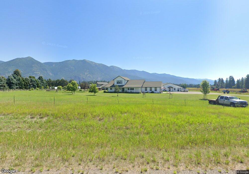
1072 Mt Highway 206 Columbia Falls, MT 59912
Estimated Value: $1,015,441 - $1,834,000
3
Beds
3
Baths
2,560
Sq Ft
$508/Sq Ft
Est. Value
About This Home
This home is located at 1072 Mt Highway 206, Columbia Falls, MT 59912 and is currently estimated at $1,299,360, approximately $507 per square foot. 1072 Mt Highway 206 is a home located in Flathead County with nearby schools including Fair-Mont-Egan Elementary School, Fair-Mont-Egan Junior High School, and Flathead High School.
Ownership History
Date
Name
Owned For
Owner Type
Purchase Details
Closed on
Jun 26, 2021
Sold by
Henson Joseph Edward and Henson Shannon Ray
Bought by
Henson Joseph Edward and Henson Shannon Ray
Current Estimated Value
Home Financials for this Owner
Home Financials are based on the most recent Mortgage that was taken out on this home.
Original Mortgage
$281,000
Outstanding Balance
$235,475
Interest Rate
3%
Mortgage Type
New Conventional
Estimated Equity
$1,063,885
Purchase Details
Closed on
Nov 9, 2006
Sold by
Henson J E
Bought by
Montana Department Of Transportation
Purchase Details
Closed on
Apr 11, 2005
Sold by
Henson J E
Bought by
Henson Shannon R
Create a Home Valuation Report for This Property
The Home Valuation Report is an in-depth analysis detailing your home's value as well as a comparison with similar homes in the area
Home Values in the Area
Average Home Value in this Area
Purchase History
| Date | Buyer | Sale Price | Title Company |
|---|---|---|---|
| Henson Joseph Edward | -- | None Available | |
| Montana Department Of Transportation | -- | None Available | |
| Henson Shannon R | -- | None Available |
Source: Public Records
Mortgage History
| Date | Status | Borrower | Loan Amount |
|---|---|---|---|
| Open | Henson Joseph Edward | $281,000 |
Source: Public Records
Tax History Compared to Growth
Tax History
| Year | Tax Paid | Tax Assessment Tax Assessment Total Assessment is a certain percentage of the fair market value that is determined by local assessors to be the total taxable value of land and additions on the property. | Land | Improvement |
|---|---|---|---|---|
| 2025 | $3,788 | $959,100 | $0 | $0 |
| 2024 | $4,010 | $702,700 | $0 | $0 |
| 2023 | $4,013 | $702,700 | $0 | $0 |
| 2022 | $3,629 | $505,900 | $0 | $0 |
| 2021 | $4,037 | $505,900 | $0 | $0 |
| 2020 | $3,593 | $438,200 | $0 | $0 |
| 2019 | $3,541 | $438,200 | $0 | $0 |
| 2018 | $3,381 | $404,700 | $0 | $0 |
| 2017 | $3,217 | $404,700 | $0 | $0 |
| 2016 | $2,724 | $330,800 | $0 | $0 |
| 2015 | $2,741 | $330,800 | $0 | $0 |
| 2014 | $2,604 | $190,907 | $0 | $0 |
Source: Public Records
Map
Nearby Homes
- 1020 Middle Rd
- 521 Yeoman Hall Rd
- 962 White Fawn Ln
- 1200 Fairview Cemetery Rd Unit 1200
- 2049 Homestead Trail
- 2022 Homestead Trail
- 834 Blackmer Ln
- 56 Wood Ridge Dr
- 43 Ridgeway Ct
- 660 Sweetgrass Ranch Rd
- 1017 Green Valley Ct
- 1012 Green Valley Ct
- 74 Wood Ridge Dr
- 100 Timber Axe Ln
- 32 Elk Meadow Ln
- 200 & 190 Weaver Ln
- 113 Wood Ridge Dr
- 532 Sweetgrass Ranch Rd
- 1785 Mt Highway 206
- 599 Van Sant Rd
- 1020 Mt Highway 206
- 1065 Mt Highway 206
- 1059 Montana Highway 206
- 1065 Montana Highway 206
- 1055 Mt Highway 206
- 1076 Mt Highway 206
- 1277 Austin Crossroad
- 208 Palouse Ln
- 141 Blackmer Ln
- 190 Palouse Ln
- NHN Blackmer Ln Unit Lot 3
- NHN Blackmer Ln
- 153 Blackmer Ln
- 220 Palouse Ln
- 201 Palouse Ln
- 185 Palouse Ln
- 218 Blackmer Ln
- 210 Blackmer Ln
- 202 Blackmer Ln
- 281 Blackmer Ln