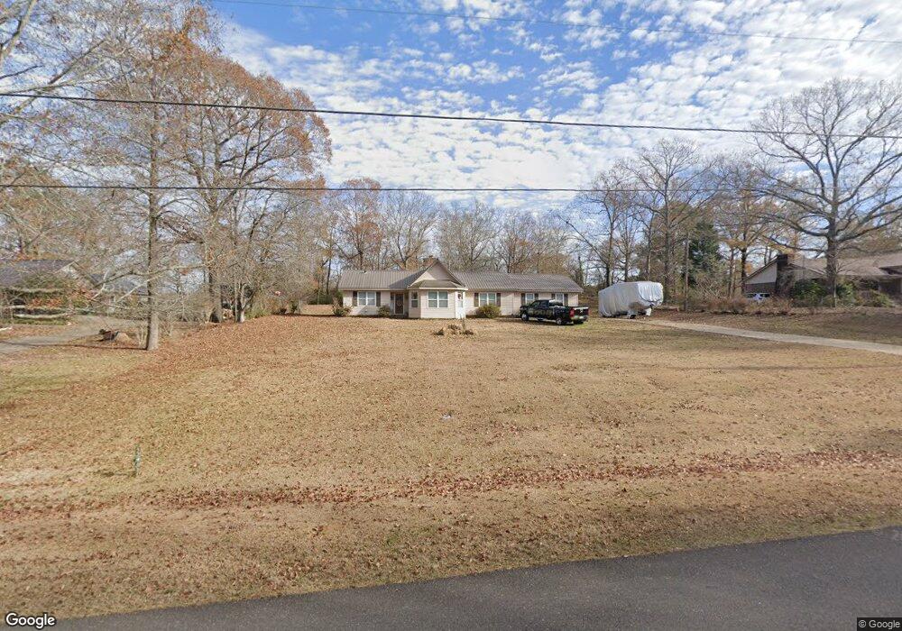
10720 Lower Coaling Rd Coaling, AL 35453
Estimated Value: $240,349 - $305,000
--
Bed
1
Bath
2,126
Sq Ft
$129/Sq Ft
Est. Value
About This Home
This home is located at 10720 Lower Coaling Rd, Coaling, AL 35453 and is currently estimated at $274,337, approximately $129 per square foot. 10720 Lower Coaling Rd is a home located in Tuscaloosa County with nearby schools including Vance Elementary School, Brookwood Middle School, and Brookwood High School.
Ownership History
Date
Name
Owned For
Owner Type
Purchase Details
Closed on
Sep 22, 2008
Sold by
Boyd Ronald H
Bought by
Ramer Jerold
Current Estimated Value
Home Financials for this Owner
Home Financials are based on the most recent Mortgage that was taken out on this home.
Original Mortgage
$150,297
Outstanding Balance
$99,633
Interest Rate
6.45%
Estimated Equity
$174,704
Purchase Details
Closed on
May 6, 2008
Sold by
Boyd Rachel
Bought by
Boyd Ronald H
Home Financials for this Owner
Home Financials are based on the most recent Mortgage that was taken out on this home.
Original Mortgage
$122,500
Interest Rate
5.82%
Create a Home Valuation Report for This Property
The Home Valuation Report is an in-depth analysis detailing your home's value as well as a comparison with similar homes in the area
Home Values in the Area
Average Home Value in this Area
Purchase History
| Date | Buyer | Sale Price | Title Company |
|---|---|---|---|
| Ramer Jerold | $152,297 | -- | |
| Boyd Ronald H | $184,500 | -- |
Source: Public Records
Mortgage History
| Date | Status | Borrower | Loan Amount |
|---|---|---|---|
| Open | Boyd Ronald H | $150,297 | |
| Previous Owner | Boyd Ronald H | $122,500 |
Source: Public Records
Tax History Compared to Growth
Tax History
| Year | Tax Paid | Tax Assessment Tax Assessment Total Assessment is a certain percentage of the fair market value that is determined by local assessors to be the total taxable value of land and additions on the property. | Land | Improvement |
|---|---|---|---|---|
| 2024 | $496 | $29,700 | $1,360 | $28,340 |
| 2023 | $496 | $29,700 | $1,360 | $28,340 |
| 2022 | $577 | $34,060 | $1,360 | $32,700 |
| 2021 | $577 | $34,060 | $1,360 | $32,700 |
| 2020 | $500 | $14,970 | $680 | $14,290 |
| 2019 | $500 | $14,970 | $680 | $14,290 |
| 2018 | $475 | $14,300 | $680 | $13,620 |
| 2017 | $430 | $0 | $0 | $0 |
| 2016 | $455 | $0 | $0 | $0 |
| 2015 | $455 | $0 | $0 | $0 |
| 2014 | $455 | $13,760 | $680 | $13,080 |
Source: Public Records
Map
Nearby Homes
- 14541 Keenes Mill Rd
- 10463 Beulah Lake Ln
- 10884 W Manor Dr
- 1 Brant Ward Rd
- 10799 Melrose Ln
- 00 Ashborough Dr
- 10452 N Davis Rd
- 0 N Davis Rd
- 14194 Chapel Park Rd
- 11762 Brant Ward Rd
- 0 Mallard Trail
- 10802 Mallard Lake Ln
- 16414 Highway 11 N
- 0 Wire Rd
- 10464 Nicole St
- 0 Unit 21420013
- 10617 Austin Loop
- 0 Station 32 Rd Unit 170891
- 10432 Nicole St
- 16670 Laney Ln
- 10734 Lower Coaling Rd
- 10706 Lower Coaling Rd
- 10696 Lower Coaling Rd
- 10701 Lower Coaling Rd
- 10802 Yellowstone Cir
- 10678 Lower Coaling Rd
- 10784 Yellowstone Cir
- 10784 Yellowstone Cir
- 15127 Highway 11 N
- 14974 Kepple Loop
- 10794 Lower Coaling Rd
- 14960 Kepple Loop
- 15135 Highway 11 N
- 14911 Kepple Loop
- 10805 Lower Coaling Rd
- 15081 Honeybrook Ln
- 10812 Lower Coaling Rd
- 15089 Honeybrook Ln
- 15095 Honeybrook Ln
- 10793 Lower Coaling Rd