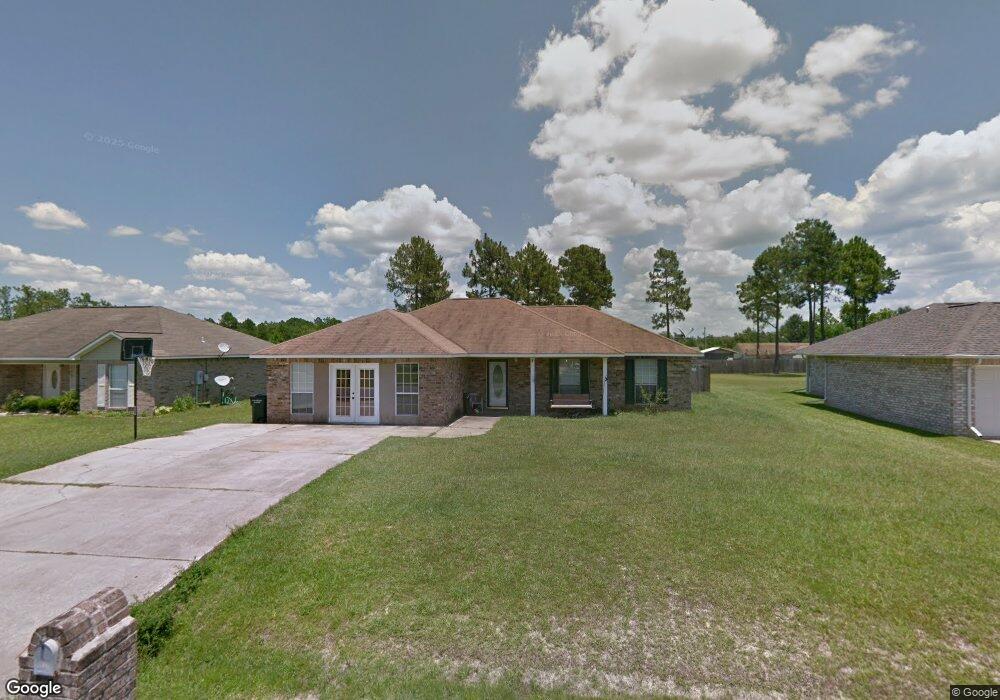
10720 Maple St Vancleave, MS 39565
Estimated Value: $209,980 - $243,000
--
Bed
2
Baths
1,968
Sq Ft
$113/Sq Ft
Est. Value
About This Home
This home is located at 10720 Maple St, Vancleave, MS 39565 and is currently estimated at $223,245, approximately $113 per square foot. 10720 Maple St is a home located in Jackson County with nearby schools including St Martin East Elementary School, St Martin North Elementary School, and St Martin Upper Elementary School.
Ownership History
Date
Name
Owned For
Owner Type
Purchase Details
Closed on
Aug 11, 2010
Sold by
Swetman Winfield S and Swetman Jon'Elle
Bought by
Swetman Properties Llc
Current Estimated Value
Home Financials for this Owner
Home Financials are based on the most recent Mortgage that was taken out on this home.
Original Mortgage
$145,500
Interest Rate
5%
Mortgage Type
Purchase Money Mortgage
Create a Home Valuation Report for This Property
The Home Valuation Report is an in-depth analysis detailing your home's value as well as a comparison with similar homes in the area
Home Values in the Area
Average Home Value in this Area
Purchase History
| Date | Buyer | Sale Price | Title Company |
|---|---|---|---|
| Swetman Properties Llc | -- | -- |
Source: Public Records
Mortgage History
| Date | Status | Borrower | Loan Amount |
|---|---|---|---|
| Closed | Swetman Properties Llc | $145,500 |
Source: Public Records
Tax History Compared to Growth
Tax History
| Year | Tax Paid | Tax Assessment Tax Assessment Total Assessment is a certain percentage of the fair market value that is determined by local assessors to be the total taxable value of land and additions on the property. | Land | Improvement |
|---|---|---|---|---|
| 2024 | $2,069 | $16,981 | $3,132 | $13,849 |
| 2023 | $2,069 | $16,981 | $3,132 | $13,849 |
| 2022 | $2,014 | $16,981 | $3,132 | $13,849 |
| 2021 | $2,026 | $17,078 | $0 | $0 |
| 2020 | $1,968 | $15,977 | $2,912 | $13,065 |
| 2019 | $1,948 | $15,977 | $2,912 | $13,065 |
| 2018 | $1,985 | $15,977 | $2,912 | $13,065 |
| 2017 | $2,018 | $15,977 | $2,912 | $13,065 |
| 2016 | $1,939 | $15,977 | $2,912 | $13,065 |
| 2015 | $1,551 | $84,670 | $19,410 | $65,260 |
| 2014 | $1,567 | $13,063 | $2,912 | $10,151 |
| 2013 | $1,491 | $12,848 | $2,912 | $9,936 |
Source: Public Records
Map
Nearby Homes
- 14920 Pine Blvd
- 10616 Oak St
- 14929 Pine Blvd
- 15712 Poydras Cir
- 0 Dantzler Rd
- 15001 Dillon St
- 13809 Briarwood Dr
- 0 Theriot Ave
- 14910 Stacey St W Unit A/B
- 9632 Theriot Ave
- 9636 Nevada Ave
- 9620 Nevada Ave
- 15228 Masterson Ave
- 9612 Nevada Ave
- 9529 Smith Ave
- 13601 Virginia St
- 14500 Mcclellan Rd
- 15232 Cypress Way
- 15655 Krohn Rd
- 9475 Belle Creek Dr
- 10724 Maple St
- 10716 Maple St
- 10800 Maple St
- 10712 Maple St
- 10721 Dogwood Dr
- 10725 Dogwood Dr
- 10717 Dogwood Dr
- 10717 Dogwood St
- 10804 Maple St
- 10708 Maple St
- 10801 Dogwood Dr
- 10721 Maple St
- 10725 Dogwood St
- 10713 Dogwood Dr
- 10717 Maple St
- 10725 Maple St
- 10713 Maple St
- 10801 Maple St
- 10805 Dogwood Dr
- 10808 Maple St