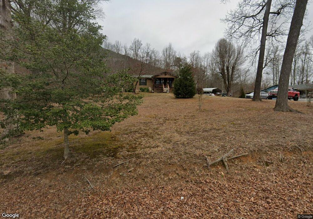
10723 Mcafee Rd Soddy Daisy, TN 37379
Estimated Value: $183,910 - $258,000
--
Bed
--
Bath
1,008
Sq Ft
$227/Sq Ft
Est. Value
About This Home
This home is located at 10723 Mcafee Rd, Soddy Daisy, TN 37379 and is currently estimated at $228,478, approximately $226 per square foot. 10723 Mcafee Rd is a home located in Hamilton County with nearby schools including New South Daisy Christian Academy.
Ownership History
Date
Name
Owned For
Owner Type
Purchase Details
Closed on
Oct 10, 2018
Sold by
Pate Mary R
Bought by
Yother Jeffrey
Current Estimated Value
Home Financials for this Owner
Home Financials are based on the most recent Mortgage that was taken out on this home.
Original Mortgage
$70,000
Outstanding Balance
$61,044
Interest Rate
4.5%
Mortgage Type
New Conventional
Estimated Equity
$167,434
Purchase Details
Closed on
Oct 14, 2003
Sold by
Thompson Regina
Bought by
Pate Mary R
Purchase Details
Closed on
Oct 11, 2003
Sold by
Pate Ray
Bought by
Pate Mary R
Purchase Details
Closed on
Sep 30, 2003
Sold by
Pate Roger
Bought by
Pate Mary R
Create a Home Valuation Report for This Property
The Home Valuation Report is an in-depth analysis detailing your home's value as well as a comparison with similar homes in the area
Home Values in the Area
Average Home Value in this Area
Purchase History
| Date | Buyer | Sale Price | Title Company |
|---|---|---|---|
| Yother Jeffrey | $120,000 | Northgate Title Ins Agcy Inc | |
| Pate Mary R | -- | -- | |
| Pate Mary R | -- | -- | |
| Pate Mary R | -- | -- |
Source: Public Records
Mortgage History
| Date | Status | Borrower | Loan Amount |
|---|---|---|---|
| Open | Yother Jeffrey | $70,000 |
Source: Public Records
Tax History Compared to Growth
Tax History
| Year | Tax Paid | Tax Assessment Tax Assessment Total Assessment is a certain percentage of the fair market value that is determined by local assessors to be the total taxable value of land and additions on the property. | Land | Improvement |
|---|---|---|---|---|
| 2024 | $690 | $30,825 | $0 | $0 |
| 2023 | $1,043 | $30,825 | $0 | $0 |
| 2022 | $1,043 | $30,825 | $0 | $0 |
| 2021 | $1,043 | $30,825 | $0 | $0 |
| 2020 | $985 | $23,700 | $0 | $0 |
| 2019 | $985 | $23,700 | $0 | $0 |
| 2018 | $985 | $23,700 | $0 | $0 |
| 2017 | $985 | $23,700 | $0 | $0 |
| 2016 | $973 | $0 | $0 | $0 |
| 2015 | $973 | $23,400 | $0 | $0 |
| 2014 | $973 | $0 | $0 | $0 |
Source: Public Records
Map
Nearby Homes
- 203 Northern Trails Dr
- 201 Northern Trails Dr
- 13212 Dayton Pike
- 11998 Dayton Pike
- 168 Turner Rd
- 110 Mountainview Dr
- 110 Mountain View Dr
- 11138 Hallett St
- 0 Hallett St
- 841 Sluder Ln
- 11008 Lovell Rd
- 11213 Dayton Pike
- 10280 Card Rd
- 11219 Dayton Pike
- 11221 Dayton Pike
- 11326 Old Dayton Pike
- 345 Ducktown St
- 325 Durham St
- 10206 Card Rd
- 10729 Mcafee Rd
- 10816 Mcafee Rd
- 212 Northern Trails Dr
- 209 Northern Trails Dr
- 10873 Ward Rd
- 10824 Mcafee Rd
- 10814 Mcafee Rd
- 200 Northern Trails Dr
- 198 Northern Trails Dr
- 210 Northern Trails Dr
- 10869 Ward Rd
- 207 Northern Trails Dr
- 207 Northern Trails Dr
- 10875 Ward Rd
- 208 Northern Trails Dr
- 10872 Ward Rd
- 10702 Mcafee Rd
- 10830 S Bend Rd
- 10876 Ward Rd
- 206 Northern Trails Dr