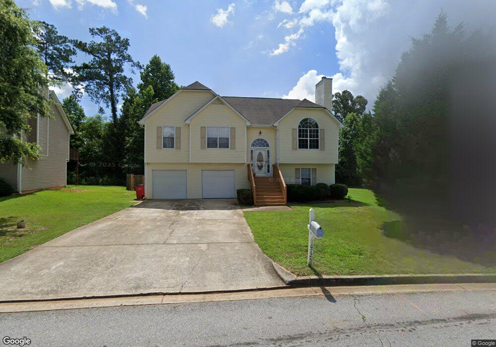
10725 Barberry Dr Unit 92 Hampton, GA 30228
Estimated Value: $307,000 - $320,000
5
Beds
3
Baths
2,684
Sq Ft
$116/Sq Ft
Est. Value
About This Home
This home is located at 10725 Barberry Dr Unit 92, Hampton, GA 30228 and is currently estimated at $312,069, approximately $116 per square foot. 10725 Barberry Dr Unit 92 is a home located in Clayton County with nearby schools including Kemp Primary School, Kemp Elementary School, and Eddie White Academy.
Ownership History
Date
Name
Owned For
Owner Type
Purchase Details
Closed on
Jul 26, 1999
Sold by
Tim Jones Communities Inc
Bought by
Crutcher Michale and Crutcher Nikita
Current Estimated Value
Home Financials for this Owner
Home Financials are based on the most recent Mortgage that was taken out on this home.
Original Mortgage
$138,226
Outstanding Balance
$37,555
Interest Rate
7.66%
Mortgage Type
VA
Estimated Equity
$274,514
Create a Home Valuation Report for This Property
The Home Valuation Report is an in-depth analysis detailing your home's value as well as a comparison with similar homes in the area
Home Values in the Area
Average Home Value in this Area
Purchase History
| Date | Buyer | Sale Price | Title Company |
|---|---|---|---|
| Crutcher Michale | $134,200 | -- |
Source: Public Records
Mortgage History
| Date | Status | Borrower | Loan Amount |
|---|---|---|---|
| Open | Crutcher Michale | $138,226 |
Source: Public Records
Tax History
| Year | Tax Paid | Tax Assessment Tax Assessment Total Assessment is a certain percentage of the fair market value that is determined by local assessors to be the total taxable value of land and additions on the property. | Land | Improvement |
|---|---|---|---|---|
| 2025 | $5,323 | $138,000 | $8,800 | $129,200 |
| 2024 | $5,539 | $141,000 | $8,800 | $132,200 |
| 2023 | $4,624 | $128,080 | $8,800 | $119,280 |
| 2022 | $4,118 | $103,960 | $8,800 | $95,160 |
| 2021 | $3,174 | $79,400 | $8,800 | $70,600 |
| 2020 | $2,913 | $71,882 | $8,800 | $63,082 |
| 2019 | $2,776 | $67,457 | $8,000 | $59,457 |
| 2018 | $2,396 | $58,090 | $8,000 | $50,090 |
| 2017 | $2,207 | $53,306 | $8,000 | $45,306 |
| 2016 | $1,832 | $44,080 | $8,000 | $36,080 |
| 2015 | $1,802 | $0 | $0 | $0 |
| 2014 | $1,357 | $33,152 | $8,000 | $25,152 |
Source: Public Records
Map
Nearby Homes
- 10725 Barberry Dr Unit 5
- 10571 Starling Trail Unit II
- 1429 Trellis Ct Unit (LOT 9)
- 1429 Trellis Ct
- 10617 Barberry Dr
- 1441 Trellis Ct
- 1441 Trellis Ct Unit (LOT 7)
- 1416 Trellis Ct
- 1428 Trellis Ct Unit (LOT 23)
- 1428 Trellis Ct
- 1434 Trellis Ct
- 1434 Trellis Ct Unit (LOT 24)
- 1362 Tara Rd
- 10429 Trellis Ln
- 10429 Trellis Ln Unit (LOT 29)
- 1342 Winslow Dr
- 10413 Trellis Ln
- 10413 Trellis Ln Unit (LOT 33)
- 1528 Carriage Ln
- 10664 Sandpiper Rd
- 10717 Barberry Dr
- 10733 Barberry Dr Unit 2
- 10523 Starling Trail
- 10709 Barberry Dr
- 10515 Starling Trail
- 10741 Barberry Dr
- 10507 Starling Trail Unit II
- 10531 Starling Trail
- 10499 Starling Trail Unit II
- 10730 Barberry Dr
- 10718 Barberry Dr
- 10701 Barberry Dr
- 10749 Barberry Dr Unit 2
- 10539 Starling Trail
- 10740 Barberry Dr
- 10493 Starling Trail
- 10708 Barberry Dr
- 10750 Barberry Dr Unit 2
- 10693 Barberry Dr
- 10547 Starling Trail Unit A
Your Personal Tour Guide
Ask me questions while you tour the home.