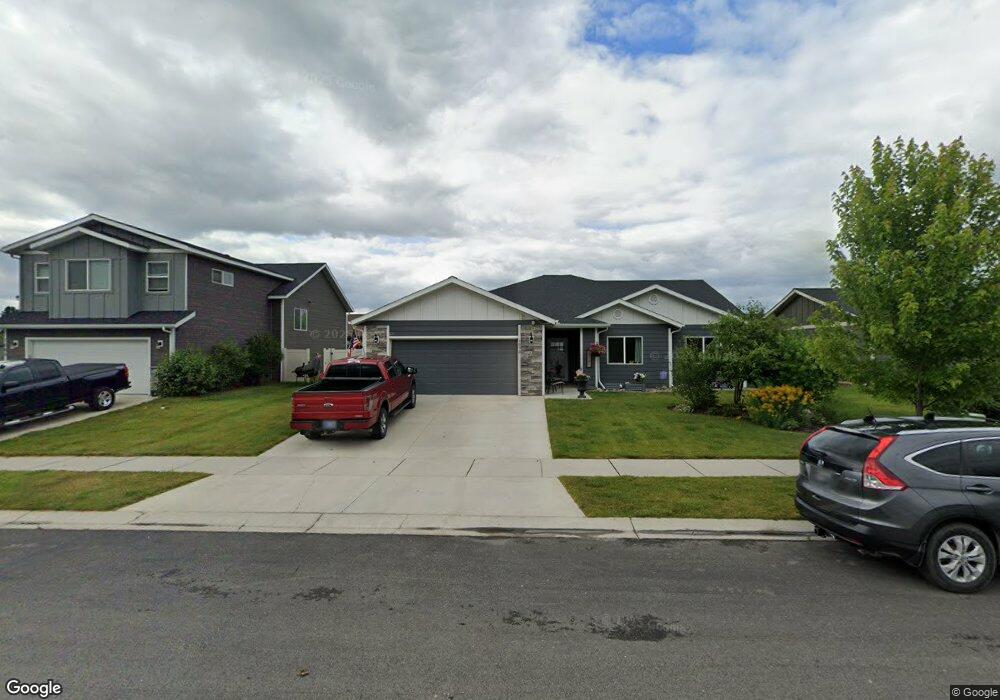
1073 Clark Fork Dr Kalispell, MT 59901
Estimated Value: $510,569 - $554,000
3
Beds
2
Baths
1,508
Sq Ft
$356/Sq Ft
Est. Value
About This Home
This home is located at 1073 Clark Fork Dr, Kalispell, MT 59901 and is currently estimated at $537,392, approximately $356 per square foot. 1073 Clark Fork Dr is a home located in Flathead County with nearby schools including Helena Flats Elementary School, Helena Flats Junior High School, and Glacier High School.
Ownership History
Date
Name
Owned For
Owner Type
Purchase Details
Closed on
Nov 20, 2020
Sold by
Swan Theresa
Bought by
Zier Dotty L and Zier Phillip E
Current Estimated Value
Home Financials for this Owner
Home Financials are based on the most recent Mortgage that was taken out on this home.
Original Mortgage
$335,000
Outstanding Balance
$298,102
Interest Rate
2.8%
Mortgage Type
Commercial
Estimated Equity
$239,290
Purchase Details
Closed on
Jun 26, 2017
Sold by
Bighorn Development & Homebuilder Inc
Bought by
Swan Gerald and Swan Theresa
Home Financials for this Owner
Home Financials are based on the most recent Mortgage that was taken out on this home.
Original Mortgage
$159,900
Interest Rate
4.05%
Mortgage Type
VA
Purchase Details
Closed on
Jul 21, 2016
Sold by
Trumbull Creek Crossing Ii Llc
Bought by
Bighorn Development & Homebuilder Inc
Create a Home Valuation Report for This Property
The Home Valuation Report is an in-depth analysis detailing your home's value as well as a comparison with similar homes in the area
Home Values in the Area
Average Home Value in this Area
Purchase History
| Date | Buyer | Sale Price | Title Company |
|---|---|---|---|
| Zier Dotty L | -- | Insured Titles | |
| Swan Gerald | -- | None Available | |
| Bighorn Development & Homebuilder Inc | -- | Atec |
Source: Public Records
Mortgage History
| Date | Status | Borrower | Loan Amount |
|---|---|---|---|
| Open | Zier Dotty L | $335,000 | |
| Previous Owner | Swan Gerald | $159,900 |
Source: Public Records
Tax History Compared to Growth
Tax History
| Year | Tax Paid | Tax Assessment Tax Assessment Total Assessment is a certain percentage of the fair market value that is determined by local assessors to be the total taxable value of land and additions on the property. | Land | Improvement |
|---|---|---|---|---|
| 2025 | $2,231 | $510,100 | $0 | $0 |
| 2024 | $2,448 | $378,200 | $0 | $0 |
| 2023 | $2,477 | $378,200 | $0 | $0 |
| 2022 | $2,646 | $309,500 | $0 | $0 |
| 2021 | $2,717 | $309,500 | $0 | $0 |
| 2020 | $81 | $271,900 | $0 | $0 |
| 2019 | $81 | $271,900 | $0 | $0 |
| 2018 | $81 | $251,300 | $0 | $0 |
| 2017 | $426 | $50,300 | $0 | $0 |
Source: Public Records
Map
Nearby Homes
- 1056 Clark Fork Dr
- 696 Mountain View Dr
- 136 Weimar Way
- 130 E Reserve Dr
- 654 Pebble Dr
- 741 Shadow Ln
- 547 Maple Dr
- 672 Shadow Ln
- 791 Springwood Ln
- 111 Freedom Way Unit BARNDOMINIUM
- 223 Cooperative Way
- 430 Judith Rd
- 103 Spring Creek Dr
- 112 Freedom Way
- 11 Mountain View Ct
- 140 Riverstone Dr
- 10 Cheery Lynn Ct
- 132 Shadow Mountain Trail
- 196 Shadow Mountain Trail
- 164 Shadow Mountain Trail
- 1073 Clark Fork Dr
- 1065 Clark Fork Dr
- 1081 Clark Fork Dr
- 2058 Mahogany Ave
- 2050 Mahogany Ave
- 1005 Clark Fork Dr
- 2066 Mahogany Ave
- 1080 Clark Fork Dr
- 1072 Clark Fork Dr
- 1064 Clark Dr
- 1064 Clark Fork Dr
- 1056 Clark Dr
- 2057 Mahogany Ave
- 2065 Mahogany Ave
- 1100 Clark Fork Dr
- 2041 Mahogany Ave
- 636 Granite View Dr
- 739 Mountain View Dr
- 1116 Clark Fork Dr
- 1044 Clark Fork Dr