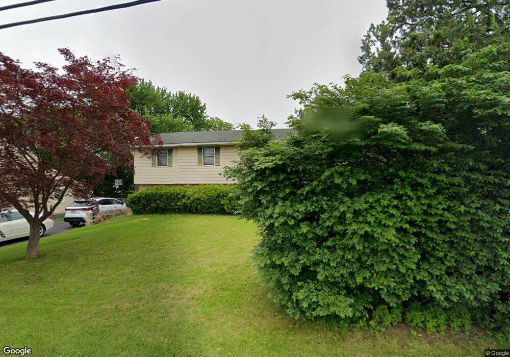
1073 S Krocks Rd Allentown, PA 18106
Lower Macungie Township East NeighborhoodEstimated Value: $381,198 - $435,000
3
Beds
2
Baths
1,760
Sq Ft
$234/Sq Ft
Est. Value
About This Home
This home is located at 1073 S Krocks Rd, Allentown, PA 18106 and is currently estimated at $412,050, approximately $234 per square foot. 1073 S Krocks Rd is a home located in Lehigh County with nearby schools including Willow Lane Elementary School, Lower Macungie Middle School, and Emmaus High School.
Ownership History
Date
Name
Owned For
Owner Type
Purchase Details
Closed on
Jul 28, 2000
Sold by
Daddona John L and Daddona Dino
Bought by
Nguyen Loc B and Tran Loan T
Current Estimated Value
Purchase Details
Closed on
Aug 22, 1996
Sold by
Audette Daniel J and Audette Deborah J
Bought by
Daddona John L and Daddona Dino A
Purchase Details
Closed on
Jul 23, 1986
Sold by
Adur Ashok M and Adur Ameeta
Bought by
Audette Daniel J and Audette Deborah J
Purchase Details
Closed on
Sep 21, 1984
Sold by
Krepley Clara W
Bought by
Adur Ashok M and Adur Ameeta
Purchase Details
Closed on
Aug 1, 1983
Bought by
Krepley Clara W
Create a Home Valuation Report for This Property
The Home Valuation Report is an in-depth analysis detailing your home's value as well as a comparison with similar homes in the area
Home Values in the Area
Average Home Value in this Area
Purchase History
| Date | Buyer | Sale Price | Title Company |
|---|---|---|---|
| Nguyen Loc B | $134,500 | -- | |
| Daddona John L | $110,000 | -- | |
| Audette Daniel J | $84,000 | -- | |
| Adur Ashok M | $72,000 | -- | |
| Krepley Clara W | $15,500 | -- |
Source: Public Records
Tax History Compared to Growth
Tax History
| Year | Tax Paid | Tax Assessment Tax Assessment Total Assessment is a certain percentage of the fair market value that is determined by local assessors to be the total taxable value of land and additions on the property. | Land | Improvement |
|---|---|---|---|---|
| 2025 | $4,309 | $168,800 | $31,600 | $137,200 |
| 2024 | $4,169 | $168,800 | $31,600 | $137,200 |
| 2023 | $4,086 | $168,800 | $31,600 | $137,200 |
| 2022 | $3,989 | $168,800 | $137,200 | $31,600 |
| 2021 | $3,905 | $168,800 | $31,600 | $137,200 |
| 2020 | $3,867 | $168,800 | $31,600 | $137,200 |
| 2019 | $3,802 | $168,800 | $31,600 | $137,200 |
| 2018 | $3,752 | $168,800 | $31,600 | $137,200 |
| 2017 | $3,686 | $168,800 | $31,600 | $137,200 |
| 2016 | -- | $168,800 | $31,600 | $137,200 |
| 2015 | -- | $168,800 | $31,600 | $137,200 |
| 2014 | -- | $168,800 | $31,600 | $137,200 |
Source: Public Records
Map
Nearby Homes
- 5673 Wedge Ln
- 5619 Stonecroft Ln
- 5736 Greens Dr
- 5524 Stonecroft Ln
- 5475 Hamilton Blvd Unit 7
- 1037 Village Round Unit L
- 997 Village Round Unit K
- 997K Village Round Unit 104K
- 5300 Hanover Dr
- 6179 Fairway Ln
- 1385 Brookside Rd
- 6126 Palomino Dr
- 6007 Timberknoll Dr
- 5280 Townsquare Dr
- 4881 Spruce Rd
- 1675 Hamlet Dr
- 5133 Meadow Ln
- 5821 Daniel St
- 1991 Autumn Ridge Rd
- 2056 Autumn Ridge Rd
- 1085 S Krocks Rd
- 1061 S Krocks Rd
- 1088 Driver Place
- 1086 Driver Place
- 1096 Driver Place
- 1082 Driver Place
- 1080 Driver Place
- 1098 Driver Place
- 1102 Driver Place
- 1076 Driver Place
- 1106 Driver Place
- 1041 S Krocks Rd
- 1103 S Krocks Rd
- 5650 Kart Dr
- 5661 Wood Ln
- 5657 Wood Ln
- 5646 Kart Dr
- 1130 Driver Place
- 1119 S Krocks Rd
- 5653 Kart Dr