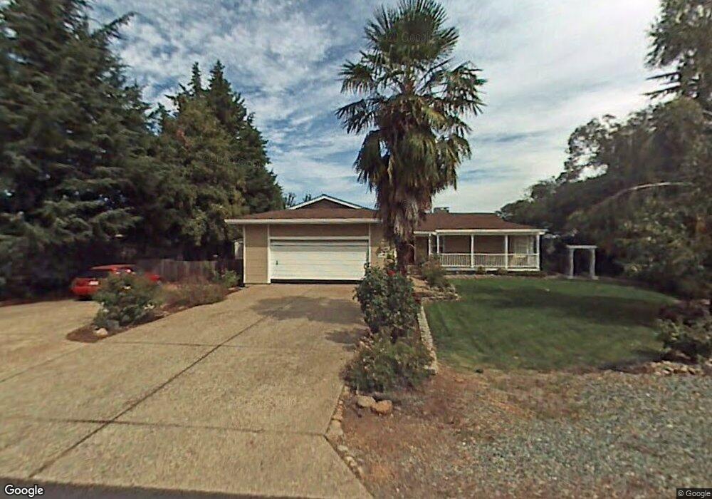
10731 Sutter Cir Sutter Creek, CA 95685
Estimated Value: $490,000 - $543,000
3
Beds
2
Baths
1,582
Sq Ft
$327/Sq Ft
Est. Value
About This Home
This home is located at 10731 Sutter Cir, Sutter Creek, CA 95685 and is currently estimated at $517,433, approximately $327 per square foot. 10731 Sutter Cir is a home located in Amador County with nearby schools including Jackson Elementary School, Jackson Junior High School, and Argonaut High School.
Ownership History
Date
Name
Owned For
Owner Type
Purchase Details
Closed on
Dec 11, 2024
Sold by
Weisman Lisa G
Bought by
Lisa G Weisman Trust and Weisman
Current Estimated Value
Purchase Details
Closed on
Apr 4, 2008
Sold by
Woods Linda J and The Linda Woods Trust
Bought by
Weisman Lisa G
Home Financials for this Owner
Home Financials are based on the most recent Mortgage that was taken out on this home.
Original Mortgage
$314,000
Interest Rate
6.22%
Mortgage Type
Purchase Money Mortgage
Purchase Details
Closed on
Mar 18, 2008
Sold by
Weisman Eric A
Bought by
Weisman Lisa G
Home Financials for this Owner
Home Financials are based on the most recent Mortgage that was taken out on this home.
Original Mortgage
$314,000
Interest Rate
6.22%
Mortgage Type
Purchase Money Mortgage
Purchase Details
Closed on
Jul 3, 2006
Sold by
Woods Linda
Bought by
Woods Linda J and The Linda Woods Trust
Purchase Details
Closed on
Feb 13, 2006
Sold by
Woods Linda J and The Linda Woods Trust
Bought by
Woods Linda
Home Financials for this Owner
Home Financials are based on the most recent Mortgage that was taken out on this home.
Original Mortgage
$60,000
Interest Rate
6.15%
Mortgage Type
Credit Line Revolving
Purchase Details
Closed on
Mar 31, 2005
Sold by
Woods Linda J
Bought by
Woods Linda J and The Linda Woods Trust
Home Financials for this Owner
Home Financials are based on the most recent Mortgage that was taken out on this home.
Original Mortgage
$245,000
Interest Rate
5.61%
Mortgage Type
Fannie Mae Freddie Mac
Purchase Details
Closed on
Mar 7, 2005
Sold by
Armstrong Billie
Bought by
Woods Linda J
Home Financials for this Owner
Home Financials are based on the most recent Mortgage that was taken out on this home.
Original Mortgage
$245,000
Interest Rate
5.61%
Mortgage Type
Fannie Mae Freddie Mac
Purchase Details
Closed on
Feb 17, 2004
Sold by
Debrum Robert Paul and Debrum Peggy Marie
Bought by
Armstrong Billie
Create a Home Valuation Report for This Property
The Home Valuation Report is an in-depth analysis detailing your home's value as well as a comparison with similar homes in the area
Home Values in the Area
Average Home Value in this Area
Purchase History
| Date | Buyer | Sale Price | Title Company |
|---|---|---|---|
| Lisa G Weisman Trust | -- | None Listed On Document | |
| Lisa G Weisman Trust | -- | None Listed On Document | |
| Weisman Lisa G | $425,000 | Placer Title Company | |
| Weisman Lisa G | -- | Placer Title Company | |
| Woods Linda J | -- | First American Title Co | |
| Woods Linda | -- | First American Title Company | |
| Woods Linda J | -- | First American Title Co | |
| Woods Linda J | $393,500 | First American Title Co | |
| Armstrong Billie | $349,500 | Western Land Title Co |
Source: Public Records
Mortgage History
| Date | Status | Borrower | Loan Amount |
|---|---|---|---|
| Previous Owner | Weisman Lisa G | $314,000 | |
| Previous Owner | Woods Linda | $60,000 | |
| Previous Owner | Woods Linda J | $245,000 |
Source: Public Records
Tax History
| Year | Tax Paid | Tax Assessment Tax Assessment Total Assessment is a certain percentage of the fair market value that is determined by local assessors to be the total taxable value of land and additions on the property. | Land | Improvement |
|---|---|---|---|---|
| 2025 | $5,532 | $558,229 | $328,370 | $229,859 |
| 2024 | $5,532 | $547,284 | $321,932 | $225,352 |
| 2023 | $5,422 | $536,554 | $315,620 | $220,934 |
| 2022 | $5,302 | $526,034 | $309,432 | $216,602 |
| 2021 | $4,671 | $463,655 | $227,454 | $236,201 |
| 2020 | $4,245 | $421,504 | $206,776 | $214,728 |
| 2019 | $3,965 | $393,929 | $193,249 | $200,680 |
| 2018 | $3,812 | $378,778 | $185,816 | $192,962 |
| 2017 | $3,432 | $341,242 | $167,402 | $173,840 |
| 2016 | $3,175 | $315,965 | $155,002 | $160,963 |
| 2015 | $2,940 | $292,560 | $143,520 | $149,040 |
| 2014 | $2,442 | $243,800 | $119,600 | $124,200 |
Source: Public Records
Map
Nearby Homes
- 0 Ridge Rd Unit 225119705
- 1330 Jackson Gate Rd
- 1234 Jackson Gate Rd
- 0 Sutter Creek Rd Unit 226008937
- 00000 Sutter Creek Rd
- 12280 Old Ridge Rd
- 11900 Sutter Hill Rd
- 70 Greenstone Terrace
- 12380 Eureka St
- 20 Rollingwood Dr Unit 209
- 20 Rollingwood Dr Unit 88
- 20 Rollingwood Dr Unit 55
- 20 Rollingwood Dr Unit 212
- 20 Rollingwood Dr Unit 200
- 20 Rollingwood Dr Unit 119
- 20 Rollingwood Dr Unit 70
- 20 Rollingwood Dr Unit 155
- 20 Rollingwood Dr Unit 141
- 20 Rollingwood Dr Unit 83
- 20 Rollingwood Dr Unit 159
- 10741 Sutter Cir
- 11908 Sutter Cir
- 10730 Sutter Cir
- 11930 Colt Dr
- 10751 Sutter Cir
- 10770 Sutter Cir
- 11906 Sutter Cir
- 11919 Colt Dr
- 10780 Sutter Cir
- 10771 Sutter Cir
- 13504 Buckeye Ct
- 10761 Sutter Cir
- 10781 Sutter Cir
- 11684 Nugget Ln
- 10886 Sutter Cir
- 10895 Sutter Cir
- 11692 Nugget Ln
- 10791 Sutter Cir
- 13477 Buckeye Ct
- 11959 Colt Dr
Your Personal Tour Guide
Ask me questions while you tour the home.