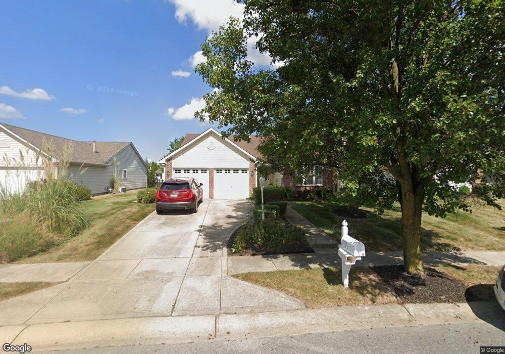
10732 Springston Ct Fishers, IN 46037
Estimated Value: $340,000 - $363,000
3
Beds
2
Baths
1,668
Sq Ft
$208/Sq Ft
Est. Value
About This Home
This home is located at 10732 Springston Ct, Fishers, IN 46037 and is currently estimated at $347,304, approximately $208 per square foot. 10732 Springston Ct is a home located in Hamilton County with nearby schools including Sigourney Elementary School, Lantern Road Elementary School, and Riverside Junior High School.
Ownership History
Date
Name
Owned For
Owner Type
Purchase Details
Closed on
Dec 10, 2013
Sold by
Gerdts Zachary A
Bought by
Gerdts Zachary A and Gerdts Nancy L
Current Estimated Value
Purchase Details
Closed on
Dec 1, 2004
Sold by
Frank Sharon
Bought by
Gerdts Zachary A
Home Financials for this Owner
Home Financials are based on the most recent Mortgage that was taken out on this home.
Original Mortgage
$107,000
Interest Rate
5.37%
Mortgage Type
Purchase Money Mortgage
Purchase Details
Closed on
Sep 28, 2001
Sold by
Lighthiser Karl J and Lighthiser Carolyn S
Bought by
Frank Sharon
Home Financials for this Owner
Home Financials are based on the most recent Mortgage that was taken out on this home.
Original Mortgage
$114,400
Interest Rate
6.99%
Create a Home Valuation Report for This Property
The Home Valuation Report is an in-depth analysis detailing your home's value as well as a comparison with similar homes in the area
Home Values in the Area
Average Home Value in this Area
Purchase History
| Date | Buyer | Sale Price | Title Company |
|---|---|---|---|
| Gerdts Zachary A | -- | None Available | |
| Gerdts Zachary A | -- | -- | |
| Frank Sharon | -- | -- |
Source: Public Records
Mortgage History
| Date | Status | Borrower | Loan Amount |
|---|---|---|---|
| Previous Owner | Gerdts Zachary A | $107,000 | |
| Previous Owner | Frank Sharon | $114,400 |
Source: Public Records
Tax History Compared to Growth
Tax History
| Year | Tax Paid | Tax Assessment Tax Assessment Total Assessment is a certain percentage of the fair market value that is determined by local assessors to be the total taxable value of land and additions on the property. | Land | Improvement |
|---|---|---|---|---|
| 2024 | $5,918 | $279,800 | $51,000 | $228,800 |
| 2023 | $5,918 | $273,100 | $51,000 | $222,100 |
| 2022 | $5,432 | $243,000 | $51,000 | $192,000 |
| 2021 | $4,953 | $217,300 | $51,000 | $166,300 |
| 2020 | $4,561 | $197,400 | $51,000 | $146,400 |
| 2019 | $4,237 | $182,400 | $39,100 | $143,300 |
| 2018 | $4,026 | $173,200 | $39,100 | $134,100 |
| 2017 | $3,731 | $162,200 | $39,100 | $123,100 |
| 2016 | $3,600 | $157,400 | $39,100 | $118,300 |
| 2014 | $1,414 | $146,900 | $47,000 | $99,900 |
| 2013 | $1,414 | $151,400 | $47,000 | $104,400 |
Source: Public Records
Map
Nearby Homes
- 10737 Springston Ct
- 10290 Glenn Abbey Ln
- 10384 Glenn Abbey Ln
- 10244 Red Tail Dr
- 10844 Fairwoods Dr
- 10334 Hillsborough Dr
- 9831 Carefree Dr
- 10602 Fall Rd
- 10272 Whitetail Cir
- 10515 Collingswood Rd
- 10518 Greenway Dr
- 10946 Geist Woods South Dr
- 10026 Parkway Dr
- 11216 Windermere Blvd
- 11011 Brigantine Dr
- 10919 Brigantine Dr
- 11240 E 106th St
- 10132 Lauren Pass
- 10661 Burning Ridge Ln
- 10331 Blue Fin Dr
- 10728 Springston Ct
- 10736 Springston Ct
- 10724 Springston Ct
- 10740 Springston Ct
- 10733 Springston Ct
- 10278 Glenn Abbey Ln
- 10266 Glenn Abbey Ln
- 10725 Springston Ct
- 10744 Springston Ct
- 10254 Glenn Abbey Ln
- 10721 Springston Ct
- 10294 Glenn Abbey Ln
- 10242 Glenn Abbey Ln
- 10708 Springston Ct
- 10709 Springston Ct
- 10748 Springston Ct
- 10230 Glenn Abbey Ln
- 10304 Glenn Abbey Ln
- 10745 Springston Ct