Estimated Value: $296,000 - $342,000
3
Beds
2
Baths
2,500
Sq Ft
$131/Sq Ft
Est. Value
About This Home
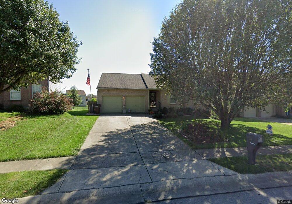
This home is located at 10736 Station Ln, Union, KY 41091 and is currently estimated at $328,298, approximately $131 per square foot. 10736 Station Ln is a home located in Boone County with nearby schools including New Haven Elementary School, Gray Middle School, and Larry A. Ryle High School.
Ownership History
Date
Name
Owned For
Owner Type
Purchase Details
Closed on
Oct 17, 2014
Sold by
Allen William J and Allen Lesley J
Bought by
Burklo Gregory L and Burklo Gail S
Current Estimated Value
Home Financials for this Owner
Home Financials are based on the most recent Mortgage that was taken out on this home.
Original Mortgage
$35,000
Interest Rate
4.17%
Mortgage Type
New Conventional
Purchase Details
Closed on
Jul 3, 2000
Sold by
Smith Builders Inc
Bought by
Allen William J and Brock Lesley J
Home Financials for this Owner
Home Financials are based on the most recent Mortgage that was taken out on this home.
Original Mortgage
$135,880
Interest Rate
8.63%
Mortgage Type
FHA
Purchase Details
Closed on
Mar 16, 1999
Sold by
Skyview Properties Llc
Bought by
Smith Builders Inc
Purchase Details
Closed on
Jul 22, 1998
Sold by
Barlow Homes Inc
Bought by
Skyview Properties Llc
Create a Home Valuation Report for This Property
The Home Valuation Report is an in-depth analysis detailing your home's value as well as a comparison with similar homes in the area
Home Values in the Area
Average Home Value in this Area
Purchase History
| Date | Buyer | Sale Price | Title Company |
|---|---|---|---|
| Burklo Gregory L | $170,000 | Kentucky Land Title Agency | |
| Allen William J | $137,000 | -- | |
| Smith Builders Inc | $26,500 | -- | |
| Skyview Properties Llc | $318,000 | -- |
Source: Public Records
Mortgage History
| Date | Status | Borrower | Loan Amount |
|---|---|---|---|
| Closed | Burklo Gregory L | $35,000 | |
| Previous Owner | Allen William J | $135,880 |
Source: Public Records
Tax History
| Year | Tax Paid | Tax Assessment Tax Assessment Total Assessment is a certain percentage of the fair market value that is determined by local assessors to be the total taxable value of land and additions on the property. | Land | Improvement |
|---|---|---|---|---|
| 2025 | $1,909 | $213,200 | $35,000 | $178,200 |
| 2024 | $1,908 | $213,200 | $35,000 | $178,200 |
| 2023 | $1,499 | $178,100 | $35,000 | $143,100 |
| 2022 | $1,545 | $178,100 | $35,000 | $143,100 |
| 2021 | $1,623 | $178,100 | $35,000 | $143,100 |
| 2020 | $1,589 | $178,100 | $35,000 | $143,100 |
| 2019 | $1,514 | $170,000 | $28,000 | $142,000 |
| 2018 | $1,586 | $170,000 | $28,000 | $142,000 |
| 2017 | $1,940 | $170,000 | $28,000 | $142,000 |
| 2015 | $1,916 | $170,000 | $28,000 | $142,000 |
| 2013 | -- | $150,500 | $26,500 | $124,000 |
Source: Public Records
Map
Nearby Homes
- 10756 Station Ln
- 738 Buckshire Glen
- 10138 Ash Creek Dr
- 12885 Frogtown Connector Rd
- 10713 Meadow Stable Ln
- 10653 Chenery Cove
- 10664 Turcotte Ct
- 10147 Cedarwood Dr
- 10892 Appaloosa Dr
- 9954 Calava Ct
- 176 Maher Rd
- 810 Skyline Dr
- 10202 Cardigan Dr
- 10070 Cedarwood Dr
- 10281 Cardigan Dr
- 10803 Muirfield Ct
- 3 Lots Tiburon Dr
- 10853 Sawgrass Ct
- 10125 Breezy Ln
- 10878 Saint Andrews Dr
- 10732 Station Ln
- 10740 Station Ln
- 78 Station Ln Unit 78
- 88 Station Ln Unit 88
- 18 Station Ln Unit 18
- 77 Station Ln Unit 77
- 79 Station Ln Unit 79
- 82 Station Ln Unit 82
- 85 Station Ln Unit 85
- 81 Station Ln Unit 81
- 83 Station Ln Unit 83
- 84 Station Ln Unit 84
- 93 Station Ln Unit 93
- 76 Station Ln
- 10728 Station Ln
- 561 Buckshire Glen
- 10744 Station Ln
- 557 Buckshire Glen
- 567 Buckshire Glen
- 10741 Station Ln