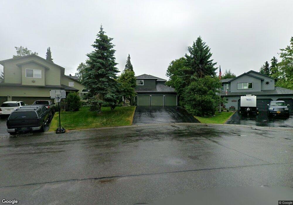
10745 Flagship Cir Anchorage, AK 99515
Bayshore-Klatt NeighborhoodEstimated Value: $523,000 - $727,000
4
Beds
4
Baths
2,690
Sq Ft
$232/Sq Ft
Est. Value
About This Home
This home is located at 10745 Flagship Cir, Anchorage, AK 99515 and is currently estimated at $624,155, approximately $232 per square foot. 10745 Flagship Cir is a home located in Anchorage Municipality with nearby schools including Bayshore Elementary School, Mears Middle School, and Dimond High School.
Ownership History
Date
Name
Owned For
Owner Type
Purchase Details
Closed on
Jan 5, 2001
Sold by
Obeidi Mousa S
Bought by
Malik Mohammad Irshad and Malik Nosheen N
Current Estimated Value
Create a Home Valuation Report for This Property
The Home Valuation Report is an in-depth analysis detailing your home's value as well as a comparison with similar homes in the area
Home Values in the Area
Average Home Value in this Area
Purchase History
| Date | Buyer | Sale Price | Title Company |
|---|---|---|---|
| Malik Mohammad Irshad | -- | Pacific Northwest Title | |
| Malik Mohammad Irshad | -- | -- |
Source: Public Records
Tax History
| Year | Tax Paid | Tax Assessment Tax Assessment Total Assessment is a certain percentage of the fair market value that is determined by local assessors to be the total taxable value of land and additions on the property. | Land | Improvement |
|---|---|---|---|---|
| 2025 | $5,851 | $629,300 | $145,500 | $483,800 |
| 2024 | $5,851 | $587,400 | $128,800 | $458,600 |
| 2023 | $8,035 | $520,800 | $122,600 | $398,200 |
| 2022 | $7,778 | $511,900 | $122,600 | $389,300 |
| 2021 | $8,642 | $479,600 | $122,600 | $357,000 |
| 2020 | $6,972 | $460,400 | $122,600 | $337,800 |
| 2019 | $6,907 | $472,200 | $122,600 | $349,600 |
| 2018 | $6,806 | $465,000 | $122,600 | $342,400 |
| 2017 | $6,997 | $466,800 | $122,600 | $344,200 |
| 2016 | $6,379 | $490,100 | $122,600 | $367,500 |
| 2015 | $6,379 | $462,800 | $122,600 | $340,200 |
| 2014 | $6,379 | $456,800 | $122,600 | $334,200 |
Source: Public Records
Map
Nearby Homes
- 2356 Leander Cir
- L6 B8 Spartan Dr
- L5 B8 Spartan Dr
- 11500 Jennifer Ann Cir
- 2855 Diligence Cir
- 2541 Brookstone Loop
- 3871 Amber Bay Loop
- 9665 Victor Rd Unit 7B
- 2059 Stonegate Cir
- 9520 Albatross Dr
- 10545 Vancouver Cir
- 1595 Bellevue Cir
- 2923 Kingfisher Dr
- 2542 Curlew Cir Unit 5
- 9200 Glenn Haven Dr Unit F4
- 9468 Canton Loop Unit 158
- 9200 Sea Parrot Cir
- 3806 N Point Cir
- 9353 Blackberry St Unit 2
- 3769 Quartz Cir
- 10737 Flagship Cir
- 10753 Flagship Cir
- 10729 Flagship Cir
- L6 B1 Southport Add Unit 2
- L6 B1 Southport Add
- 10754 Flagship Cir
- 10721 Flagship Cir
- 10724 Flagship Cir
- 10744 Flagship Cir
- 10734 Flagship Cir
- 10714 Flagship Cir
- 2541 Stern Cir
- 2531 Stern Cir
- 10713 Flagship Cir
- 10830 Northfleet Dr
- 10840 Northfleet Dr
- 10820 Northfleet Dr
- 10661 Cutter Cir
- 10807 Refuge Cir
- 10704 Flagship Cir
Your Personal Tour Guide
Ask me questions while you tour the home.