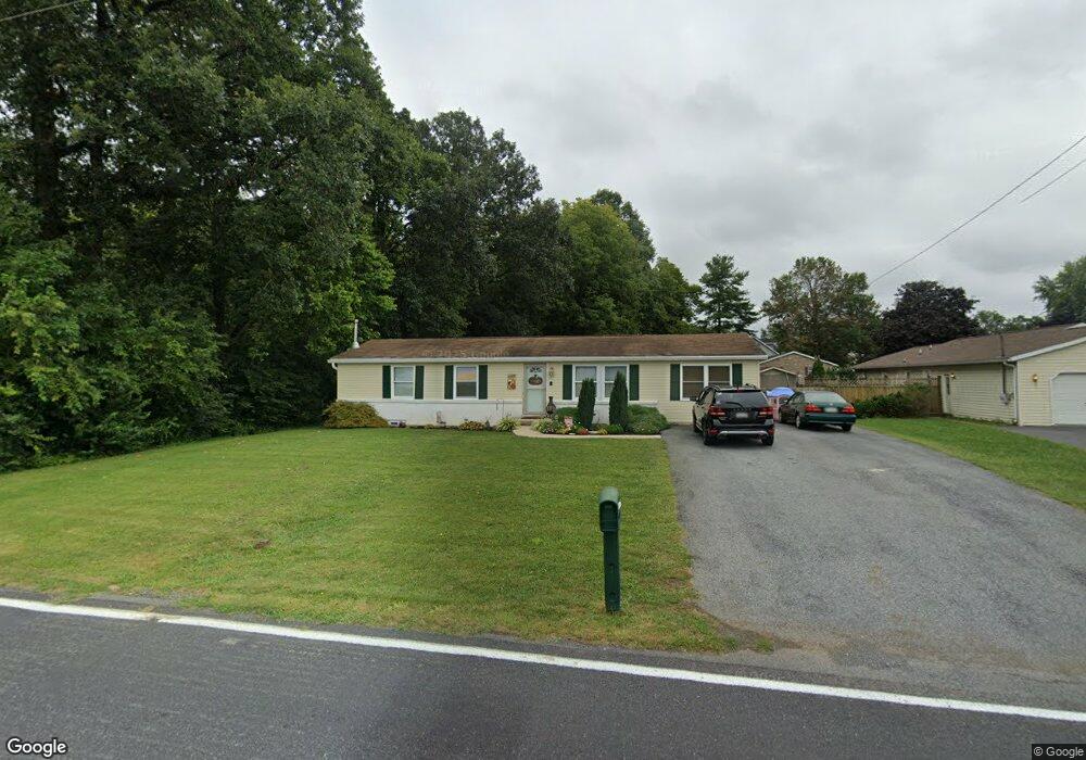
10746 Grindstone Hill Rd Greencastle, PA 17225
Estimated Value: $196,513 - $316,000
4
Beds
2
Baths
1,760
Sq Ft
$155/Sq Ft
Est. Value
About This Home
This home is located at 10746 Grindstone Hill Rd, Greencastle, PA 17225 and is currently estimated at $273,128, approximately $155 per square foot. 10746 Grindstone Hill Rd is a home located in Franklin County with nearby schools including Greencastle-Antrim Primary School, Greencastle-Antrim Elementary School, and Greencastle-Antrim Middle School.
Ownership History
Date
Name
Owned For
Owner Type
Purchase Details
Closed on
Sep 10, 2009
Sold by
Danks Brian P and Danks Kimberly V
Bought by
Miller Wallace S and Miller Stevens Audrey L
Current Estimated Value
Home Financials for this Owner
Home Financials are based on the most recent Mortgage that was taken out on this home.
Original Mortgage
$155,830
Outstanding Balance
$102,377
Interest Rate
5.28%
Mortgage Type
FHA
Estimated Equity
$170,751
Purchase Details
Closed on
Mar 24, 2005
Sold by
Young Carol Hill
Bought by
Danks Brian P and Danks Kimberly V
Home Financials for this Owner
Home Financials are based on the most recent Mortgage that was taken out on this home.
Original Mortgage
$144,516
Interest Rate
5.7%
Mortgage Type
VA
Create a Home Valuation Report for This Property
The Home Valuation Report is an in-depth analysis detailing your home's value as well as a comparison with similar homes in the area
Home Values in the Area
Average Home Value in this Area
Purchase History
| Date | Buyer | Sale Price | Title Company |
|---|---|---|---|
| Miller Wallace S | $158,705 | None Available | |
| Danks Brian P | $139,900 | None Available |
Source: Public Records
Mortgage History
| Date | Status | Borrower | Loan Amount |
|---|---|---|---|
| Open | Miller Wallace S | $155,830 | |
| Previous Owner | Danks Brian P | $144,516 |
Source: Public Records
Tax History Compared to Growth
Tax History
| Year | Tax Paid | Tax Assessment Tax Assessment Total Assessment is a certain percentage of the fair market value that is determined by local assessors to be the total taxable value of land and additions on the property. | Land | Improvement |
|---|---|---|---|---|
| 2025 | $2,954 | $17,660 | $900 | $16,760 |
| 2024 | $2,680 | $17,660 | $900 | $16,760 |
| 2023 | $2,649 | $17,660 | $900 | $16,760 |
| 2022 | $2,649 | $17,660 | $900 | $16,760 |
| 2021 | $2,597 | $17,660 | $900 | $16,760 |
| 2020 | $2,530 | $17,660 | $900 | $16,760 |
| 2019 | $2,472 | $17,660 | $900 | $16,760 |
| 2018 | $2,446 | $17,660 | $900 | $16,760 |
| 2017 | $2,384 | $17,660 | $900 | $16,760 |
| 2016 | $506 | $17,660 | $900 | $16,760 |
| 2015 | $472 | $17,660 | $900 | $16,760 |
| 2014 | $472 | $17,660 | $900 | $16,760 |
Source: Public Records
Map
Nearby Homes
- 823 Buchanan Trail E
- 602 Brookview Dr
- 560 Meadowview Cir
- 271 E Baltimore St
- 231 N Allison St Unit 1
- 431 Leitersburg St
- 101 N Carlisle St
- 148 N Carlisle St
- 674 Lohman Ave
- 1631 Buchanan Trail E
- 775 Lohman Ave
- 45 W Dahlgren St
- 34.77 Acres Red Oak Estate S
- 64 W Walter Ave
- 90 W Walter Ave
- 341 W Baltimore St
- 480 S Carlisle St
- 140 Williamson Ave
- 0 Celestial Terrace
- 171 Celestial Terrace
- 705 Ryan Ln
- 713 Ryan Ln
- 706 Ryan Ln
- 719 Ryan Ln
- 725 Ryan Ln
- 10786 Grindstone Hill Rd
- 10698 Grindstone Hill Rd
- 720 Ryan Ln
- 731 Ryan Ln
- 10796 Grindstone Hill Rd
- 726 Ryan Ln
- 730 Ryan Ln
- 10785 Grindstone Hill Rd
- 735 Ryan Ln
- 10806 Grindstone Hill Rd
- 707 Franklin Ct
- 10925 Antrim Ct
- 813 Tower Dr
- 743 Ryan Ln
- 10820 Grindstone Hill Rd