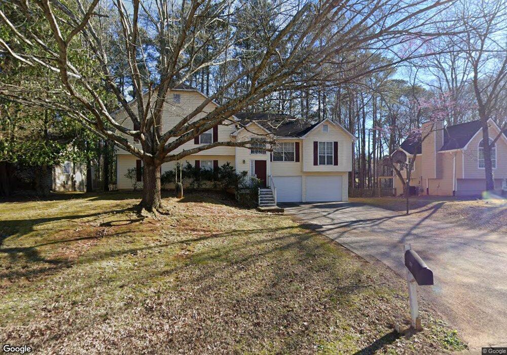
1076 Whistle Dr Unit I Austell, GA 30106
Estimated Value: $310,000 - $353,000
4
Beds
3
Baths
1,692
Sq Ft
$199/Sq Ft
Est. Value
About This Home
This home is located at 1076 Whistle Dr Unit I, Austell, GA 30106 and is currently estimated at $336,689, approximately $198 per square foot. 1076 Whistle Dr Unit I is a home located in Cobb County with nearby schools including Deerwood Elementary School, Russell Elementary School, and Floyd Middle School.
Ownership History
Date
Name
Owned For
Owner Type
Purchase Details
Closed on
Jul 25, 2002
Sold by
Gallup James H and Gallup Patricia P
Bought by
Goslow Harry J
Current Estimated Value
Home Financials for this Owner
Home Financials are based on the most recent Mortgage that was taken out on this home.
Original Mortgage
$163,445
Outstanding Balance
$68,845
Interest Rate
6.62%
Mortgage Type
New Conventional
Estimated Equity
$267,844
Purchase Details
Closed on
Dec 31, 1993
Sold by
Smith Daniel C and Beach Jo Ann C
Bought by
Gallup James H Patricia F
Home Financials for this Owner
Home Financials are based on the most recent Mortgage that was taken out on this home.
Original Mortgage
$116,956
Interest Rate
7.19%
Mortgage Type
FHA
Create a Home Valuation Report for This Property
The Home Valuation Report is an in-depth analysis detailing your home's value as well as a comparison with similar homes in the area
Home Values in the Area
Average Home Value in this Area
Purchase History
| Date | Buyer | Sale Price | Title Company |
|---|---|---|---|
| Goslow Harry J | $168,500 | -- | |
| Gallup James H Patricia F | $119,000 | -- |
Source: Public Records
Mortgage History
| Date | Status | Borrower | Loan Amount |
|---|---|---|---|
| Open | Goslow Harry J | $163,445 | |
| Previous Owner | Gallup James H Patricia F | $116,956 |
Source: Public Records
Tax History Compared to Growth
Tax History
| Year | Tax Paid | Tax Assessment Tax Assessment Total Assessment is a certain percentage of the fair market value that is determined by local assessors to be the total taxable value of land and additions on the property. | Land | Improvement |
|---|---|---|---|---|
| 2025 | $3,362 | $144,432 | $22,000 | $122,432 |
| 2024 | $3,365 | $144,432 | $22,000 | $122,432 |
| 2023 | $2,822 | $144,432 | $22,000 | $122,432 |
| 2022 | $2,544 | $105,688 | $16,000 | $89,688 |
| 2021 | $2,145 | $87,460 | $16,000 | $71,460 |
| 2020 | $2,145 | $87,460 | $16,000 | $71,460 |
| 2019 | $2,065 | $83,796 | $12,800 | $70,996 |
| 2018 | $2,065 | $83,796 | $12,800 | $70,996 |
| 2017 | $1,670 | $69,328 | $12,800 | $56,528 |
| 2016 | $1,672 | $69,328 | $12,800 | $56,528 |
| 2015 | $1,414 | $56,840 | $12,000 | $44,840 |
| 2014 | $1,426 | $56,840 | $0 | $0 |
Source: Public Records
Map
Nearby Homes
- 936 Tyrell Dr
- 1097 Trestle Dr
- 895 Tyrell Dr
- 1240 Parktown Dr Unit 4
- 4072 Elsdon Dr
- 1021 Wisteria Dr SW
- 1078 Hibiscus Way SW
- 4201 Regal Ridge Rd
- 1146 Silvergate Ln
- 960 Verlander Trail
- 971 Verlander Trail
- 3869 Merryweather Trail
- Kaufman Plan at Wilkins Walk
- Bryson Plan at Wilkins Walk
- Brooks Plan at Wilkins Walk
- 4569 Moray Dr
- 4581 Moray Dr
- 4187 Alaina Cir Unit 18
- 4589 Moray Dr
- 4561 Moray Dr
- 1072 Whistle Dr Unit 1
- 1080 Whistle Dr
- 1068 Whistle Dr
- 1075 Whistle Dr
- 1075 Whistle Dr
- 1071 Whistle Dr
- 1079 Whistle Dr
- 1067 Whistle Dr
- 1088 Whistle Dr
- 1064 Whistle Dr
- 1064 Whistle Dr Unit 50
- 1024 Trestle Dr
- 4201 Pullman Ln
- 4297 Cades Cove Dr
- 1060 Whistle Dr
- 1092 Whistle Dr Unit 1
- 1063 Whistle Dr
- 1020 Trestle Dr
- 4295 Cades Cove Dr
- 4299 Cades Cove Dr