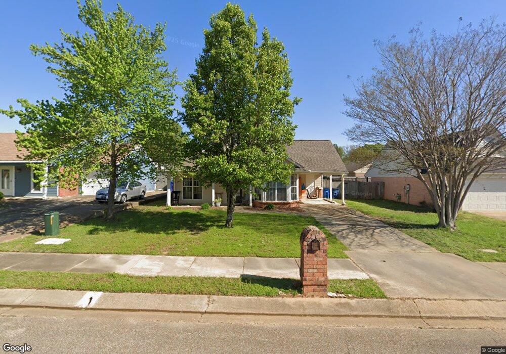
10760 Oak Cir N Olive Branch, MS 38654
Estimated Value: $206,000 - $232,000
3
Beds
2
Baths
1,209
Sq Ft
$180/Sq Ft
Est. Value
About This Home
This home is located at 10760 Oak Cir N, Olive Branch, MS 38654 and is currently estimated at $217,772, approximately $180 per square foot. 10760 Oak Cir N is a home located in DeSoto County with nearby schools including Olive Branch Elementary School, Chickasaw Elementary School, and Olive Branch Middle School.
Ownership History
Date
Name
Owned For
Owner Type
Purchase Details
Closed on
Aug 13, 2021
Sold by
Landreth Michael L and Landreth Bobbi
Bought by
Landreth Investments Llc Series K
Current Estimated Value
Purchase Details
Closed on
Apr 11, 2008
Sold by
Secretary Of Housing & Urban Development
Bought by
Landreth Michael L and Landreth Bobbi
Home Financials for this Owner
Home Financials are based on the most recent Mortgage that was taken out on this home.
Original Mortgage
$83,200
Interest Rate
6.22%
Mortgage Type
Purchase Money Mortgage
Create a Home Valuation Report for This Property
The Home Valuation Report is an in-depth analysis detailing your home's value as well as a comparison with similar homes in the area
Home Values in the Area
Average Home Value in this Area
Purchase History
| Date | Buyer | Sale Price | Title Company |
|---|---|---|---|
| Landreth Investments Llc Series K | -- | Accommodation | |
| Landreth Michael L | -- | None Available |
Source: Public Records
Mortgage History
| Date | Status | Borrower | Loan Amount |
|---|---|---|---|
| Previous Owner | Landreth Michael L | $83,200 |
Source: Public Records
Tax History Compared to Growth
Tax History
| Year | Tax Paid | Tax Assessment Tax Assessment Total Assessment is a certain percentage of the fair market value that is determined by local assessors to be the total taxable value of land and additions on the property. | Land | Improvement |
|---|---|---|---|---|
| 2024 | $1,707 | $12,509 | $3,000 | $9,509 |
| 2023 | $1,707 | $12,509 | $0 | $0 |
| 2022 | $1,714 | $12,557 | $3,000 | $9,557 |
| 2021 | $1,714 | $12,557 | $3,000 | $9,557 |
| 2020 | $1,609 | $11,792 | $3,000 | $8,792 |
| 2019 | $1,609 | $11,792 | $3,000 | $8,792 |
| 2017 | $1,578 | $20,006 | $11,503 | $8,503 |
| 2016 | $1,578 | $11,503 | $3,000 | $8,503 |
| 2015 | $1,578 | $20,006 | $11,503 | $8,503 |
| 2014 | $1,643 | $11,976 | $0 | $0 |
| 2013 | $1,595 | $11,976 | $0 | $0 |
Source: Public Records
Map
Nearby Homes
- 10625 Kristen Dr
- 10862 Wiseman Dr
- 10475 Courtney Cove
- 6716 Branch Rd S
- 6729 Branch Rd S
- 6741 Hacks Cross Rd
- 10227 Williford Dr
- 10155 Riggan Dr
- 10335 Yates Dr
- 6967 Green Way Cove
- 10101 Stephenson Ln
- 10640 Mississippi 178
- 9919 Adina Cove
- 10082 Lacey Dr
- 9821 Morgan Manor Dr
- LOT 3 Old Goodman Rd
- 6041 Allen Pkwy W
- 9800 Cherokee Dr
- 10719 Highway 178
- 9759 Pigeon Roost Park Cir
- 10748 Oak Cir N
- 10772 Oak Cir N
- 6419 Oak Leaf Dr
- 10736 Oak Cir N
- 10767 Oak Cir N
- 6437 Oak Leaf Dr
- 10749 Oak Leaf Dr
- 10755 Oak Cir N
- 10724 Oak Cir N
- 10737 Oak Leaf Dr
- 10743 Oak Cir N
- 6365 Oak Leaf Dr
- 10731 Oak Cir N
- 10725 Oak Leaf Dr
- 6398 Oak Leaf Dr
- 6410 Oak Leaf Dr
- 10712 Oak Cir N
- 6386 Oak Leaf Dr
- 6422 Oak Leaf Dr
- 10719 Oak Cir N