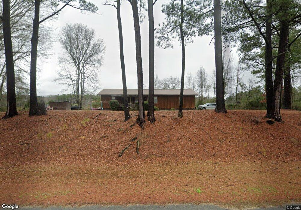
1077 Newton Calhoun Rd Newton, MS 39345
Estimated Value: $134,186 - $214,000
--
Bed
2
Baths
1,472
Sq Ft
$111/Sq Ft
Est. Value
About This Home
This home is located at 1077 Newton Calhoun Rd, Newton, MS 39345 and is currently estimated at $163,797, approximately $111 per square foot. 1077 Newton Calhoun Rd is a home located in Newton County with nearby schools including Newton Elementary School, N.H. Pilate Middle School, and Newton High School.
Ownership History
Date
Name
Owned For
Owner Type
Purchase Details
Closed on
Dec 20, 2021
Sold by
Jay Lisa M
Bought by
Jay Ronald
Current Estimated Value
Home Financials for this Owner
Home Financials are based on the most recent Mortgage that was taken out on this home.
Original Mortgage
$63,600
Outstanding Balance
$58,359
Interest Rate
3.09%
Mortgage Type
New Conventional
Estimated Equity
$105,438
Purchase Details
Closed on
Jul 16, 2013
Sold by
Jay Roland
Bought by
Jay Lisa M
Create a Home Valuation Report for This Property
The Home Valuation Report is an in-depth analysis detailing your home's value as well as a comparison with similar homes in the area
Home Values in the Area
Average Home Value in this Area
Purchase History
| Date | Buyer | Sale Price | Title Company |
|---|---|---|---|
| Jay Ronald | $84,588 | None Listed On Document | |
| Jay Lisa M | -- | -- |
Source: Public Records
Mortgage History
| Date | Status | Borrower | Loan Amount |
|---|---|---|---|
| Open | Jay Ronald | $63,600 |
Source: Public Records
Tax History Compared to Growth
Tax History
| Year | Tax Paid | Tax Assessment Tax Assessment Total Assessment is a certain percentage of the fair market value that is determined by local assessors to be the total taxable value of land and additions on the property. | Land | Improvement |
|---|---|---|---|---|
| 2025 | $606 | $7,398 | $0 | $0 |
| 2024 | $629 | $7,395 | $0 | $0 |
| 2023 | $636 | $7,400 | $0 | $0 |
| 2022 | $638 | $7,405 | $0 | $0 |
| 2021 | $0 | $6,951 | $0 | $0 |
| 2020 | $0 | $6,451 | $0 | $0 |
| 2019 | $541 | $6,460 | $0 | $0 |
| 2018 | $537 | $6,463 | $0 | $0 |
| 2017 | $543 | $6,483 | $0 | $0 |
| 2016 | $537 | $6,468 | $0 | $0 |
| 2015 | -- | $6,455 | $0 | $0 |
| 2014 | -- | $6,442 | $0 | $0 |
Source: Public Records
Map
Nearby Homes
- 2906 Highway 15
- 0 Clyde Evans Rd
- Lot 3 Triple Ridge Blvd
- 602 S Main St
- 205 Ridge Dr
- 0000 Airport Rd
- 0 1st Ave
- 104 W Tatum St
- 200 W Tatum St
- 0 Airport Rd
- 103 Rew St
- 110 Victoria Cir
- 106 Stennis St
- 402 E Church St
- 0 High St
- 306 W Church St
- 502 W Church St
- 508 W Church St
- 202 New Ireland St
- 108 Frances Ave
- 1166 Newton Calhoun Rd
- 3167 Highway 15
- 2879 Highway 15
- 3246 Highway 15
- 719 Newton Calhoun Rd
- 2822 Highway 15
- 2732 Highway 15
- 656 Newton Calhoun Rd
- 2702 Highway 15
- 605 Newton Calhoun Rd
- 585 Newton Calhoun Rd
- 581 Newton Calhoun Rd
- 1635 Newton Calhoun Rd
- 517 Newton Calhoun Rd
- 521 Newton Calhoun Rd
- 509 Newton Calhoun Rd
- 1528 Newton Calhoun Rd
- 436 Newton Calhoun Rd
- 3896 Highway 15
- 825 Liberty Church Rd