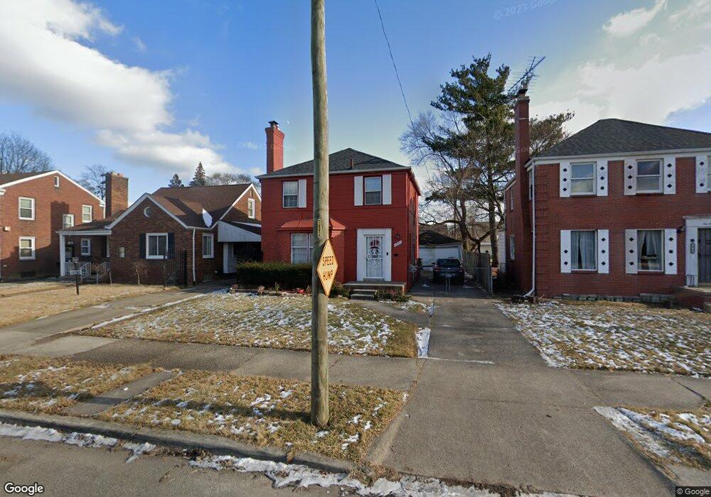
10770 Beaconsfield St Detroit, MI 48224
Yorkshire Woods NeighborhoodEstimated Value: $72,000 - $94,000
3
Beds
1
Bath
1,482
Sq Ft
$59/Sq Ft
Est. Value
About This Home
This home is located at 10770 Beaconsfield St, Detroit, MI 48224 and is currently estimated at $87,347, approximately $58 per square foot. 10770 Beaconsfield St is a home located in Wayne County with nearby schools including Wayne Elementary School, Edward 'Duke' Ellington Conservatory of Music and Art, and Charles L. Spain Elementary-Middle School.
Ownership History
Date
Name
Owned For
Owner Type
Purchase Details
Closed on
Oct 1, 2010
Sold by
Donovan Shaun and Secretary Of Housing & Urban D
Bought by
Jackson Denise
Current Estimated Value
Purchase Details
Closed on
May 20, 2010
Sold by
Wells Fargo Bank Na
Bought by
The Secretary Of Housing & Urban Develop
Purchase Details
Closed on
Nov 19, 2009
Sold by
Johnson Diane L
Bought by
Wells Fargo Bank Na
Purchase Details
Closed on
Mar 21, 1995
Sold by
William Custer
Bought by
A T Investment Corp
Create a Home Valuation Report for This Property
The Home Valuation Report is an in-depth analysis detailing your home's value as well as a comparison with similar homes in the area
Home Values in the Area
Average Home Value in this Area
Purchase History
| Date | Buyer | Sale Price | Title Company |
|---|---|---|---|
| Jackson Denise | $12,246 | None Available | |
| The Secretary Of Housing & Urban Develop | -- | None Available | |
| Wells Fargo Bank Na | $53,726 | None Available | |
| A T Investment Corp | $28,500 | -- |
Source: Public Records
Tax History Compared to Growth
Tax History
| Year | Tax Paid | Tax Assessment Tax Assessment Total Assessment is a certain percentage of the fair market value that is determined by local assessors to be the total taxable value of land and additions on the property. | Land | Improvement |
|---|---|---|---|---|
| 2025 | $125 | $45,700 | $0 | $0 |
| 2024 | $125 | $0 | $0 | $0 |
| 2023 | $1,122 | $34,200 | $0 | $0 |
| 2022 | $251 | $0 | $0 | $0 |
| 2021 | $1,133 | $22,300 | $0 | $0 |
| 2020 | $1,184 | $20,800 | $0 | $0 |
| 2019 | $1,166 | $18,000 | $0 | $0 |
| 2018 | $997 | $15,400 | $0 | $0 |
| 2017 | $239 | $12,600 | $0 | $0 |
| 2016 | $1,422 | $19,600 | $0 | $0 |
| 2015 | $1,960 | $19,600 | $0 | $0 |
| 2013 | $2,715 | $27,154 | $0 | $0 |
| 2010 | -- | $39,812 | $1,396 | $38,416 |
Source: Public Records
Map
Nearby Homes
- 10773 Beaconsfield St
- 10713 Beaconsfield St
- 10551 Somerset Ave
- 10595 Somerset Ave
- 10508 Nottingham Rd
- 10817 Nottingham Rd
- 10597 Beaconsfield St
- 10823 Nottingham Rd
- 10947 Roxbury St
- 11009 Roxbury St
- 10818 Nottingham Rd
- 10468 Nottingham Rd
- 10811 Roxbury St
- 10404 Somerset Ave
- 10851 Nottingham Rd
- 10731 Somerset Ave
- 10390 Somerset Ave
- 10842 Nottingham Rd
- 10857 Nottingham Rd
- 10862 Nottingham Rd
- 10780 Beaconsfield St
- 10760 Beaconsfield St
- 10752 Beaconsfield St
- 10786 Beaconsfield St
- 10746 Beaconsfield St
- 10794 Beaconsfield St
- 10663 Nottingham Rd
- 10647 Nottingham Rd
- 10673 Nottingham Rd
- 10655 Nottingham Rd
- 10681 Nottingham Rd
- 10736 Beaconsfield St
- 10765 Beaconsfield St
- 10687 Nottingham Rd
- 10755 Beaconsfield St
- 10783 Beaconsfield St
- 10637 Nottingham Rd
- 10728 Beaconsfield St
- 10745 Beaconsfield St
- 10810 Beaconsfield St Unit Bldg-Unit
