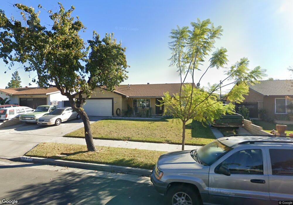
10770 Broderick Dr Riverside, CA 92505
La Sierra NeighborhoodEstimated Value: $601,143 - $635,000
4
Beds
2
Baths
1,378
Sq Ft
$445/Sq Ft
Est. Value
About This Home
This home is located at 10770 Broderick Dr, Riverside, CA 92505 and is currently estimated at $612,786, approximately $444 per square foot. 10770 Broderick Dr is a home located in Riverside County with nearby schools including Collett Elementary School, Arizona Middle School, and La Sierra High School.
Ownership History
Date
Name
Owned For
Owner Type
Purchase Details
Closed on
Mar 13, 2001
Sold by
Federal Home Loan Mortgage Corporation
Bought by
Valle Moises and Valle Ana E
Current Estimated Value
Home Financials for this Owner
Home Financials are based on the most recent Mortgage that was taken out on this home.
Original Mortgage
$133,119
Outstanding Balance
$49,089
Interest Rate
7.19%
Mortgage Type
FHA
Estimated Equity
$563,697
Purchase Details
Closed on
Jul 10, 2000
Sold by
Santos Cervantes and Santos Esperanza Cervantes
Bought by
Federal Home Loan Mortgage Corporation
Create a Home Valuation Report for This Property
The Home Valuation Report is an in-depth analysis detailing your home's value as well as a comparison with similar homes in the area
Home Values in the Area
Average Home Value in this Area
Purchase History
| Date | Buyer | Sale Price | Title Company |
|---|---|---|---|
| Valle Moises | $135,000 | First American Title Co | |
| Federal Home Loan Mortgage Corporation | $113,341 | North American Title Co |
Source: Public Records
Mortgage History
| Date | Status | Borrower | Loan Amount |
|---|---|---|---|
| Open | Valle Moises | $133,119 |
Source: Public Records
Tax History
| Year | Tax Paid | Tax Assessment Tax Assessment Total Assessment is a certain percentage of the fair market value that is determined by local assessors to be the total taxable value of land and additions on the property. | Land | Improvement |
|---|---|---|---|---|
| 2025 | $2,393 | $203,392 | $67,792 | $135,600 |
| 2023 | $2,393 | $195,496 | $65,160 | $130,336 |
| 2022 | $2,213 | $191,664 | $63,883 | $127,781 |
| 2021 | $2,186 | $187,907 | $62,631 | $125,276 |
| 2020 | $2,150 | $185,981 | $61,989 | $123,992 |
| 2019 | $2,121 | $182,335 | $60,774 | $121,561 |
| 2018 | $2,091 | $178,761 | $59,584 | $119,177 |
| 2017 | $2,051 | $175,257 | $58,416 | $116,841 |
| 2016 | $2,017 | $171,821 | $57,271 | $114,550 |
| 2015 | $1,986 | $169,241 | $56,411 | $112,830 |
| 2014 | $1,977 | $165,928 | $55,307 | $110,621 |
Source: Public Records
Map
Nearby Homes
- 4389 Drexel Ave
- 11140 Bridgepoint Ct
- 11141 Gardenhurst Ct
- 10520 Cook Ave
- 4247 Bravado
- 0 Bushnell Ave
- 10495 Cook Ave
- 4201 Ferguson Ct
- 4834 Hedrick Ave
- 0 Sunnyslope Ave
- 4998 Bushnell Ave
- 4878 Streambay Ct
- 10710 Brookfield Dr
- 4314 Baggett Dr
- 11332 Riverbury Ct
- 11306 Trailstone Ct
- 10372 Wells Ave
- 4581 Geraty Ct
- 11369 Brookglen Ct
- 11327 Streamhurst Dr
- 10780 Broderick Dr
- 10764 Broderick Dr
- 10790 Broderick Dr
- 10758 Broderick Dr
- 4650 Pavia Way
- 10901 Finchley Ave
- 10891 Finchley Ave
- 4655 Lanai Ct
- 10911 Finchley Ave
- 10881 Finchley Ave
- 10800 Broderick Dr
- 10750 Broderick Dr
- 4640 Pavia Way
- 4645 Pavia Way
- 10921 Finchley Ave
- 10871 Finchley Ave
- 4645 Lanai Ct
- 10810 Broderick Dr
- 10742 Broderick Dr
- 4630 Pavia Way
Your Personal Tour Guide
Ask me questions while you tour the home.