Estimated Value: $178,000 - $181,278
--
Bed
1
Bath
1,352
Sq Ft
$133/Sq Ft
Est. Value
About This Home
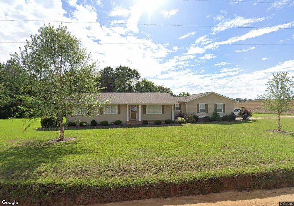
This home is located at 1078 Saint Paul Church Rd, Omega, GA 31775 and is currently estimated at $179,426, approximately $132 per square foot. 1078 Saint Paul Church Rd is a home located in Colquitt County with nearby schools including Norman Park Elementary School, C.A. Gray Junior High School, and Willie J. Williams Middle School.
Ownership History
Date
Name
Owned For
Owner Type
Purchase Details
Closed on
May 10, 2002
Sold by
Sumner Steven M
Bought by
Sumner Becky L
Current Estimated Value
Purchase Details
Closed on
Apr 24, 2002
Sold by
Woody L Roy Life Estate
Bought by
Sumner Steven M
Purchase Details
Closed on
Jan 5, 2000
Sold by
Woody L Roy
Bought by
Woody L Roy Life Estate
Purchase Details
Closed on
Aug 26, 1993
Bought by
Bass Marilyn W
Create a Home Valuation Report for This Property
The Home Valuation Report is an in-depth analysis detailing your home's value as well as a comparison with similar homes in the area
Home Values in the Area
Average Home Value in this Area
Purchase History
| Date | Buyer | Sale Price | Title Company |
|---|---|---|---|
| Sumner Becky L | $25,000 | -- | |
| Sumner Steven M | -- | -- | |
| Woody L Roy Life Estate | -- | -- | |
| Woody L Roy | -- | -- | |
| Bass Marilyn W | -- | -- |
Source: Public Records
Tax History Compared to Growth
Tax History
| Year | Tax Paid | Tax Assessment Tax Assessment Total Assessment is a certain percentage of the fair market value that is determined by local assessors to be the total taxable value of land and additions on the property. | Land | Improvement |
|---|---|---|---|---|
| 2024 | $1,235 | $63,487 | $5,013 | $58,474 |
| 2023 | $1,297 | $50,619 | $5,013 | $45,606 |
| 2022 | $1,040 | $45,698 | $4,456 | $41,242 |
| 2021 | $829 | $36,142 | $3,248 | $32,894 |
| 2020 | $781 | $33,599 | $3,248 | $30,351 |
| 2019 | $822 | $31,904 | $3,248 | $28,656 |
| 2018 | $816 | $31,904 | $3,248 | $28,656 |
| 2017 | $805 | $31,571 | $2,915 | $28,656 |
| 2016 | $663 | $26,027 | $2,915 | $23,112 |
| 2015 | $669 | $26,027 | $2,915 | $23,112 |
| 2014 | -- | $26,027 | $2,915 | $23,112 |
| 2013 | -- | $26,026 | $2,914 | $23,112 |
Source: Public Records
Map
Nearby Homes
- 146 Lamar St
- 142 Lamar St
- 122 New St
- 86 Owen Medford Rd
- 1427 S Ty Omega Rd
- 221 Rentz Bridge Rd
- 5015 Union Rd
- 187 Bussell Rd
- 1396 Livingston Bridge Rd
- 0 S Us Hwy 41 Lee Ball Rd Unit 134993
- 83 W Gray Ave
- 411 S Robinson St
- 320 E Central Ave
- 77 S Bobby St
- 4716 Union Rd
- 160 Main Street Crosland
- 801 Broad St
- 171 Ellis Bryan Rd
- 0 Union Industrial Way
- 54 Jacks Way
- 432 Rudolph Sumner Rd
- 842 Mitchell Store Rd
- 150 Colquitt County Line Rd
- 162 Colquitt County Line Rd
- 168 Colquitt County Line Rd
- 257 Rudolph Sumner Rd
- 106 Colquitt County Line Rd
- 877 Saint Paul Church Rd
- 202 Colquitt County Line Rd
- 69 Colquitt County Line Rd
- 816 Mitchell Store Rd
- 528 Saint Paul Church Rd
- 803 Mitchell Store Rd
- 531 Tift County Line Rd
- 531 Tift County Line Rd
- 28 Colquitt County Line Rd
- 272 Colquitt County Line Rd
- 272 Colquitt County Line Rd
- 296 Colquitt County Line Rd
- 770 Mitchell Store Rd