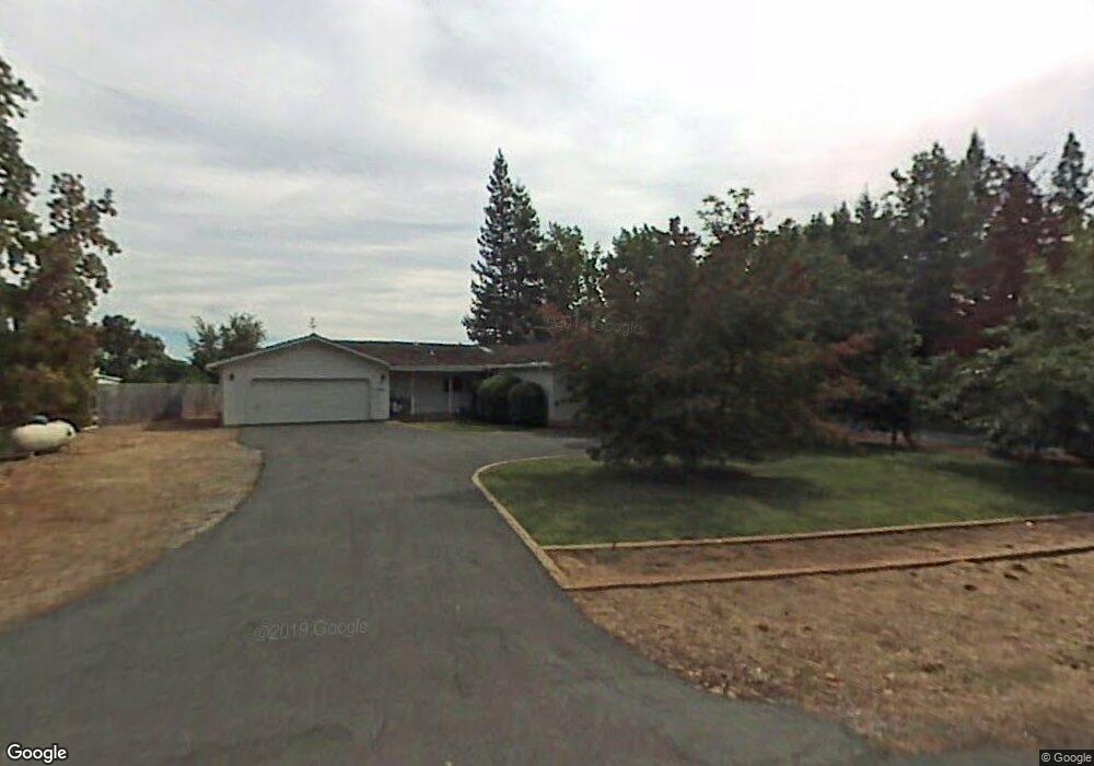
10781 Sutter Cir Sutter Creek, CA 95685
Estimated Value: $365,000 - $481,000
3
Beds
2
Baths
1,370
Sq Ft
$297/Sq Ft
Est. Value
About This Home
This home is located at 10781 Sutter Cir, Sutter Creek, CA 95685 and is currently estimated at $407,030, approximately $297 per square foot. 10781 Sutter Cir is a home located in Amador County with nearby schools including Jackson Elementary School, Jackson Junior High School, and Argonaut High School.
Ownership History
Date
Name
Owned For
Owner Type
Purchase Details
Closed on
Aug 21, 2015
Sold by
Burns Robert H
Bought by
Burns Eric J
Current Estimated Value
Home Financials for this Owner
Home Financials are based on the most recent Mortgage that was taken out on this home.
Original Mortgage
$51,586
Outstanding Balance
$40,489
Interest Rate
3.97%
Mortgage Type
Seller Take Back
Estimated Equity
$366,541
Purchase Details
Closed on
Dec 1, 2014
Sold by
Friis Dennis R and The Friis Family Trust
Bought by
Burns Robert H and Burns Eric J
Purchase Details
Closed on
Nov 20, 2014
Sold by
Burns Billie Y
Bought by
Burns Robert H
Create a Home Valuation Report for This Property
The Home Valuation Report is an in-depth analysis detailing your home's value as well as a comparison with similar homes in the area
Home Values in the Area
Average Home Value in this Area
Purchase History
| Date | Buyer | Sale Price | Title Company |
|---|---|---|---|
| Burns Eric J | -- | First American Title Company | |
| Burns Robert H | $200,000 | First American Title Company | |
| Burns Robert H | -- | First American Title Company |
Source: Public Records
Mortgage History
| Date | Status | Borrower | Loan Amount |
|---|---|---|---|
| Open | Burns Eric J | $51,586 |
Source: Public Records
Tax History Compared to Growth
Tax History
| Year | Tax Paid | Tax Assessment Tax Assessment Total Assessment is a certain percentage of the fair market value that is determined by local assessors to be the total taxable value of land and additions on the property. | Land | Improvement |
|---|---|---|---|---|
| 2025 | $2,378 | $240,360 | $72,106 | $168,254 |
| 2024 | $2,378 | $235,648 | $70,693 | $164,955 |
| 2023 | $2,330 | $231,028 | $69,307 | $161,721 |
| 2022 | $2,267 | $226,499 | $67,949 | $158,550 |
| 2021 | $2,223 | $222,059 | $66,617 | $155,442 |
| 2020 | $2,200 | $219,783 | $65,934 | $153,849 |
| 2019 | $2,155 | $215,475 | $64,642 | $150,833 |
| 2018 | $2,113 | $211,251 | $63,375 | $147,876 |
| 2017 | $2,071 | $207,110 | $62,133 | $144,977 |
| 2016 | $2,029 | $203,050 | $60,915 | $142,135 |
| 2015 | $2,013 | $200,000 | $60,000 | $140,000 |
| 2014 | $1,582 | $159,053 | $41,417 | $117,636 |
Source: Public Records
Map
Nearby Homes
- 1436 Jackson Gate Rd
- 1420 Jackson Gate Rd
- 9 Raggio Rd
- 11321 New York Ranch Rd
- 0 Ridge Rd Unit 225119705
- 1330 Jackson Gate Rd
- 0 Sutter Creek Rd Unit 225088865
- 00000 Sutter Creek Rd
- 20 Rollingwood #200 Dr
- 0 Eureka St
- 20 Rollingwood Dr Unit 150
- 20 Rollingwood Dr Unit 70
- 20 Rollingwood Dr Unit 200
- 20 Rollingwood Dr Unit 119
- 20 Rollingwood Dr Unit 50
- 20 Rollingwood Dr Unit 88
- 20 Rollingwood Dr Unit 55
- 20 Rollingwood Dr Unit 159
- 20 Rollingwood Dr Unit 141
- 20 Rollingwood Dr Unit 80
- 10791 Sutter Cir
- 10771 Sutter Cir
- 10780 Sutter Cir
- 10770 Sutter Cir
- 10801 Sutter Cir
- 10796 Sutter Cir
- 10751 Sutter Cir
- 10730 Sutter Cir
- 10761 Sutter Cir
- 10741 Sutter Cir
- 13508 Monitor Ln
- 10731 Sutter Cir
- 11906 Sutter Cir
- 10886 Sutter Cir
- 10810 Sutter Cir
- 10860 Sutter Cir
- 13485 Monitor Ln
- 11908 Sutter Cir
- 18440 Sutter
- 10815 Sutter Cir