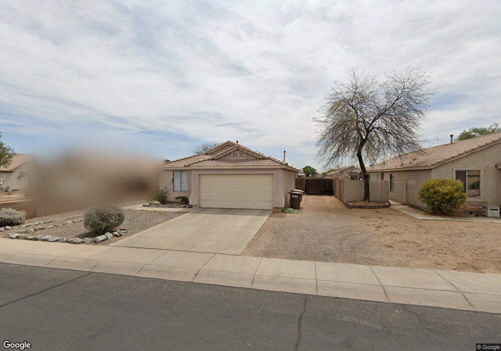
10781 W Donald Dr Sun City, AZ 85373
Estimated Value: $359,112 - $422,000
3
Beds
2
Baths
1,368
Sq Ft
$292/Sq Ft
Est. Value
About This Home
This home is located at 10781 W Donald Dr, Sun City, AZ 85373 and is currently estimated at $398,778, approximately $291 per square foot. 10781 W Donald Dr is a home located in Maricopa County with nearby schools including Zuni Hills Elementary School, Liberty High School, and Candeo Peoria.
Ownership History
Date
Name
Owned For
Owner Type
Purchase Details
Closed on
Sep 3, 2010
Sold by
Rinaldini Susan W
Bought by
Rinaldini Susan W and Rinaldini Living Trust
Current Estimated Value
Purchase Details
Closed on
Apr 23, 2008
Sold by
Rinaldini Susan W and Rinaldini Tara L
Bought by
Rinaldini Susan W
Purchase Details
Closed on
Apr 22, 2008
Sold by
Rinaldini Susan W
Bought by
Rinaldini Susan W and Rinaldini Tara L
Purchase Details
Closed on
Feb 14, 2008
Sold by
Rinaldini Niki
Bought by
Rinaldini Susan Whittaker
Purchase Details
Closed on
Aug 20, 1999
Sold by
Pulte Home Corp
Bought by
Rinaldini Niki A
Home Financials for this Owner
Home Financials are based on the most recent Mortgage that was taken out on this home.
Original Mortgage
$70,000
Interest Rate
7.56%
Mortgage Type
New Conventional
Create a Home Valuation Report for This Property
The Home Valuation Report is an in-depth analysis detailing your home's value as well as a comparison with similar homes in the area
Home Values in the Area
Average Home Value in this Area
Purchase History
| Date | Buyer | Sale Price | Title Company |
|---|---|---|---|
| Rinaldini Susan W | -- | None Available | |
| Rinaldini Susan W | -- | None Available | |
| Rinaldini Susan W | -- | None Available | |
| Rinaldini Susan Whittaker | -- | None Available | |
| Rinaldini Niki A | $114,835 | Transnation Title Ins Co |
Source: Public Records
Mortgage History
| Date | Status | Borrower | Loan Amount |
|---|---|---|---|
| Previous Owner | Rinaldini Niki A | $70,000 |
Source: Public Records
Tax History Compared to Growth
Tax History
| Year | Tax Paid | Tax Assessment Tax Assessment Total Assessment is a certain percentage of the fair market value that is determined by local assessors to be the total taxable value of land and additions on the property. | Land | Improvement |
|---|---|---|---|---|
| 2025 | $1,481 | $15,841 | -- | -- |
| 2024 | $1,453 | $15,087 | -- | -- |
| 2023 | $1,453 | $30,100 | $6,020 | $24,080 |
| 2022 | $1,425 | $21,280 | $4,250 | $17,030 |
| 2021 | $1,492 | $19,480 | $3,890 | $15,590 |
| 2020 | $1,501 | $17,820 | $3,560 | $14,260 |
| 2019 | $1,456 | $16,770 | $3,350 | $13,420 |
| 2018 | $1,413 | $15,310 | $3,060 | $12,250 |
| 2017 | $1,409 | $14,060 | $2,810 | $11,250 |
| 2016 | $1,384 | $13,080 | $2,610 | $10,470 |
| 2015 | $1,296 | $11,880 | $2,370 | $9,510 |
Source: Public Records
Map
Nearby Homes
- 10824 W Sands Dr
- 10617 W Daley Ln
- 22488 N 104th Ln
- 10456 W Los Gatos Dr
- 22760 N 103rd Ln
- 22729 N 103rd Ln
- 10370 W Sands Dr Unit 463
- 10328 W Carlota Ln
- 10296 W Sands Dr Unit 485
- 10423 W Navigator Ln
- 10446 W Navigator Ln
- 10806 W Adam Ave
- 10459 W Pinnacle Peak Rd Unit 29
- 10252 W Villa Chula
- 10816 W Quail Ave
- 10446 W Lone Cactus Dr
- 10549 W Albert Ln
- 21479 N 104th Dr
- 10172 W Carlota Ln
- 10816 W Deanna Dr
- 10789 W Donald Dr
- 10773 W Donald Dr
- 10797 W Donald Dr
- 10782 W Robin Ln
- 10765 W Donald Dr
- 10774 W Robin Ln
- 10790 W Robin Ln
- 10766 W Robin Ln
- 10798 W Robin Ln
- 10782 W Donald Dr
- 10790 W Donald Dr
- 10774 W Donald Dr
- 10798 W Donald Dr
- 10758 W Robin Ln
- 10758 W Donald Dr
- 22482 N 107th Dr
- 22472 N 107th Dr
- 10766 W Donald Dr
- 22462 N 107th Dr
- 10781 W Robin Ln