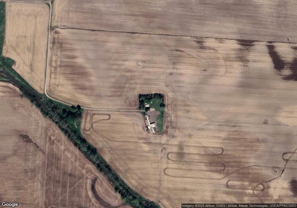
10787 Lancaster Rd Hebron, OH 43025
Union NeighborhoodEstimated Value: $286,000 - $1,281,791
2
Beds
1
Bath
1,360
Sq Ft
$531/Sq Ft
Est. Value
About This Home
This home is located at 10787 Lancaster Rd, Hebron, OH 43025 and is currently estimated at $722,264, approximately $531 per square foot. 10787 Lancaster Rd is a home located in Licking County with nearby schools including Jackson Intermediate School, Lakewood Middle School, and Lakewood High School.
Ownership History
Date
Name
Owned For
Owner Type
Purchase Details
Closed on
Jul 17, 2018
Sold by
Slater John W and Slater Penny L
Bought by
Luray Union Llc
Current Estimated Value
Purchase Details
Closed on
Nov 22, 2016
Sold by
Marilyn A Trux
Bought by
Slater John and Slater Penny
Home Financials for this Owner
Home Financials are based on the most recent Mortgage that was taken out on this home.
Original Mortgage
$265,637
Interest Rate
3.94%
Purchase Details
Closed on
May 26, 2016
Sold by
Slater Donald and Slater Laura J
Bought by
Slater John W and Slater Penny L
Home Financials for this Owner
Home Financials are based on the most recent Mortgage that was taken out on this home.
Original Mortgage
$450,000
Interest Rate
3.59%
Mortgage Type
Purchase Money Mortgage
Purchase Details
Closed on
Jan 31, 2007
Sold by
Slater Donald and Slater Laura J
Bought by
Slater Donald and Slater Laura J
Purchase Details
Closed on
Mar 27, 2003
Sold by
Slater Wanda W
Bought by
Slater Charles E
Create a Home Valuation Report for This Property
The Home Valuation Report is an in-depth analysis detailing your home's value as well as a comparison with similar homes in the area
Home Values in the Area
Average Home Value in this Area
Purchase History
| Date | Buyer | Sale Price | Title Company |
|---|---|---|---|
| Luray Union Llc | -- | None Available | |
| Slater John | -- | -- | |
| Slater John W | $550,000 | None Available | |
| Slater Donald | -- | Attorney | |
| Slater Charles E | -- | -- |
Source: Public Records
Mortgage History
| Date | Status | Borrower | Loan Amount |
|---|---|---|---|
| Previous Owner | Slater John | $265,637 | |
| Previous Owner | Slater John | -- | |
| Previous Owner | Slater John W | $450,000 |
Source: Public Records
Tax History Compared to Growth
Tax History
| Year | Tax Paid | Tax Assessment Tax Assessment Total Assessment is a certain percentage of the fair market value that is determined by local assessors to be the total taxable value of land and additions on the property. | Land | Improvement |
|---|---|---|---|---|
| 2024 | $4,805 | $299,500 | $258,650 | $40,850 |
| 2023 | $4,857 | $299,500 | $258,650 | $40,850 |
| 2022 | $3,108 | $241,500 | $210,490 | $31,010 |
| 2021 | $3,205 | $241,500 | $210,490 | $31,010 |
| 2020 | $3,315 | $241,500 | $210,490 | $31,010 |
| 2019 | $4,285 | $181,760 | $155,930 | $25,830 |
| 2018 | $4,176 | $0 | $0 | $0 |
| 2017 | $6,287 | $0 | $0 | $0 |
| 2016 | $5,333 | $0 | $0 | $0 |
| 2015 | $2,604 | $0 | $0 | $0 |
| 2014 | $7,776 | $0 | $0 | $0 |
| 2013 | $1,360 | $0 | $0 | $0 |
Source: Public Records
Map
Nearby Homes
- 3371 Shepard Ave
- 9257 Lancaster Rd
- 90 Louella Dr
- 4780 Walnut Rd
- 12291 Ohio Ave
- 814 W Main St
- 104 Cumberland Meadows Cir
- 12055 7th Ave
- 11999 Broad St
- 11116 Hebron Rd
- 3424 S Bank Rd NE
- 11007 Hebron Rd
- 3317 S Bank Rd NE
- 11047 Hebron Rd
- 13504 Shell Beach Rd NE
- 11890 Broad St
- 3427 S Bank Rd NE
- 83 Seymour Ave
- 173 Highland Ave
- 129 Park St
- 10785 Lancaster Rd
- 10489 Canal Rd
- 2710 Walnut Rd NE
- 10938 Lancaster Rd
- 11089 Canal Rd
- 2843 Walnut Rd NE
- 2845 Walnut Rd NE
- 10616 Lancaster Rd
- 11171 Lancaster Rd
- 10319 Lancaster Rd
- 13845 Millersport Rd NE
- 3195 Walnut Rd
- 11368 Lancaster Rd
- 10285 Lancaster Rd
- 4035 Walnut Rd
- 0 NE Walnut Rd Unit 4120519
- 0 NE Walnut Rd Unit 212025523
- 10517 Canal Rd
- 1989 Walnut Rd NE
- 2482 Palmer Rd
