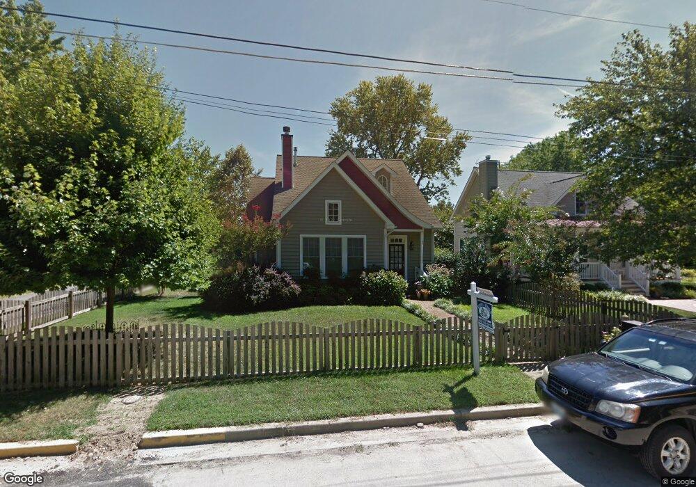
108 E Maple Ave Saint Michaels, MD 21663
Estimated Value: $758,294 - $861,000
3
Beds
3
Baths
2,201
Sq Ft
$368/Sq Ft
Est. Value
About This Home
This home is located at 108 E Maple Ave, Saint Michaels, MD 21663 and is currently estimated at $809,824, approximately $367 per square foot. 108 E Maple Ave is a home located in Talbot County with nearby schools including St. Michaels Elementary School, St. Michaels Middle/High School, and Easton High School.
Ownership History
Date
Name
Owned For
Owner Type
Purchase Details
Closed on
Nov 9, 2007
Sold by
Richards Eugene T
Bought by
Henson Jay Carroll and Henson Kimberly Erin Colomb
Current Estimated Value
Purchase Details
Closed on
Sep 1, 2006
Sold by
Richards Mark
Bought by
Richards Eugene T and Richards Mary Ellen Burke
Purchase Details
Closed on
Aug 30, 2006
Sold by
Richards Mark
Bought by
Richards Eugene T and Richards Mary Ellen Burke
Create a Home Valuation Report for This Property
The Home Valuation Report is an in-depth analysis detailing your home's value as well as a comparison with similar homes in the area
Home Values in the Area
Average Home Value in this Area
Purchase History
| Date | Buyer | Sale Price | Title Company |
|---|---|---|---|
| Henson Jay Carroll | $460,000 | -- | |
| Henson Jay Carroll | $460,000 | -- | |
| Richards Eugene T | $200,000 | -- | |
| Richards Eugene T | $200,000 | -- |
Source: Public Records
Tax History
| Year | Tax Paid | Tax Assessment Tax Assessment Total Assessment is a certain percentage of the fair market value that is determined by local assessors to be the total taxable value of land and additions on the property. | Land | Improvement |
|---|---|---|---|---|
| 2025 | $4,265 | $485,900 | $143,900 | $342,000 |
| 2024 | $4,199 | $462,767 | $0 | $0 |
| 2023 | $4,019 | $439,633 | $0 | $0 |
| 2022 | $3,859 | $416,500 | $143,900 | $272,600 |
| 2021 | $3,809 | $410,133 | $0 | $0 |
| 2020 | $3,809 | $403,767 | $0 | $0 |
| 2019 | $3,802 | $397,400 | $122,000 | $275,400 |
| 2018 | $3,708 | $374,233 | $0 | $0 |
| 2017 | $3,567 | $351,067 | $0 | $0 |
| 2016 | $3,156 | $327,900 | $0 | $0 |
| 2015 | $3,705 | $327,900 | $0 | $0 |
| 2014 | $3,705 | $327,900 | $0 | $0 |
Source: Public Records
Map
Nearby Homes
- 105 Seymour Ave
- 204 E Marengo St
- Lot 16A Meadow St
- 114 E Chew Ave
- 303 Manor St
- 216 E Chew Ave
- 106 E Chestnut St
- 222 E Chestnut St
- 107 W Chestnut St
- 114 W Chestnut St
- 101 Mulberry St
- 938 Marea Terrace
- 113 Gloria Ave
- 111 Gloria Ave
- 912 Calvert Ave
- 205 Cherry St
- 117 Chesapeake Ave
- 926 Calvert Ave
- 228 Tyler Ave
- 408 Spinnaker Ln
- 106 E Maple Ave
- 801 New Ln
- 200 E Maple Ave
- 109 Seymour Ave
- 104 E Maple Ave
- 107 Seymour Ave
- 111 E Maple Ave
- 201 Seymour Ave
- 803 New Ln
- 201 E Maple Ave
- 202 E Maple Ave
- 107 W Maple Ave
- 109 E Maple Ave
- 110 Grace St W
- 107 E Maple Ave
- 203 Seymour Ave
- 705 New Ln
- 105 W Maple Ave
- 105 E Maple Ave
- 105 Maple Street A E
Your Personal Tour Guide
Ask me questions while you tour the home.