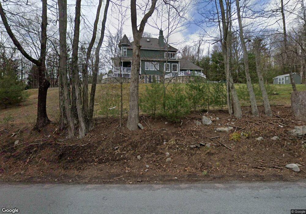
108 Foster Hill Rd Milford, PA 18337
Estimated Value: $668,214 - $734,000
3
Beds
3
Baths
3,129
Sq Ft
$224/Sq Ft
Est. Value
About This Home
This home is located at 108 Foster Hill Rd, Milford, PA 18337 and is currently estimated at $701,107, approximately $224 per square foot. 108 Foster Hill Rd is a home located in Pike County with nearby schools including Delaware Valley High School.
Ownership History
Date
Name
Owned For
Owner Type
Purchase Details
Closed on
Apr 14, 2022
Sold by
Williams Peter
Bought by
Isaza Elizabeth and Isaza I
Current Estimated Value
Purchase Details
Closed on
Nov 30, 2007
Sold by
Wells Fargo Bank N A
Bought by
Williams Peter and Williams Carmen
Home Financials for this Owner
Home Financials are based on the most recent Mortgage that was taken out on this home.
Original Mortgage
$283,500
Interest Rate
6.37%
Mortgage Type
New Conventional
Purchase Details
Closed on
Sep 8, 2006
Sold by
Bueki Philip
Bought by
Degiorgis Diana
Create a Home Valuation Report for This Property
The Home Valuation Report is an in-depth analysis detailing your home's value as well as a comparison with similar homes in the area
Home Values in the Area
Average Home Value in this Area
Purchase History
| Date | Buyer | Sale Price | Title Company |
|---|---|---|---|
| Isaza Elizabeth | $575,000 | -- | |
| Williams Peter | $335,000 | Land Title Insurance Company | |
| Degiorgis Diana | $536 | None Available |
Source: Public Records
Mortgage History
| Date | Status | Borrower | Loan Amount |
|---|---|---|---|
| Previous Owner | Williams Peter | $283,500 |
Source: Public Records
Tax History Compared to Growth
Tax History
| Year | Tax Paid | Tax Assessment Tax Assessment Total Assessment is a certain percentage of the fair market value that is determined by local assessors to be the total taxable value of land and additions on the property. | Land | Improvement |
|---|---|---|---|---|
| 2025 | $8,980 | $57,260 | $10,080 | $47,180 |
| 2024 | $8,980 | $57,260 | $10,080 | $47,180 |
| 2023 | $8,736 | $57,260 | $10,080 | $47,180 |
| 2022 | $8,508 | $57,260 | $10,080 | $47,180 |
| 2021 | $8,422 | $57,260 | $10,080 | $47,180 |
| 2020 | $8,308 | $57,260 | $10,080 | $47,180 |
| 2019 | $8,042 | $57,260 | $10,080 | $47,180 |
| 2018 | $8,042 | $57,260 | $10,080 | $47,180 |
| 2017 | $7,829 | $57,260 | $10,080 | $47,180 |
| 2016 | $0 | $57,260 | $10,080 | $47,180 |
| 2014 | -- | $57,260 | $10,080 | $47,180 |
Source: Public Records
Map
Nearby Homes
- 110 Shadow Ln
- 212 W John St
- Lot 469 W Sarah St
- 619 5th St
- LOT 600 W High St
- 311 W Catherine St
- 112 W High St
- 509 Broad St
- 105 Bennett Ave
- 00 Minisink Ct
- Lot 54 Skyline Dr
- Lot 59 Skyline Dr
- 0 Milford Heights Rd
- 203 W Harford St
- 106 Mill St
- 208 E High St
- 173 Skyline Dr
- 134 Bennett Ave
- 107 Broad St
- 218 Vandermark Dr
- 108 Foster Hill Rd
- 109 Chippy Cole Rd
- 109 Chippy Cole Rd
- 109 Chippy Cole Rd
- 103 Chippy Cole Rd
- 0 Chippy Cole Rd
- 114 Foster Hill Rd
- 113 Chippy Cole Rd
- 108 Chippy Cole Rd
- 117 Foster Hill Rd
- 100 Chippy Cole Rd
- 103 Nearing Ln
- 801 7th St
- 106 Chippy Cole Rd
- 122 Tower Dr
- 122 Tower Dr
- 105 Nearing Ln
- 111 Nearing Ln
- 110 Chippy Cole Rd
- 113 Nearing Ln