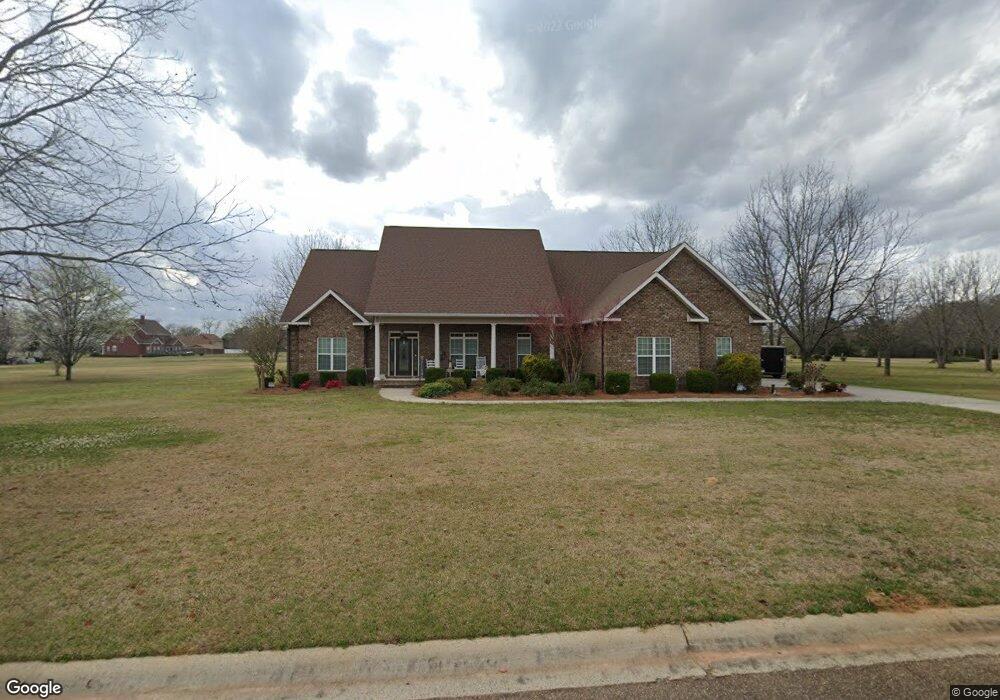
108 Liberty Ridge Dr Macon, GA 31216
Estimated Value: $473,000 - $518,000
4
Beds
4
Baths
3,146
Sq Ft
$154/Sq Ft
Est. Value
About This Home
This home is located at 108 Liberty Ridge Dr, Macon, GA 31216 and is currently estimated at $485,809, approximately $154 per square foot. 108 Liberty Ridge Dr is a home with nearby schools including Heard Elementary School, Rutland Middle School, and Rutland High School.
Ownership History
Date
Name
Owned For
Owner Type
Purchase Details
Closed on
Apr 10, 2012
Sold by
Hall Merrell G
Bought by
Wilcox Malcolm C and Wilcox Sandra J
Current Estimated Value
Purchase Details
Closed on
Dec 14, 2004
Purchase Details
Closed on
Aug 4, 2003
Create a Home Valuation Report for This Property
The Home Valuation Report is an in-depth analysis detailing your home's value as well as a comparison with similar homes in the area
Home Values in the Area
Average Home Value in this Area
Purchase History
| Date | Buyer | Sale Price | Title Company |
|---|---|---|---|
| Wilcox Malcolm C | $43,000 | None Available | |
| -- | -- | -- | |
| -- | -- | -- |
Source: Public Records
Tax History Compared to Growth
Tax History
| Year | Tax Paid | Tax Assessment Tax Assessment Total Assessment is a certain percentage of the fair market value that is determined by local assessors to be the total taxable value of land and additions on the property. | Land | Improvement |
|---|---|---|---|---|
| 2025 | $4,572 | $193,056 | $14,580 | $178,476 |
| 2024 | $4,694 | $191,834 | $14,580 | $177,254 |
| 2023 | $3,726 | $171,712 | $11,340 | $160,372 |
| 2022 | $4,357 | $132,858 | $20,000 | $112,858 |
| 2021 | $4,783 | $132,858 | $20,000 | $112,858 |
| 2020 | $4,886 | $132,858 | $20,000 | $112,858 |
| 2019 | $4,927 | $132,858 | $20,000 | $112,858 |
| 2018 | $7,725 | $132,858 | $20,000 | $112,858 |
| 2017 | $4,715 | $132,858 | $20,000 | $112,858 |
| 2016 | $4,354 | $132,858 | $20,000 | $112,858 |
| 2015 | $6,164 | $132,858 | $20,000 | $112,858 |
| 2014 | $6,174 | $132,858 | $20,000 | $112,858 |
Source: Public Records
Map
Nearby Homes
- 0 Liberty Ridge Dr Unit 7403011
- 0 Liberty Ridge Dr Unit 7053054
- 0 Liberty Ridge Dr Unit 8047654
- 0 Liberty Ridge Dr
- 224 Liberty Trace
- 200 Liberty Trace
- 2925 Liberty Church Rd
- 221 Liberty Trace
- 217 Liberty Trace
- 228 Liberty Trace
- 229 Liberty Trace
- 2891 Liberty Church Rd
- 2987 Liberty Church Rd
- 205 Liberty Trace
- 233 Liberty Trace
- 2871 Liberty Church Rd
- 236 Liberty Trace
- 241 Liberty Trace
- 132 Francis Dr
- 131 Francis Dr