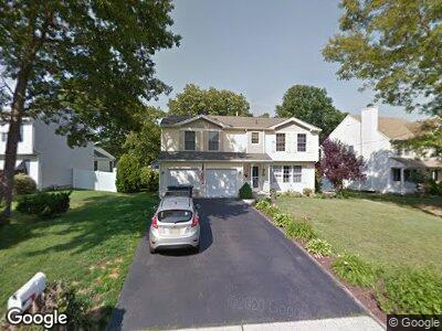
108 Yeoman Rd Manahawkin, NJ 08050
Stafford NeighborhoodEstimated Value: $428,641 - $524,000
5
Beds
3
Baths
2,450
Sq Ft
$201/Sq Ft
Est. Value
About This Home
This home is located at 108 Yeoman Rd, Manahawkin, NJ 08050 and is currently estimated at $493,410, approximately $201 per square foot. 108 Yeoman Rd is a home located in Ocean County with nearby schools including Ocean Acres Elementary School, Oxycocus Elementary School, and McKinley Avenue Elementary School.
Ownership History
Date
Name
Owned For
Owner Type
Purchase Details
Closed on
May 16, 1997
Sold by
Tupper Lake Inc
Bought by
Ferraro David and Ferraro Kyle Mary
Current Estimated Value
Home Financials for this Owner
Home Financials are based on the most recent Mortgage that was taken out on this home.
Original Mortgage
$93,000
Interest Rate
8.09%
Mortgage Type
Purchase Money Mortgage
Create a Home Valuation Report for This Property
The Home Valuation Report is an in-depth analysis detailing your home's value as well as a comparison with similar homes in the area
Home Values in the Area
Average Home Value in this Area
Purchase History
| Date | Buyer | Sale Price | Title Company |
|---|---|---|---|
| Ferraro David | $106,650 | -- |
Source: Public Records
Mortgage History
| Date | Status | Borrower | Loan Amount |
|---|---|---|---|
| Open | Ferraro David J | $312,000 | |
| Closed | Ferraro David J | $105,000 | |
| Closed | Ferraro David J | $20,000 | |
| Closed | Ferraro David J | $26,000 | |
| Closed | Ferraro David J | $60,000 | |
| Closed | Ferraro David | $93,000 |
Source: Public Records
Tax History Compared to Growth
Tax History
| Year | Tax Paid | Tax Assessment Tax Assessment Total Assessment is a certain percentage of the fair market value that is determined by local assessors to be the total taxable value of land and additions on the property. | Land | Improvement |
|---|---|---|---|---|
| 2024 | $6,088 | $247,600 | $62,100 | $185,500 |
| 2023 | $5,829 | $247,600 | $62,100 | $185,500 |
| 2022 | $5,829 | $247,600 | $62,100 | $185,500 |
| 2021 | $5,749 | $247,600 | $62,100 | $185,500 |
| 2020 | $5,757 | $247,600 | $62,100 | $185,500 |
| 2019 | $5,675 | $247,600 | $62,100 | $185,500 |
| 2018 | $5,640 | $247,600 | $62,100 | $185,500 |
| 2017 | $5,701 | $242,300 | $62,100 | $180,200 |
| 2016 | $5,643 | $242,300 | $62,100 | $180,200 |
| 2015 | $5,444 | $242,300 | $62,100 | $180,200 |
| 2014 | $5,351 | $235,200 | $61,300 | $173,900 |
Source: Public Records
Map
Nearby Homes
- 249 Mermaid Dr
- 117 Bowsprit Rd
- 90 Atlantis Ave
- 101 Outboard Ave
- 1534 Forecastle Ave
- 1632 Breakers Dr
- 214 Atlantis Ave
- 173 Sextant Rd
- 226 Atlantis Ave
- 1505 Forecastle Ave
- 308 Leeward Rd
- 204 Stormy Rd
- 1604, 1608, 1612 W Route 72 Hwy
- 153 Neptune Dr
- 121 Gaff Rd
- 120 Mooring Rd
- 1210 Ripple Ave
- 1151 Treasure Ave
- 385 Mermaid Dr
- 1130 Treasure Ave