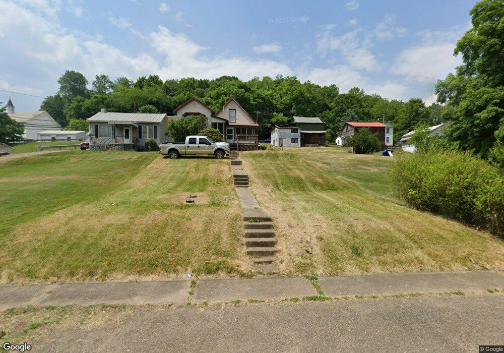
1080 Paw Paw Creek Rd Lower Salem, OH 45745
Estimated Value: $163,462 - $292,000
2
Beds
1
Bath
1,512
Sq Ft
$140/Sq Ft
Est. Value
About This Home
This home is located at 1080 Paw Paw Creek Rd, Lower Salem, OH 45745 and is currently estimated at $211,616, approximately $139 per square foot. 1080 Paw Paw Creek Rd is a home located in Washington County with nearby schools including Fort Frye High School.
Ownership History
Date
Name
Owned For
Owner Type
Purchase Details
Closed on
May 23, 2012
Sold by
Camp Dustie L
Bought by
Lighthall Ronald F and Lighthall Kim W
Current Estimated Value
Home Financials for this Owner
Home Financials are based on the most recent Mortgage that was taken out on this home.
Original Mortgage
$84,600
Outstanding Balance
$11,460
Interest Rate
3.11%
Mortgage Type
New Conventional
Estimated Equity
$200,156
Purchase Details
Closed on
Jul 7, 2011
Sold by
Secretary Of Housing And Urban Developme
Bought by
Lighthall Ronald F and Lighthall Kim W
Home Financials for this Owner
Home Financials are based on the most recent Mortgage that was taken out on this home.
Original Mortgage
$82,592
Interest Rate
5%
Mortgage Type
Purchase Money Mortgage
Purchase Details
Closed on
Jan 21, 2011
Sold by
Camp Daniel and Camp Daniel W
Bought by
Fifth Third Mortgage Company
Purchase Details
Closed on
Jan 20, 2011
Sold by
Fifth Third Mortgage Company
Bought by
Secretary Of Housing & Urban Development
Purchase Details
Closed on
Dec 5, 2008
Sold by
Tucholski Edward R
Bought by
Camp Daniel and Camp Dustie
Home Financials for this Owner
Home Financials are based on the most recent Mortgage that was taken out on this home.
Original Mortgage
$118,855
Interest Rate
6.49%
Mortgage Type
FHA
Purchase Details
Closed on
Jan 18, 2008
Sold by
Fouss Daniel A
Bought by
Tucholski Edward R and Tucholski Reta N
Purchase Details
Closed on
Jan 12, 2008
Sold by
Tucholski Edward R and Tucholski Reta N
Bought by
Fouss Daniel A
Create a Home Valuation Report for This Property
The Home Valuation Report is an in-depth analysis detailing your home's value as well as a comparison with similar homes in the area
Home Values in the Area
Average Home Value in this Area
Purchase History
| Date | Buyer | Sale Price | Title Company |
|---|---|---|---|
| Lighthall Ronald F | -- | Attorney | |
| Lighthall Ronald F | -- | None Available | |
| Fifth Third Mortgage Company | $64,000 | None Available | |
| Secretary Of Housing & Urban Development | -- | None Available | |
| Camp Daniel | $119,625 | Century Title & Escrow | |
| Tucholski Edward R | -- | Attorney | |
| Fouss Daniel A | -- | Attorney | |
| Johns Ii Allen W | $115,000 | Attorney |
Source: Public Records
Mortgage History
| Date | Status | Borrower | Loan Amount |
|---|---|---|---|
| Open | Lighthall Ronald F | $84,600 | |
| Previous Owner | Lighthall Ronald F | $82,592 | |
| Previous Owner | Camp Daniel | $118,855 |
Source: Public Records
Tax History Compared to Growth
Tax History
| Year | Tax Paid | Tax Assessment Tax Assessment Total Assessment is a certain percentage of the fair market value that is determined by local assessors to be the total taxable value of land and additions on the property. | Land | Improvement |
|---|---|---|---|---|
| 2024 | $1,131 | $33,880 | $4,690 | $29,190 |
| 2023 | $1,131 | $33,880 | $4,690 | $29,190 |
| 2022 | $1,079 | $33,880 | $4,690 | $29,190 |
| 2021 | $851 | $25,680 | $3,680 | $22,000 |
| 2020 | $846 | $25,680 | $3,680 | $22,000 |
| 2019 | $850 | $25,680 | $3,680 | $22,000 |
| 2018 | $843 | $25,350 | $3,350 | $22,000 |
| 2017 | $847 | $25,350 | $3,350 | $22,000 |
| 2016 | $1,592 | $25,350 | $3,350 | $22,000 |
| 2015 | $895 | $25,690 | $3,170 | $22,520 |
| 2014 | $1,605 | $25,690 | $3,170 | $22,520 |
| 2013 | $448 | $25,690 | $3,170 | $22,520 |
Source: Public Records
Map
Nearby Homes
- 9865 State Route 821
- 65 Warner Second St
- 2800 Tick Ridge Rd
- 50 & 60 Railroad St
- 200 Frakes Rd
- 0 Highland Ridge Rd
- 3275 Highland Ridge Rd
- 0 Highland Ridge Rd
- 4595 Ohio 530
- 0 Stanleyville Rd
- 2115 Goss Fork Rd
- 0 Township Highway 272
- 0 Dixon Ridge Rd Unit 5152245
- 9125 Highland Ridge Re
- 9125 Highland Ridge Rd
- Lot 4 Moss Run Rd
- 34799 Paw Rd
- 0 Heddleson Ridge Unit 223033844
- 1 Brooks Ln
- 15545 Ohio 821
- 1040 Paw Paw Creek Rd
- 1330 Paw Paw Creek Rd
- 1350 Paw Paw Creek Rd
- 10080 State Route 821
- 9720 State Route 821
- 855 Tick Ridge Rd
- 230 Paw Paw Creek Rd
- 9935 State Route 821
- 9875 State Route 821
- 9855 State Route 821
- 0 Main St
- 120 Main St
- 123 Main St
- 201 Main St
- 301 Main St
- 303 Main St
- 321 Main St
- 309 Main St
- 305 Main St
- 119 Main St