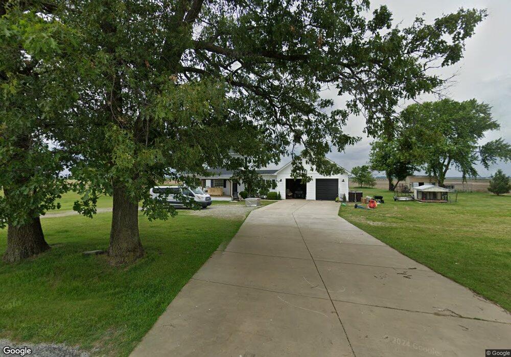
1080 S 600 E Kouts, IN 46347
Porter County NeighborhoodEstimated Value: $274,000 - $312,855
3
Beds
2
Baths
1,664
Sq Ft
$180/Sq Ft
Est. Value
About This Home
This home is located at 1080 S 600 E, Kouts, IN 46347 and is currently estimated at $299,714, approximately $180 per square foot. 1080 S 600 E is a home located in Porter County with nearby schools including Kouts Elementary School and Kouts Middle/High School.
Ownership History
Date
Name
Owned For
Owner Type
Purchase Details
Closed on
Aug 7, 2007
Sold by
Baranowski Margaret T and Kravchuk Ruslan
Bought by
Trumbo Ii David
Current Estimated Value
Home Financials for this Owner
Home Financials are based on the most recent Mortgage that was taken out on this home.
Original Mortgage
$168,000
Outstanding Balance
$103,666
Interest Rate
6.71%
Mortgage Type
Purchase Money Mortgage
Estimated Equity
$196,048
Create a Home Valuation Report for This Property
The Home Valuation Report is an in-depth analysis detailing your home's value as well as a comparison with similar homes in the area
Home Values in the Area
Average Home Value in this Area
Purchase History
| Date | Buyer | Sale Price | Title Company |
|---|---|---|---|
| Trumbo Ii David | -- | Chicago Title Insurance Co |
Source: Public Records
Mortgage History
| Date | Status | Borrower | Loan Amount |
|---|---|---|---|
| Open | Trumbo Ii David | $168,000 |
Source: Public Records
Tax History
| Year | Tax Paid | Tax Assessment Tax Assessment Total Assessment is a certain percentage of the fair market value that is determined by local assessors to be the total taxable value of land and additions on the property. | Land | Improvement |
|---|---|---|---|---|
| 2025 | $1,802 | $264,400 | $44,900 | $219,500 |
| 2024 | $1,843 | $263,900 | $35,900 | $228,000 |
| 2023 | $1,817 | $255,600 | $34,500 | $221,100 |
| 2022 | $1,677 | $236,000 | $34,500 | $201,500 |
| 2021 | $1,629 | $205,300 | $34,500 | $170,800 |
| 2020 | $1,595 | $201,600 | $30,000 | $171,600 |
| 2019 | $1,325 | $173,500 | $30,000 | $143,500 |
| 2018 | $1,194 | $162,600 | $30,000 | $132,600 |
| 2017 | $1,168 | $162,100 | $30,000 | $132,100 |
| 2016 | $1,096 | $156,100 | $30,400 | $125,700 |
| 2014 | $713 | $120,100 | $29,700 | $90,400 |
| 2013 | -- | $117,600 | $30,900 | $86,700 |
Source: Public Records
Map
Nearby Homes
- 548 E 1400 S
- 109 Iowa St
- 0 E 995 S
- B1-3 State Road 8
- 0-Lot B6-7 State Road 8
- 18 Genesse St
- 202 Genesse St
- 14 N Michigan St
- 601 E Main St
- 0 Vanessa Way Unit GNR544729
- 0 Sharyn St Unit GNR544743
- 0 Sharyn St Unit GNR544737
- 0 Sharyn St Unit GNR544741
- 708 S Main St
- 204 N Main St
- 702 W Jefferson St
- 103 Mckinley St
- 805 Sunset Dr
- 401 Sutton Ave
- 401 S Sutton Ave
Your Personal Tour Guide
Ask me questions while you tour the home.