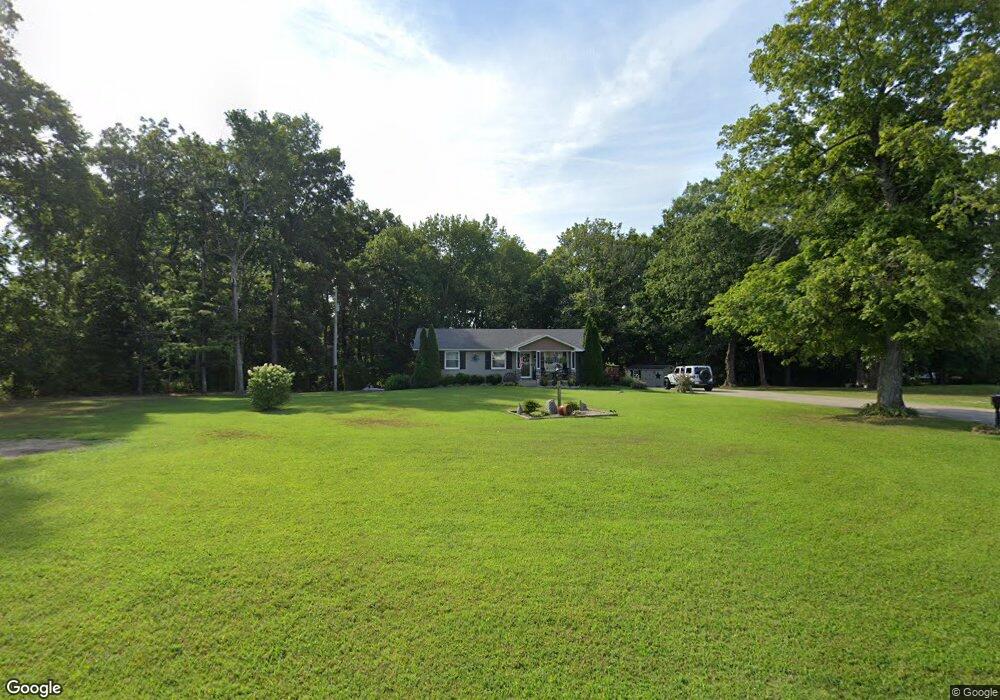
1080 Shady Grove Rd Clarksville, TN 37043
Estimated Value: $233,000 - $311,000
--
Bed
1
Bath
1,175
Sq Ft
$235/Sq Ft
Est. Value
About This Home
This home is located at 1080 Shady Grove Rd, Clarksville, TN 37043 and is currently estimated at $276,631, approximately $235 per square foot. 1080 Shady Grove Rd is a home located in Montgomery County with nearby schools including East Montgomery Elementary School, Richview Middle School, and Clarksville High School.
Ownership History
Date
Name
Owned For
Owner Type
Purchase Details
Closed on
Jan 31, 2024
Sold by
Herbert Debra F
Bought by
Herbert Siegfried and Herbert Debra F
Current Estimated Value
Home Financials for this Owner
Home Financials are based on the most recent Mortgage that was taken out on this home.
Original Mortgage
$140,000
Outstanding Balance
$137,388
Interest Rate
6.61%
Mortgage Type
New Conventional
Estimated Equity
$139,243
Purchase Details
Closed on
Dec 3, 2010
Sold by
Welch Danell D
Bought by
Boggs Debra F
Home Financials for this Owner
Home Financials are based on the most recent Mortgage that was taken out on this home.
Original Mortgage
$117,775
Interest Rate
4.32%
Purchase Details
Closed on
Jun 24, 2010
Sold by
Felts Ernest Burney
Bought by
Welch Danell D
Create a Home Valuation Report for This Property
The Home Valuation Report is an in-depth analysis detailing your home's value as well as a comparison with similar homes in the area
Home Values in the Area
Average Home Value in this Area
Purchase History
| Date | Buyer | Sale Price | Title Company |
|---|---|---|---|
| Herbert Siegfried | -- | Freedom Title | |
| Boggs Debra F | $117,775 | -- | |
| Welch Danell D | $90,000 | -- |
Source: Public Records
Mortgage History
| Date | Status | Borrower | Loan Amount |
|---|---|---|---|
| Open | Herbert Siegfried | $140,000 | |
| Previous Owner | Boggs Debra F | $117,775 |
Source: Public Records
Tax History Compared to Growth
Tax History
| Year | Tax Paid | Tax Assessment Tax Assessment Total Assessment is a certain percentage of the fair market value that is determined by local assessors to be the total taxable value of land and additions on the property. | Land | Improvement |
|---|---|---|---|---|
| 2024 | $1,378 | $65,600 | $0 | $0 |
| 2023 | $1,378 | $35,250 | $0 | $0 |
| 2022 | $1,054 | $35,250 | $0 | $0 |
| 2021 | $1,054 | $35,250 | $0 | $0 |
| 2020 | $1,054 | $35,250 | $0 | $0 |
| 2019 | $1,054 | $35,250 | $0 | $0 |
| 2018 | $710 | $14,650 | $0 | $0 |
| 2017 | $710 | $23,125 | $0 | $0 |
| 2016 | $710 | $23,125 | $0 | $0 |
| 2015 | $710 | $23,125 | $0 | $0 |
| 2014 | $688 | $23,125 | $0 | $0 |
| 2013 | $722 | $23,000 | $0 | $0 |
Source: Public Records
Map
Nearby Homes
- 208 Markie Dr
- 1319 Shady Grove Rd
- 1375 Tannahill Way
- 635 Mobley Rd
- 629 Mobley Rd
- 4392 Ashland City Rd
- 1591 Rosebury Ln
- 4565 Old Ashland City Rd S
- 1680 Heritage Dr
- 1 Pace Rd
- 3 Pace Rd
- 2 Pace Rd
- 5 Pace Rd
- 7 Pace Rd
- 8 Pace Rd
- 6 Pace Rd
- 0 Pace Rd Unit RTC2996293
- 1591 Clay Hills Dr
- 3507 Shadowbend Ln
- 3501 Shadowbend Ln
- 1090 Mcdaniel Rd
- 1088 Mcdaniel Rd
- 1087 Shady Grove Rd
- 1100 Mcdaniel Rd
- 1000 Felts Dr
- 1020 Felts Dr
- 1004 Felts Dr
- 1016 Felts Dr
- 1008 Felts Dr
- 1075 Shady Grove Rd
- 1028 Felts Dr
- 1024 Felts Dr
- 1041 Shady Grove Rd
- 1128 Shady Grove Rd
- 1021 Felts Dr
- 4 Marquee Estates (Lot 4)
- 1017 Felts Dr
- 201 Markie Dr
- 301 Brigg Dr
- 1032 Felts Dr