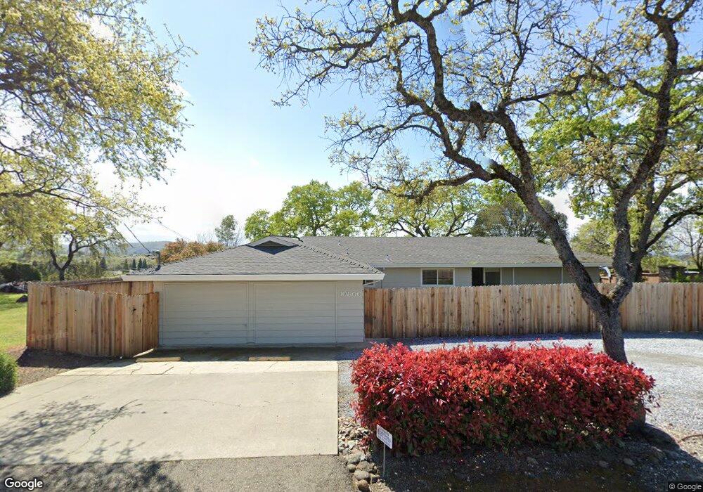
10800 Indian Hill Rd Auburn, CA 95603
Estimated Value: $711,000
3
Beds
2
Baths
1,678
Sq Ft
$424/Sq Ft
Est. Value
About This Home
This home is located at 10800 Indian Hill Rd, Auburn, CA 95603 and is currently estimated at $711,000, approximately $423 per square foot. 10800 Indian Hill Rd is a home located in Placer County with nearby schools including Skyridge Elementary School, Placer High School, and Newcastle Elementary Charter School.
Ownership History
Date
Name
Owned For
Owner Type
Purchase Details
Closed on
Nov 15, 2007
Sold by
Graves James R
Bought by
Uaic Development Corp
Current Estimated Value
Purchase Details
Closed on
Jun 15, 2000
Sold by
Ken Mccarns and Ken Ruby
Bought by
Graves James R
Home Financials for this Owner
Home Financials are based on the most recent Mortgage that was taken out on this home.
Original Mortgage
$165,000
Interest Rate
8.08%
Mortgage Type
Commercial
Purchase Details
Closed on
Mar 30, 1998
Sold by
Wuesthoff Charles F Living Trust
Bought by
Mccarns Ken and Crosley Ruby
Create a Home Valuation Report for This Property
The Home Valuation Report is an in-depth analysis detailing your home's value as well as a comparison with similar homes in the area
Home Values in the Area
Average Home Value in this Area
Purchase History
| Date | Buyer | Sale Price | Title Company |
|---|---|---|---|
| Uaic Development Corp | -- | Multiple | |
| Graves James R | $212,000 | Placer Title Company | |
| Mccarns Ken | $140,000 | Fidelity National Title Co |
Source: Public Records
Mortgage History
| Date | Status | Borrower | Loan Amount |
|---|---|---|---|
| Previous Owner | Graves James R | $165,000 |
Source: Public Records
Tax History
| Year | Tax Paid | Tax Assessment Tax Assessment Total Assessment is a certain percentage of the fair market value that is determined by local assessors to be the total taxable value of land and additions on the property. | Land | Improvement |
|---|---|---|---|---|
| 2025 | $9,483 | $919,451 | $722,429 | $197,022 |
| 2023 | $9,483 | $883,749 | $694,377 | $189,372 |
| 2022 | $9,338 | $866,421 | $680,762 | $185,659 |
| 2021 | $9,003 | $849,433 | $667,414 | $182,019 |
| 2020 | $8,941 | $840,724 | $660,571 | $180,153 |
| 2019 | $8,776 | $824,240 | $647,619 | $176,621 |
| 2018 | $8,300 | $808,079 | $634,921 | $173,158 |
| 2017 | $8,153 | $792,235 | $622,472 | $169,763 |
| 2016 | $7,982 | $776,702 | $610,267 | $166,435 |
| 2015 | $7,789 | $765,036 | $601,101 | $163,935 |
| 2014 | $7,672 | $750,051 | $589,327 | $160,724 |
Source: Public Records
Map
Nearby Homes
- 11220 Sunrise Ridge Cir
- 797 Grandview Dr
- 534 Sawka Dr
- 1107 Humbug Way
- 1325 Appaloosa Ct
- 858 Supreme Ct
- 10917 Sunrise Ridge Cir
- 1540 Ridgeview Cir
- 11248 Shady Run
- 0 Shirland Tract Rd Unit 226009120
- 11111 Tanglewood Dr
- 11110 Tanglewood Dr
- 791 Tyler Dr
- 627 Lakeridge Dr
- 10010 Snowy Owl Way
- 622 Lakeridge Dr
- 1822 Crockett Rd
- 980 MacHty Ct
- 634 Lakeridge Dr
- 2045 Toscana Place
- 10840 Indian Hill Rd
- 700 Grandview Dr
- 704 Grandview Dr
- 815 Indian Rancheria Rd
- 604 Sawka Dr
- 11130 Sunrise Ridge Cir
- 11140 Sunrise Ridge Cir
- 708 Grandview Dr
- 600 Sawka Dr
- 11150 Sunrise Ridge Cir
- 11120 Sunrise Ridge Cir
- 705 Grandview Dr
- 596 Sawka Dr
- 712 Grandview Dr
- 11160 Sunrise Ridge Cir
- 709 Grandview Dr
- 601 Sawka Dr
- 716 Grandview Dr
- 11170 Sunrise Ridge Cir
- 11100 Sunrise Ridge Cir
Your Personal Tour Guide
Ask me questions while you tour the home.