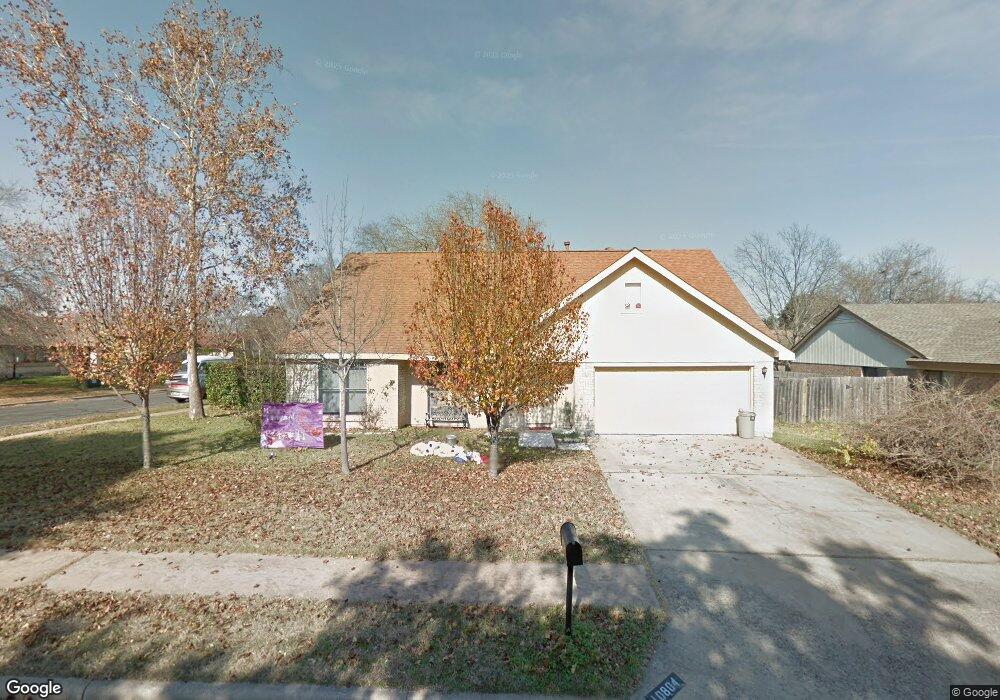
10804 Thicket Trail Austin, TX 78750
Anderson Mill NeighborhoodEstimated Value: $470,766 - $566,000
3
Beds
3
Baths
2,231
Sq Ft
$232/Sq Ft
Est. Value
About This Home
This home is located at 10804 Thicket Trail, Austin, TX 78750 and is currently estimated at $518,692, approximately $232 per square foot. 10804 Thicket Trail is a home located in Williamson County with nearby schools including Anderson Mill Elementary School, Noel Grisham Middle, and Westwood High School.
Ownership History
Date
Name
Owned For
Owner Type
Purchase Details
Closed on
Feb 4, 2005
Sold by
Bos Robert S
Bought by
Yingst Mikel J and Yingst Renee
Current Estimated Value
Home Financials for this Owner
Home Financials are based on the most recent Mortgage that was taken out on this home.
Original Mortgage
$12,180
Interest Rate
5.82%
Mortgage Type
Purchase Money Mortgage
Create a Home Valuation Report for This Property
The Home Valuation Report is an in-depth analysis detailing your home's value as well as a comparison with similar homes in the area
Home Values in the Area
Average Home Value in this Area
Purchase History
| Date | Buyer | Sale Price | Title Company |
|---|---|---|---|
| Yingst Mikel J | -- | Chicago Title Insurance Comp |
Source: Public Records
Mortgage History
| Date | Status | Borrower | Loan Amount |
|---|---|---|---|
| Closed | Yingst Mikel J | $12,180 |
Source: Public Records
Tax History
| Year | Tax Paid | Tax Assessment Tax Assessment Total Assessment is a certain percentage of the fair market value that is determined by local assessors to be the total taxable value of land and additions on the property. | Land | Improvement |
|---|---|---|---|---|
| 2025 | $7,775 | $492,378 | $88,500 | $403,878 |
| 2024 | $7,775 | $463,276 | -- | -- |
| 2023 | $7,775 | $421,160 | -- | -- |
| 2022 | $8,221 | $382,873 | $0 | $0 |
| 2021 | $8,551 | $348,066 | $72,000 | $337,397 |
| 2020 | $7,528 | $316,424 | $66,598 | $249,826 |
| 2019 | $7,569 | $309,449 | $60,700 | $248,749 |
| 2018 | $6,491 | $286,914 | $54,891 | $236,262 |
| 2017 | $6,510 | $260,831 | $51,300 | $245,060 |
| 2016 | $5,919 | $237,119 | $51,300 | $207,211 |
| 2015 | $4,738 | $215,563 | $42,100 | $191,861 |
| 2014 | $4,738 | $195,966 | $0 | $0 |
Source: Public Records
Map
Nearby Homes
- 10810 Calcite Trail
- 11535 Sandy Loam Trail
- 11000 Opal Trail
- 11100 Alison Parke Trail
- 11602 Crosstimber Dr
- 11808 Buggy Whip Trail
- 11302 Centennial Trail
- 12103 Grey Rock Ln
- 11202 Sierra Blanca St
- 1028 Verbena Dr Unit 1144
- 11310 Morning Glory Trail
- 12106 Grey Fawn Path
- 10404 Mourning Dove Dr
- 11215 Slippery Elm Trail
- 10600 Glass Mountain Trail
- 11905 Millwright Pkwy
- 11405 Antler Ln
- 11318 Bristle Oak Trail
- 10244 Missel Thrush Dr
- 11512 Tin Cup Dr Unit 309
- 10805 Calcite Trail
- 10803 Calcite Trail
- 10814 Calcite Trail
- 10812 Calcite Trail
- 10800 Thicket Trail
- 10805 Thicket Trail
- 10803 Thicket Trail
- 10901 Thicket Trail
- 10801 Calcite Trail
- 10801 Thicket Trail
- 10903 Thicket Trail
- 10808 Calcite Trail
- 10910 Thicket Trail
- 10806 Calcite Trail
- 10912 Thicket Trail
- 10804 Calcite Trail
- 11545 Sandy Loam Trail
- 11547 Sandy Loam Trail
- 10905 Thicket Trail
- 10914 Thicket Trail