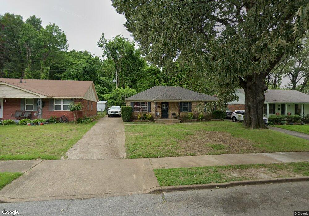
1081 Rutland Rd Memphis, TN 38114
Orange Mound NeighborhoodEstimated Value: $90,000 - $146,000
3
Beds
2
Baths
1,218
Sq Ft
$91/Sq Ft
Est. Value
About This Home
This home is located at 1081 Rutland Rd, Memphis, TN 38114 and is currently estimated at $110,358, approximately $90 per square foot. 1081 Rutland Rd is a home located in Shelby County with nearby schools including Dunbar Elementary School, Sherwood Middle, and Melrose High School.
Ownership History
Date
Name
Owned For
Owner Type
Purchase Details
Closed on
Apr 28, 2017
Sold by
Malvezzi Property Investments Llc
Bought by
Gonzalvo Sol A and Gonzalve Crispina C
Current Estimated Value
Purchase Details
Closed on
Sep 24, 2008
Sold by
Malvezzi Frank
Bought by
Malvezzi Property Investments Llc
Home Financials for this Owner
Home Financials are based on the most recent Mortgage that was taken out on this home.
Original Mortgage
$28,000
Interest Rate
6.61%
Mortgage Type
Unknown
Purchase Details
Closed on
Aug 27, 2008
Sold by
Wm Specialty Mortgage Llc
Bought by
Malvezzi Frank
Home Financials for this Owner
Home Financials are based on the most recent Mortgage that was taken out on this home.
Original Mortgage
$28,000
Interest Rate
6.61%
Mortgage Type
Unknown
Purchase Details
Closed on
Mar 27, 2008
Sold by
Davis Isaac
Bought by
Wm Specialty Mortgage Llc
Create a Home Valuation Report for This Property
The Home Valuation Report is an in-depth analysis detailing your home's value as well as a comparison with similar homes in the area
Home Values in the Area
Average Home Value in this Area
Purchase History
| Date | Buyer | Sale Price | Title Company |
|---|---|---|---|
| Gonzalvo Sol A | $32,000 | None Available | |
| Malvezzi Property Investments Llc | $32,900 | None Available | |
| Malvezzi Frank | $25,000 | Landcastle Title Llc | |
| Wm Specialty Mortgage Llc | $38,965 | None Available |
Source: Public Records
Mortgage History
| Date | Status | Borrower | Loan Amount |
|---|---|---|---|
| Previous Owner | Malvezzi Frank | $28,000 |
Source: Public Records
Tax History Compared to Growth
Tax History
| Year | Tax Paid | Tax Assessment Tax Assessment Total Assessment is a certain percentage of the fair market value that is determined by local assessors to be the total taxable value of land and additions on the property. | Land | Improvement |
|---|---|---|---|---|
| 2025 | $436 | $21,500 | $2,450 | $19,050 |
| 2024 | $436 | $12,875 | $1,000 | $11,875 |
| 2023 | $784 | $12,875 | $1,000 | $11,875 |
| 2022 | $784 | $12,875 | $1,000 | $11,875 |
| 2021 | $794 | $12,875 | $1,000 | $11,875 |
| 2020 | $915 | $12,625 | $1,000 | $11,625 |
| 2019 | $915 | $12,625 | $1,000 | $11,625 |
| 2018 | $915 | $12,625 | $1,000 | $11,625 |
| 2017 | $519 | $12,625 | $1,000 | $11,625 |
| 2016 | $567 | $12,975 | $0 | $0 |
| 2014 | $567 | $12,975 | $0 | $0 |
Source: Public Records
Map
Nearby Homes
- 2904 Barron Ave
- 1069 Poppen Dr
- 2933 N Radford Rd
- 958 Semmes St
- 3131 Barron Ave
- 1488 Pendleton St
- 1580 Marianna St
- 3172 Hoskins Rd
- 2763 Fizer Rd
- 876 Inez St
- 1091 S Greer St
- 2737 Fizer Rd
- 1309 Aubra Rd
- 3037 Chisca Ave
- 865 Haynes St
- 3094 Park Ave
- 2766 Select Ave
- 828 Semmes St
- 3017 Gulf Ave Unit 7
- 824 Semmes St
- 1087 Rutland Rd
- 1075 Rutland Rd
- 1093 Rutland Rd
- 2967 Hoskins Rd
- 1069 Rutland Rd
- 1080 Rutland Rd
- 1084 Rutland Rd
- 1099 Rutland Rd
- 1090 Rutland Rd
- 2993 Hoskins Rd
- 2959 Hoskins Dr
- 2959 Hoskins Rd
- 1096 Rutland Rd
- 2997 Hoskins Rd
- 2997 Hoskins Dr
- 1105 Rutland Rd
- 1102 Rutland Rd
- 1106 Rutland Rd
- 2970 Hoskins Dr
- 2970 Hoskins Rd