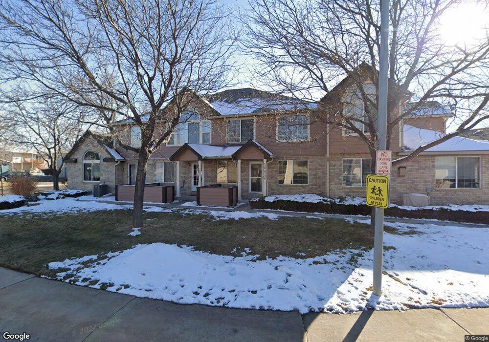
1081 W 112th Ave Unit A Denver, CO 80234
The Ranch NeighborhoodEstimated Value: $375,000 - $397,000
2
Beds
3
Baths
1,352
Sq Ft
$286/Sq Ft
Est. Value
About This Home
This home is located at 1081 W 112th Ave Unit A, Denver, CO 80234 and is currently estimated at $386,050, approximately $285 per square foot. 1081 W 112th Ave Unit A is a home located in Adams County with nearby schools including Cotton Creek Elementary School, Silver Hills Middle School, and Northglenn High School.
Ownership History
Date
Name
Owned For
Owner Type
Purchase Details
Closed on
Jun 29, 2020
Sold by
Bolton Danny R
Bought by
Danny Raymond Bolton Trust
Current Estimated Value
Purchase Details
Closed on
Aug 22, 2013
Sold by
Budzak Sean
Bought by
Bolton Danny R
Home Financials for this Owner
Home Financials are based on the most recent Mortgage that was taken out on this home.
Original Mortgage
$148,000
Outstanding Balance
$110,674
Interest Rate
4.53%
Mortgage Type
New Conventional
Estimated Equity
$275,376
Purchase Details
Closed on
May 13, 2009
Sold by
Disalle Ben
Bought by
Budzak Sean
Home Financials for this Owner
Home Financials are based on the most recent Mortgage that was taken out on this home.
Original Mortgage
$162,011
Interest Rate
4.77%
Mortgage Type
FHA
Purchase Details
Closed on
Sep 21, 1998
Sold by
D R Horton Inc Denver
Bought by
Weil Eva
Create a Home Valuation Report for This Property
The Home Valuation Report is an in-depth analysis detailing your home's value as well as a comparison with similar homes in the area
Home Values in the Area
Average Home Value in this Area
Purchase History
| Date | Buyer | Sale Price | Title Company |
|---|---|---|---|
| Danny Raymond Bolton Trust | -- | None Available | |
| Bolton Danny R | $185,000 | Land Title Guarantee Company | |
| Budzak Sean | $165,000 | Land Title Guarantee Company | |
| Weil Eva | $129,555 | -- |
Source: Public Records
Mortgage History
| Date | Status | Borrower | Loan Amount |
|---|---|---|---|
| Open | Bolton Danny R | $148,000 | |
| Previous Owner | Budzak Sean | $162,011 |
Source: Public Records
Tax History Compared to Growth
Tax History
| Year | Tax Paid | Tax Assessment Tax Assessment Total Assessment is a certain percentage of the fair market value that is determined by local assessors to be the total taxable value of land and additions on the property. | Land | Improvement |
|---|---|---|---|---|
| 2024 | $2,105 | $24,810 | $5,000 | $19,810 |
| 2023 | $2,081 | $26,250 | $4,740 | $21,510 |
| 2022 | $2,151 | $20,830 | $4,310 | $16,520 |
| 2021 | $2,151 | $20,830 | $4,310 | $16,520 |
| 2020 | $2,153 | $21,250 | $4,430 | $16,820 |
| 2019 | $2,158 | $21,250 | $4,430 | $16,820 |
| 2018 | $1,905 | $18,170 | $1,160 | $17,010 |
| 2017 | $1,715 | $18,170 | $1,160 | $17,010 |
| 2016 | $1,408 | $14,480 | $1,280 | $13,200 |
| 2015 | $1,406 | $14,480 | $1,280 | $13,200 |
| 2014 | -- | $12,020 | $1,280 | $10,740 |
Source: Public Records
Map
Nearby Homes
- 1089 W 112th Ave Unit D
- 1097 W 112th Ave Unit D
- 1113 W 112th Ave Unit A
- 1185 W 112th Ave Unit C
- 11301 Navajo Cir Unit B
- 11251 Osage Cir Unit E
- 553 W 114th Way
- 1665 W 113th Ave
- 11485 Pecos St
- 1667 W 115th Cir
- 2114 Ranch Dr
- 10951 Acoma St
- 11202 Wyandot St
- 2347 Ranch Dr
- 120 Leonard Ln
- 1421 W 106th Ave
- 11632 Community Center Dr Unit 53
- 10544 Carmela Ln
- 13507 Huron St
- 10724 Tancred St
- 1081 W 112th Ave Unit D
- 1081 W 112th Ave Unit C
- 1081 W 112th Ave Unit B
- 1081 W 112th Ave
- 1081 W 112th Ave Unit 10A
- 1077 W 112th Ave Unit D
- 1077 W 112th Ave Unit C
- 1077 W 112th Ave Unit B
- 1077 W 112th Ave Unit A
- 1161 W 112th Ave Unit D
- 1161 W 112th Ave Unit C
- 1161 W 112th Ave Unit B
- 1161 W 112th Ave Unit A
- 1093 W 112th Ave Unit D
- 1093 W 112th Ave Unit C
- 1093 W 112th Ave Unit B
- 1093 W 112th Ave Unit A
- 1093 W 112th Ave Unit 109A
- 1093 W 112th Ave
- 1097 W 112th Ave Unit C