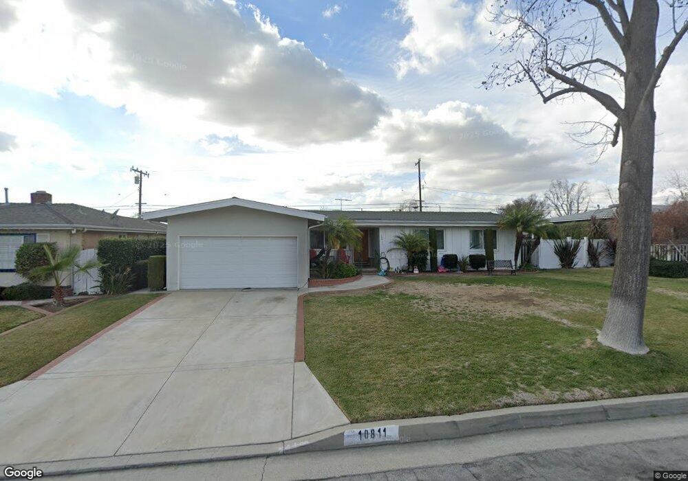
10811 Bogardus Ave Whittier, CA 90603
South Whittier NeighborhoodEstimated Value: $739,000 - $981,000
3
Beds
2
Baths
1,284
Sq Ft
$652/Sq Ft
Est. Value
About This Home
This home is located at 10811 Bogardus Ave, Whittier, CA 90603 and is currently estimated at $837,806, approximately $652 per square foot. 10811 Bogardus Ave is a home located in Los Angeles County with nearby schools including Jordan Elementary School, Rancho-Starbuck Intermediate School, and La Habra High School.
Ownership History
Date
Name
Owned For
Owner Type
Purchase Details
Closed on
Dec 11, 2015
Sold by
Bonilla Irma Patricia Loya
Bought by
Wolfe Michael Herbert
Current Estimated Value
Purchase Details
Closed on
Dec 7, 2015
Sold by
Wolfe Michael Herbert and Wolfe Emil Eugene
Bought by
Wolfe Family Trust
Purchase Details
Closed on
Jan 15, 2014
Sold by
Wolfe Emil Eugene and Wolfe Michael Herbert
Bought by
Wolfe Emil Eugene and Wolfe Michael Herbert
Purchase Details
Closed on
Jul 2, 2013
Sold by
Wolfe Emil Eugene and The Henrietta E Wolfe Living T
Bought by
Wolfe Emil Eugene and Wolfe Michael Herbert
Create a Home Valuation Report for This Property
The Home Valuation Report is an in-depth analysis detailing your home's value as well as a comparison with similar homes in the area
Home Values in the Area
Average Home Value in this Area
Purchase History
| Date | Buyer | Sale Price | Title Company |
|---|---|---|---|
| Wolfe Michael Herbert | -- | Fidelity National Title Co | |
| Wolfe Family Trust | $210,000 | Fidelity Sherman Oaks | |
| Wolfe Emil Eugene | $108,000 | None Available | |
| Wolfe Emil Eugene | -- | None Available |
Source: Public Records
Tax History Compared to Growth
Tax History
| Year | Tax Paid | Tax Assessment Tax Assessment Total Assessment is a certain percentage of the fair market value that is determined by local assessors to be the total taxable value of land and additions on the property. | Land | Improvement |
|---|---|---|---|---|
| 2025 | $4,853 | $411,616 | $268,350 | $143,266 |
| 2024 | $4,853 | $403,546 | $263,089 | $140,457 |
| 2023 | $4,749 | $395,634 | $257,931 | $137,703 |
| 2022 | $4,702 | $387,877 | $252,874 | $135,003 |
| 2021 | $4,604 | $380,272 | $247,916 | $132,356 |
| 2019 | $4,486 | $368,994 | $240,563 | $128,431 |
| 2018 | $4,226 | $361,760 | $235,847 | $125,913 |
| 2016 | $2,273 | $180,983 | $129,948 | $51,035 |
| 2015 | $2,188 | $178,266 | $127,997 | $50,269 |
| 2014 | $1,124 | $74,426 | $32,979 | $41,447 |
Source: Public Records
Map
Nearby Homes
- 10931 Groveside Ave
- 16121 Lisco St
- 10930 Groveland Ave
- 16164 Leffco Rd
- 16040 Leffingwell Rd Unit 92
- 16040 Leffingwell Rd Unit 103
- 16040 Leffingwell Rd Unit 76
- 15914 Lashburn St
- 10418 Bogardus Ave Unit 4
- 16046 Gables Loop
- 16540 Whittier Blvd
- 11315 Groveside Ave
- 15952 Norcrest Dr
- 2611 Gregory Ln
- 16428 Whittier Blvd Unit 2
- 16621 Crape Myrtle Ln
- 10303 Pounds Ave
- 11518 1st Ave
- 11503 Grovedale Dr
- 16048 Richvale Dr
- 10803 Bogardus Ave
- 10817 Bogardus Ave
- 10752 1st Ave
- 10745 Bogardus Ave
- 10825 Bogardus Ave
- 10744 1st Ave
- 10800 1st Ave
- 10810 Bogardus Ave
- 10816 Bogardus Ave
- 10802 Bogardus Ave
- 10738 1st Ave
- 10812 1st Ave
- 10737 Bogardus Ave
- 10831 Bogardus Ave
- 10824 Bogardus Ave
- 10744 Bogardus Ave
- 10730 1st Ave
- 10818 1st Ave
- 10830 Bogardus Ave
- 10811 Cullman Ave